

15 October 2017: the day Ophelia's winds set central Portugal alight
Four months after Pedrógão Grande, a Sunday of drought, heat and hurricane-driven wind produced the largest fires Portugal had recorded. Between 48 and 51 people died, and the country changed how it manages fire.
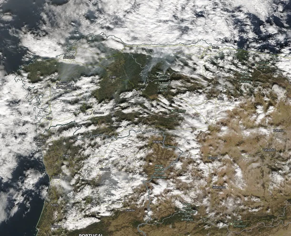
At a glance
- On Sunday 15 October 2017 about 500 fires broke out in mainland Portugal, under an extreme fire-danger forecast issued three days earlier.
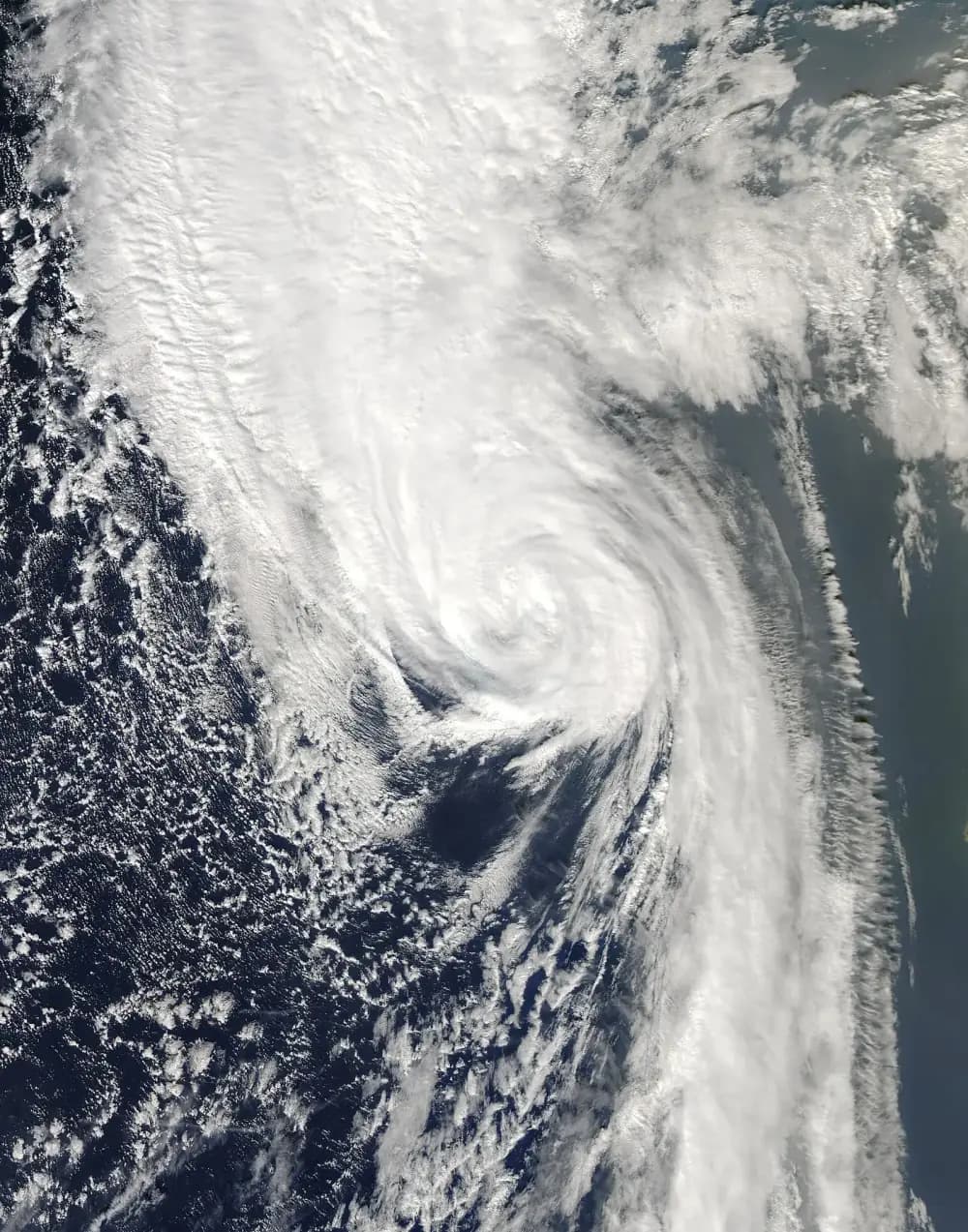
- Hurricane Ophelia, the farthest-east major hurricane of the satellite era, passed far out in the Atlantic and drew hot, dry southerly winds over a country already in drought.
- Between 48 and 51 people died, depending on the source and on how indirect deaths are counted. Most were older residents of villages in the Centre region.
- Roughly 220,000 to 290,000 hectares burned. The fire that began at Vilarinho, in Lousã, was the largest Portugal had recorded until a fire that began at Piódão, in Arganil, overtook it in August 2025.
- Coming after 64 to 66 deaths at Pedrógão Grande in June, the disaster cost the Interior Minister her job and led to a new fire agency, AGIF, and stricter vegetation-clearing rules.
A Sunday morning at Vilarinho
At 8.41 on the morning of Sunday 15 October 2017, a fire was reported at Vilarinho, in the hills of Lousã south-east of Coimbra. Investigators later traced it to the electricity network; a University of Coimbra study for the government linked it to a 15 kV line run by the utility EDP. For its first five hours it grew slowly, to 932 hectares.
Then it ran. Between 3 pm and 7 pm its main front moved north at an average of about 6 kilometres an hour, and between 6 and 7 pm, passing the Aguieira dam between Mortágua and Santa Comba Dão, it reached 8.8 km/h. That was the fastest spread the parliamentary inquiry later measured on any fire that day.
It was one of hundreds. Fire commanders interviewed by the inquiry reached for the same words: a storm of fire, a sea of fire, balls of fire thrown for kilometres. One said that in 40 years he had never seen anything like it. By the time rain arrived on 16 October, between 48 and 51 people were dead, depending on how the deaths are counted.
What you need to know first
Portugal had already lived through one catastrophe that year. On 17 June 2017 a fire at Pedrógão Grande, in the pine-covered hills of the Pinhal Interior, killed dozens of people, about three-quarters of them in or near their cars. The civil protection authority's count, limited to deaths from burns and smoke, was 64. Later tallies, which take in indirect deaths such as a woman struck by a car as she fled, reach 66.
Parliament appointed an independent technical commission of experts, known by its Portuguese initials CTI, to find out what had gone wrong. Its report, published that October, called among other things for a single agency to run the management of rural fires. It came out in the same month as the next disaster.
The summer had been relentlessly dry. At the weather station at Lousã airfield, fire danger was very high or extreme on 84 per cent of the days between the Pedrógão fire and 15 October, and only one significant rain fell in that time: 31 mm on 29 August. In the first half of October daily maximum temperatures across the country averaged about 30°C, and shrubs near Lousã held 50 to 60 per cent moisture, against about 80 per cent normal for the season.
The calendar worked against the firefighters. Portugal's firefighting system ran in seasonal phases, and by mid-October it was in Phase Delta, after the summer peak, with about 30 fewer aircraft than in the summer phase. The 15th was also a Sunday, and the inquiry found that more fires tend to start at weekends.
Yet the danger was foreseen: from 12 October IPMA, the national weather institute, forecast extreme fire danger for almost the whole country on the 15th, and on 13 October it issued a special warning of exceptionally high fire-weather values.
The same forecasts promised rain from 16 October. The inquiry thought this may have encouraged farmers to burn crop waste and renew pasture before it came. Such burning caused about a third of the fires recorded on 14–16 October; arson accounted for 36 per cent and rekindled older fires for 24 per cent.
A hurricane in the wrong place
Hurricane Ophelia became a tropical storm in the far eastern Atlantic on 9 October and never left that part of the ocean. At midday on 14 October, about 500 nautical miles south-west of the Azores, it reached 100 knots, a category 3 storm over water normally thought too cool to sustain one. The US National Hurricane Center later called it the farthest-east major hurricane observed in the satellite era.
Ophelia never touched mainland Portugal. It passed south-east of the Azores on 14 October, then raced north-east, losing its tropical character, and struck south-west Ireland as a powerful post-tropical storm on 16 October, killing three people there. On its way north it intensified a flow of hot, dry air from the south over Portugal.
On 15 October the fire danger was rated extreme across almost all of mainland Portugal. The inquiry singled out wind speed as the exceptional part of the danger index, on top of a seasonal drought. Forecasts for the uplands spoke of southerly winds of 40 to 50 km/h by the afternoon, with gusts of up to 80 km/h.
Sunday 15 October, hour by hour
About 500 fires started that day, on a day of red alert. Seven of them grew past 10,000 hectares in the Centre region. Driven by the southerly wind, they ran mostly from south-west to north-east: on the coast through the state pine forests of Leiria and Quiaios, inland through Lousã, Sertã, Arganil, Seia and Vouzela.
Crews soon could not keep up. Fire brigades sent to help neighbouring councils were called home to fight fires in their own areas. Many national resources, aircraft among them, had already been released for the season. In many places, the inquiry found, there was no possibility of fighting the fire at all, and the effort turned to defending people and houses, not always with success.
12 October
Extreme danger forecast
IPMA forecasts extreme fire danger for almost all of mainland Portugal on 15 October.
14 October
Ophelia peaks
The hurricane reaches 100 knots about 500 nautical miles south-west of the Azores.
15 Oct, c. 06:00
First of the great fires
A fire starts at Sabugueiro, in Seia.
08:41
Vilarinho, Lousã
The fire that will become the largest of the day is detected.
10:26 to 12:28
Seia, Sertã, Arganil
Fires start at Sandomil (Seia), Figueiredo (Sertã) and Esculca-Côja (Arganil).
14:01 to 14:36
The coast
Rekindled fires at Praia da Légua and Burinhosa, near Pataias, head for the Leiria pine forest. A deliberately set fire starts at Quiaios.
c. 16:00
Wind peaks
The wind then eases, and the fires begin to make their own weather.
18:00 to 19:00
Fastest run
The Lousã fire's head reaches 8.8 km/h near the Aguieira dam.
19:00 to 23:00
Fire thunderstorms
Pyrocumulonimbus clouds form over the three great inland fires, which begin to interact.
16 Oct, 00:30 to 04:00
Downdraft at Lousã
The strongest downdraft of the event hits the Lousã fire, which turns east.
16 to 17 October
Rain
Rain arrives behind Ophelia and helps crews bring the fires under control.
The wind was not the whole story. It peaked around 4 pm and then eased, and the energy released by the fires took over. From about 5 pm they built pyrocumulus clouds, towers of smoke and vapour, and between 7 and 11 pm several grew into pyrocumulonimbus, thunderstorm clouds made by fire, whose downdrafts pushed the flames erratically outwards. Between 12.30 and 4 am the largest downdraft of all hit the Lousã fire, which swung east and burned 9,138 hectares between 3 and 5 am.
The inquiry called this the largest pyroconvective event recorded in Europe and the largest in the world in 2017. Between 4 pm on 15 October and 5 am on 16 October, the five megafires it studied burned an average of 10,000 hectares an hour, and the deaths clustered in those surges.
“What was lived through in these days, above all on 15 October, amounted to a situation of dramatic abandonment, with a shortage of resources, the population left to fend for itself.”
- Main day
- Sunday 15 October 2017, into 16 October
- Fires on 15 October
- About 500
- Deaths
- 48 (inquiry), 49 to 50 (Lusa), 51 (Coimbra study)
- Area burned, 14–16 October
- About 241,000 ha (inquiry); 220,000 to 290,000 ha in other counts
- Largest fire
- Vilarinho-Lousã: 45,505 ha on the inquiry's map, about 53,000 ha in ICNF records
- Homes affected
- 1,712 (inquiry); about 1,500 destroyed or damaged (Lusa)
The dead and what was lost
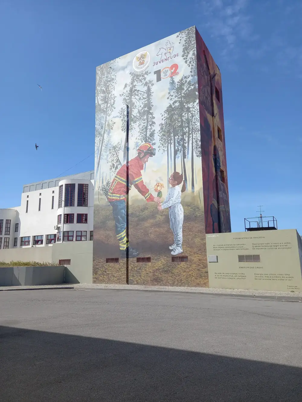
The parliamentary inquiry counted 48 dead, at 38 places in the districts of Coimbra, Viseu, Guarda and Castelo Branco. One of them, in Sertã, was still officially missing. The worst-hit municipalities were Oliveira do Hospital, with 12 deaths, and Vouzela, with 8.
The 48 already included several people who died later in hospital and four indirect deaths: two in a road accident, one in a fall at home and a cancer patient with breathing failure. Other counts are higher. Lusa, the national news agency, has given 49 and 50. A 2019 study for the government by the University of Coimbra's forest fire research centre counted 51, seven of them indirect. These reports do not explain the differences case by case.
The October dead were older than those of June. Their average age was about 63, against about 49 at Pedrógão, and 63 per cent were retired. The inquiry found that 12 died inside their own homes, eight of them probably asleep when the fire arrived; the Coimbra study counted 19 deaths at home. Most of the rest died within five kilometres of home, some while trying to save their belongings. In 60 per cent of cases, the victim's house did not burn.
How much land burned depends on who measured it. The inquiry gave about 241,000 hectares for 14–16 October; the Coimbra researchers counted more than 220,000 in under 24 hours; Lusa, the national news agency, later put it at 290,000. The inquiry counted 1,712 homes and 768 business buildings affected, and estimated damage to 521 companies at €275 million, with more than 4,500 jobs affected in 30 municipalities. Lusa's later summary gave about 1,500 houses destroyed in whole or in part.
Two of the fires were larger than any Portugal had recorded, though no two counts of their size agree. The Vilarinho-Lousã fire ran about 50 kilometres north from Lousã into the district of Viseu. The inquiry's corrected map gave it 45,505 hectares; the satellite-based EFFIS figure quoted in the same report was about 65,000; and the forestry institute, ICNF, gives about 53,000.
The Arganil complex, in the hills between Arganil, Oliveira do Hospital and Seia, covered 48,462 hectares on the inquiry's map, but that figure combines the fires that began at Esculca-Côja and Sandomil. The inquiry named Lousã the largest single fire on record, and in ICNF's records it held that place until August 2025, when a fire that began at Piódão, also in Arganil, burned about 65,000 hectares in ICNF's provisional figures.
| June (Pedrógão Grande) | October (14–16 October) | |
|---|---|---|
| Dates | 17–24 June | 14–16 October, mostly 15 October |
| Deaths | 64 in the official count; 66 including indirect deaths | 48 in the inquiry; 49 to 51 in later counts |
| Average age of the dead | About 49 | About 63 |
| Where people died | About three-quarters in or near cars | 38 places in 14 municipalities; 12 inside their homes |
| Largest fires | Pedrógão Grande 28,914 ha; Góis 17,521 ha | Seven fires over 10,000 ha; Lousã 45,505 ha (inquiry map) |
| Homes | About 490 burned, a third of them permanent homes | 1,712 affected (inquiry); about 1,500 destroyed or damaged (Lusa) |
| Businesses | Almost 50 industrial units hit | 768 business buildings affected; 521 firms, €275 million |
| Weather trigger | Heatwave and a thunderstorm gust front | Drought, heat and southerly winds drawn by Ophelia |
Figures from the two parliamentary inquiries unless stated. Sizes are the inquiries' mapped areas; other agencies give different totals.
Pine, eucalyptus and an emptying countryside
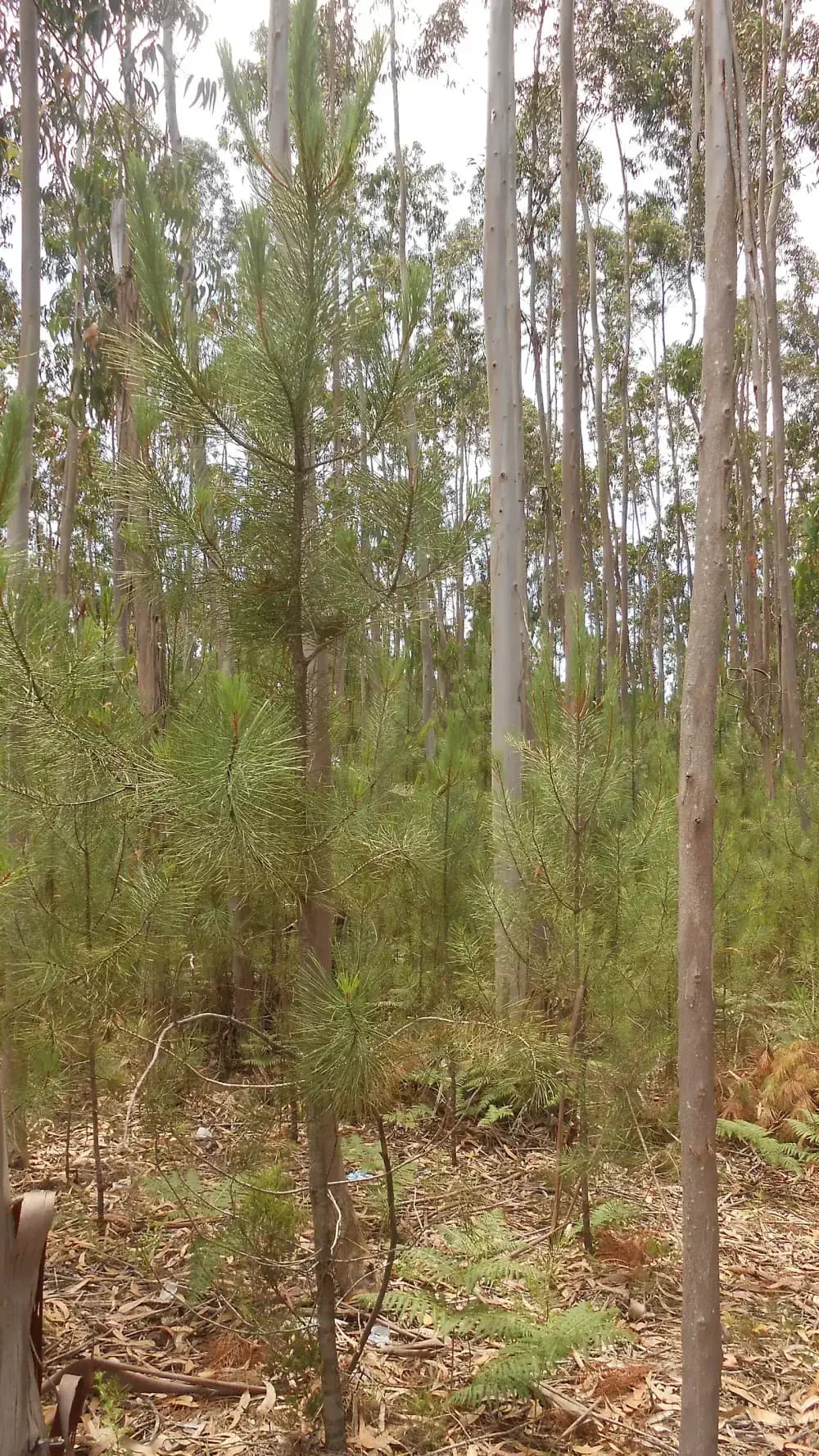
Almost 90 per cent of the forest that burned in 2017 was maritime pine (49.6 per cent) or eucalyptus (38.5 per cent), though the two species cover only about half of the national forest area. The inquiry blamed the structure of these stands, with shrubs, low branches and leaves forming a ladder of fuel from the ground to the crowns. On 15 October, 78 per cent of the area burned by the megafires was forest, and 42 per cent of the burned area had no recorded fire since 1975, so fuel had built up for decades.
The species mattered for speed too. Burning fragments carried on the wind start new fires ahead of the front, and the inquiry linked the Lousã fire's record pace to the abundant spotting from the eucalyptus along its path. The sixth national forest inventory, completed in 2019, counted 844,000 hectares of eucalyptus in Portugal and 714,000 hectares of maritime pine.
Behind the trees lay a social problem. The inquiry described the interior as a vast territory battered for decades by depopulation, the ageing of those who remained, the absence of forest management and the loss of economic activity. Most Portuguese forest is private, it noted, split among hundreds of thousands of owners and millions of plots, which makes managing it at any scale hard.
The rules for clearing vegetation along roads and around villages already existed. At most of the places where people died, the inquiry found, the required fuel-management strips had not been cut, especially along roads. In one simulation it estimated that without the scars of earlier fires and the rain that followed Ophelia, the Sertã fire alone could have reached half a million hectares.
A President's ultimatum
On 17 October President Marcelo Rebelo de Sousa addressed the nation from the town hall of Oliveira do Hospital, the municipality with the most deaths. He said the fragility the fires had exposed was real, still existed and reached the public authorities, and that opening a new cycle would oblige the government to weigh what, who, how and when best served it.
The conservative CDS party had already announced a censure motion, and he said that if anyone in Parliament doubted the government's ability to make the changes, Parliament should make clear, under the Constitution, whether it still wanted to keep the government.
“However much the coldness of these times, full of numbers and political slogans, invites us to minimise or trivialise them, these hundred dead will never leave my thoughts.”
He also called it the last chance to take the forest seriously and make it a priority. The next day the Interior Minister, Constança Urbano de Sousa, resigned. In a letter dated 17 October she wrote that she had asked insistently to leave straight after Pedrógão and had stayed out of loyalty, and that the Prime Minister, António Costa, now had to accept her resignation, if only to preserve her personal dignity.
On 21 October the government held an extraordinary cabinet meeting. It approved a package built on the June inquiry: a team to set up the new fire agency, a plan to clear verges along roads and railways, a stake for the state in SIRESP, the emergency radio network that had failed in places during both disasters, and an out-of-court compensation scheme for the families of the dead. Run by the Ombudsman, that scheme paid about €31 million for 115 deaths across June and October.
The inquiry and the reforms
The second inquiry was blunt. It found a very strong link between the number of ignitions and exceptional weather, so the surge of 15 October could and should have been anticipated, with crews and machines placed in advance. It found that some municipal fire plans were written to meet deadlines and had little effect on the ground. And it held the forestry institute, ICNF, partly responsible for the damage to the state forests, about 18,500 hectares of which burned in 2017, citing underfunding, years of lost staff and equipment, and internal disarray.
The new Agency for the Integrated Management of Rural Fires, AGIF, was created by Decree-Law 12/2018 of 16 February 2018 to plan, coordinate and evaluate the whole system, from prevention to suppression. In June 2020 the government approved a national plan for 2020–2030 that joins land management to firefighting, and Decree-Law 82/2021 of 13 October 2021 set the legal rules for the system that carries it out, the Integrated Rural Fire Management System, SGIFR.
Landowners felt the change most directly. By 2021 they had to clear vegetation in a band of 50 metres around houses and other buildings, and 100 metres around villages, campsites and industrial zones, by 15 March each year. As in every year since 2018, the fines were doubled, to between €280 and €10,000 for an individual, and councils had to do the work by 31 May where owners had not.
SIRESP changed hands as well. On 1 December 2019 the state completed its takeover of the company that runs the network, paying €7 million for the stakes held by Altice and Motorola.
Where Portugal is now
Area burned in Portugal each year, 2001–2025
hectares
Mainland Portugal. 2001–2022 from the EFFIS annual report for 2022 (Table 103); 2023–2024 from ICNF figures in the EFFIS report for 2024 (Table 33). 2025 is provisional: it is the total given by the parliamentary commission on the 2025 fires, as reported by Observador, and is not yet in the EFFIS series. 2017 is the highest year in the EFFIS series, which starts in 1980.
Show the data
| Area burned | |
|---|---|
| 2001 | 117,420 |
| 2002 | 130,849 |
| 2003 | 471,750 |
| 2004 | 151,370 |
| 2005 | 346,718 |
| 2006 | 83,706 |
| 2007 | 36,413 |
| 2008 | 19,897 |
| 2009 | 92,126 |
| 2010 | 140,953 |
| 2011 | 77,104 |
| 2012 | 117,985 |
| 2013 | 160,388 |
| 2014 | 22,820 |
| 2015 | 67,200 |
| 2016 | 167,808 |
| 2017 | 539,921 |
| 2018 | 44,578 |
| 2019 | 42,085 |
| 2020 | 67,170 |
| 2021 | 28,360 |
| 2022 | 110,097 |
| 2023 | 34,510 |
| 2024 | 137,651 |
| 2025 | 271,587 |
In the years after 2017, Portugal burned far less. From 2018 to 2024 the area burned averaged about 66,000 hectares a year, against 539,921 in 2017 alone, the highest figure in the national series that EFFIS, the European Forest Fire Information System, publishes back to 1980.
The respite did not last. In September 2024 fires burned more than 100,000 hectares of mainland Portugal in a week, and in 2025 about 271,600 hectares burned, the fourth-highest total since 2001. That August the Piódão fire in Arganil became the largest single fire on record. Deaths have stayed far below 2017: 16 in 2024 and six in 2025, two civilians and four people working on the response, according to the fire management system's annual report.
The inquiry's central argument still describes the task. Managing fuel across whole stretches of countryside, it concluded, is the only way to limit megafires of this size; the strips and patches treated before 2017 were far too small to slow them except here and there on the flanks.
See it today: the Pinhal de Leiria
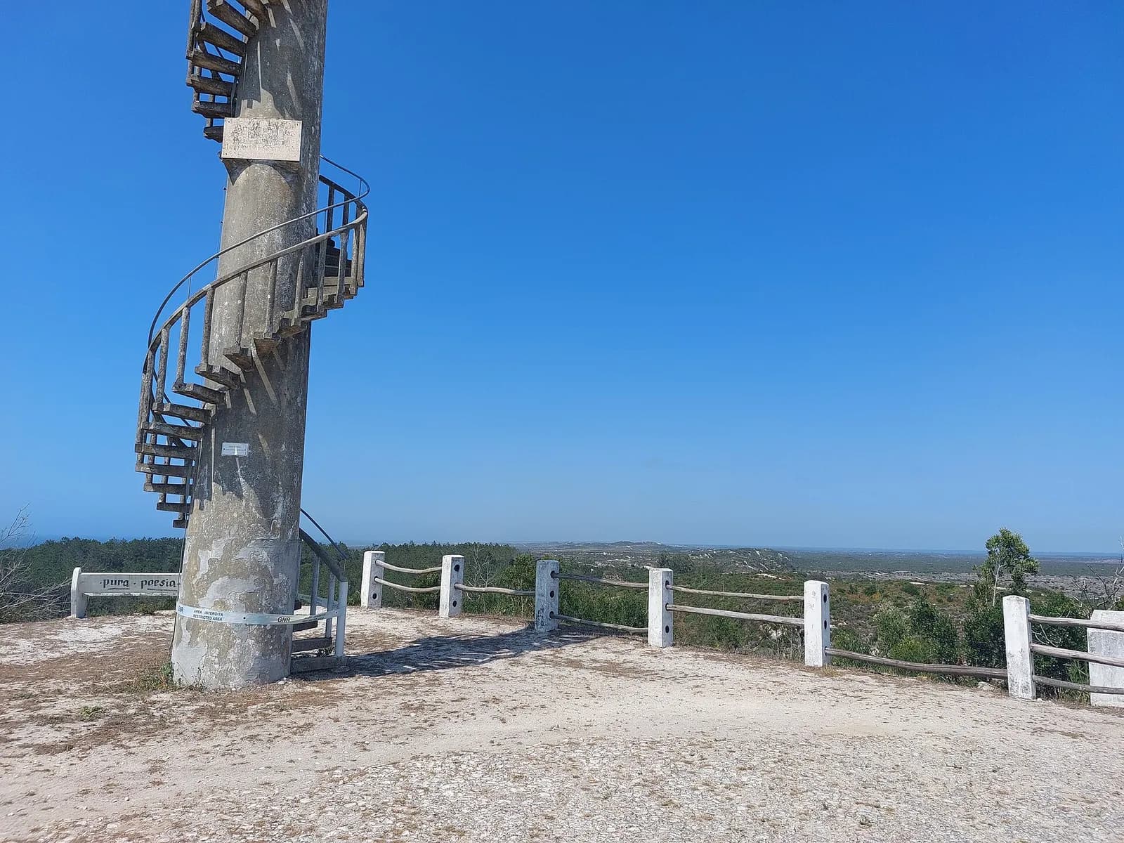
The Pinhal de Leiria, officially the Mata Nacional de Leiria, is a state forest of 11,021 hectares on the coast near Marinha Grande. It has been managed for at least seven centuries. King Dinis (1279–1325) made it a crown forest and ordered large sowings of pine, and it became the first Portuguese forest with a management plan, drawn up in 1883 and published in 1892.
On 15 October 2017 two rekindled fires near Pataias, at Praia da Légua and Burinhosa, joined and ran north parallel to the coast, reaching 6.9 km/h in places. They burned 9,475 hectares of the forest, 86 per cent of it, along with almost all of the neighbouring Pedrógão state forest and about half of the Urso forest. A year later, on 13 October 2018, the storm Leslie flattened much of what the fire had spared.
Recovery has been slow. The ICNF's plan relies on pine regenerating naturally and replants where it does not. Three years after the fire, 1,178 hectares had been replanted, with about 1,344 more to go.
FAQs
How many people died in the October 2017 fires in Portugal?
Between 48 and 51. The parliamentary inquiry counted 48 in March 2018, including four indirect deaths. Lusa has given 49 and 50, and a University of Coimbra study for the government counted 51, seven of them indirect. The state's compensation scheme covered 115 deaths from the June and October fires together.
What did Hurricane Ophelia have to do with the fires?
Ophelia stayed far out in the Atlantic, but as it moved north towards Ireland it drew hot, dry southerly winds over Portugal. Combined with months of drought, that made 15 October a day of extreme fire danger. The fires then made their own weather, with fire-generated thunderstorms that drove the worst surges.
What started the fires?
Many different things, since there were about 500 of them. For 14–16 October the inquiry attributed about a third to burning of crop waste and pasture, 36 per cent to arson and 24 per cent to rekindled older fires. The largest, at Lousã, was traced to the electricity network.
Was the Lousã fire the largest in Portugal's history?
It was when it happened. Estimates of its size range from 45,505 hectares on the inquiry's corrected map to about 65,000 in early satellite figures; the forestry institute, ICNF, records about 53,000. The inquiry called it the largest fire on record. In August 2025 a fire that started at Piódão, in Arganil, burned about 65,000 hectares in ICNF's provisional figures and took the record.
What changed after 2017?
Portugal created a fire management agency, AGIF, and later put an integrated rural fire management system into law under a 2020–2030 plan. Fines for failing to clear vegetation around houses and villages were doubled from 2018, and the state took over the company that runs the SIRESP emergency radio network.
On the timeline
Open the timelineNearby moments from portugal in europe (1986–today).
Portugal win the UEFA European Championship final 1–0 against France at the Stade de France in Saint-Denis, with an extra-time strike by Éder. After Cristiano Ronaldo limps off injured early in the match, the team holds firm to claim Portugal's first major senior international title.
The United Nations General Assembly appoints António Guterres, former Portuguese Prime Minister and UN High Commissioner for Refugees, as Secretary-General by acclamation, following the Security Council's recommendation a week earlier. He took office on 1 January 2017.
Mário Soares dies in Lisbon aged 92. Jailed and deported under the dictatorship, he co-founded the Socialist Party, was prime minister in 1976–78 and 1983–85, signed Portugal's EEC accession treaty and served two terms as president. Hailed as the father of Portuguese democracy, he was given the first state funeral since 1951.
The October 2017 wildfires
Singer Madalena Iglésias dies in Barcelona aged 78. One of the great voices of 1960s Portuguese light song, she won the 1966 RTP Song Festival with the surf-tinged 'Ele e Ela' and represented Portugal at that year's Eurovision, before giving up the stage when she married in 1972.
Edmundo Pedro dies in Lisbon aged 99. First arrested as a teenager for helping organise a strike, he was sent with his father to the Tarrafal prison camp in Cape Verde, where he spent ten years as its youngest political prisoner; he later joined the 1962 Beja revolt and, after 1974, sat in parliament for the Socialist Party.
Cristiano Ronaldo scores a hat-trick in a 3–3 draw with Spain in Sochi, completing it with an 88th-minute free kick curled into the top corner. At 33 he becomes the oldest player to score a World Cup hat-trick and the first to score at eight consecutive major tournaments.
Coming up in history
All long reads 17 October 1978Luxembourg, 1978: Portugal opens its talks to join the EEC
 18 October 1739The Inquisition condemns 'o Judeu', Lisbon's comic playwright, in 1739
 19 October 1921Noite Sangrenta: the night a Portuguese prime minister was hunted down
 20 October 1570João de Barros, the historian of Portuguese Asia who never went there
27 sources
Archives, scholarship and reporting this article was checked against.
- 1
Avaliação dos incêndios ocorridos entre 14 e 16 de outubro de 2017 em Portugal Continental: Relatório Final (Comissão Técnica Independente, coord. João Guerreiro)Assembleia da República, March 2018
- 2
- 3
Tropical Cyclone Report: Hurricane Ophelia (AL172017), 9–15 October 2017US National Hurricane Center (NOAA)
- 4
Forest Fires in Europe, Middle East and North Africa 2022 (Table 103: burnt area in five southern Member States, 1980–2022)European Commission, Joint Research Centre (EFFIS), 2023
- 5Fogos de outubro de 2017: mais de um terço das vítimas morreu em casaObservador, 28 February 2019
- 6Fogo que começou em Arganil apresenta a maior área ardida de sempre em PortugalECO / Lusa, 25 August 2025
- 7
Plano de Gestão Florestal da Mata Nacional de Leiria 2019–2038Instituto da Conservação da Natureza e das Florestas (ICNF)
- 8Pedrógão Grande: houve 64 mortos em consequência direta do incêndio, reitera Proteção CivilDiário de Notícias, 22 July 2017
- 9Pedrógão. Chamas mataram 66 pessoas e atingiram cerca de 500 casasDiário de Notícias / Lusa, 17 June 2019
- 10
Ashes: the worst day of firesFundação Francisco Manuel dos Santos
- 11Incêndios de outubro de 2017. Ainda faltam reconstruir 30 casasDiário de Notícias / Lusa, 13 October 2019
- 12Indemnizações por morte nos fogos de 2017 atingem 31 milhões de eurosECO / Lusa, 2 December 2020
- 13
8.º Relatório Provisório de Incêndios Rurais 2025 (1 de janeiro a 15 de outubro)Instituto da Conservação da Natureza e das Florestas (ICNF), 17 October 2025
- 14
6.º Inventário Florestal Nacional está concluídoGovernment of Portugal, 28 June 2019
- 15
Declaração do Presidente da República ao País (Oliveira do Hospital, 17 de outubro de 2017)Presidência da República (archive of Marcelo Rebelo de Sousa's presidency)
- 16As frases e as respostas de Marcelo Rebelo de Sousa a António CostaObservador, 17 October 2017
- 17Demissão “para preservar a dignidade pessoal”: a carta da ministra na íntegraObservador, 18 October 2017
- 18
- 19Comissão técnica: “Tínhamos instrumentos para minimizar” impacto do fogoObservador, 20 March 2018
- 20
Decreto-Lei n.º 12/2018, de 16 de fevereiro (orgânica da Agência para a Gestão Integrada de Fogos Rurais)Diário da República
- 21
Decreto-Lei n.º 82/2021, de 13 de outubro (Sistema de Gestão Integrada de Fogos Rurais)Diário da República
- 22Incêndios: prazo de limpeza de terrenos florestais termina daqui a um mêsObservador / Lusa, 15 February 2021
- 23SIRESP já é do Estado. Governo paga sete milhões à Altice e Motorola pela rede de emergênciaECO, 1 December 2019
- 24
- 25Relatório sobre incêndios denuncia “incapacidade sistémica”Observador, 2 August 2026
- 26Incêndios: 2025 ficou marcado por condições meteorológicas exigentesRTP Notícias
- 27Após três anos, Pinhal de Leiria continua à espera da reflorestaçãoDiário de Notícias / Lusa, 15 October 2020
Image credits
- North-western Iberia seen by a NASA satellite on 15 October 2017, with smoke rising from fires in Galicia and northern Portugal. The largest Portuguese fires that day burned further south, in the districts of Coimbra, Viseu and Leiria, mostly below the bottom of this frame. NASA, Public domain, via Wikimedia Commons.
- Ophelia over the Atlantic, seen by NASA's Aqua satellite on the afternoon of 15 October 2017, as it weakened and lost its tropical character on the way to Ireland. National Aeronautics and Space Administration, LANCE/EOSDIS Rapid Response, captured on Aqua satellite, Public domain, via Wikimedia Commons.
- Young pines among eucalyptus at Ferreira-a-Nova, near Figueira da Foz, in July 2018. The two species made up almost 90 per cent of the forest that burned in 2017. Joehawkins, CC BY-SA 4.0, via Wikimedia Commons.
- A mural in Oliveira do Hospital honouring the victims of the 2017 fires, photographed on 15 October 2025, the eighth anniversary. Twelve of the October deaths were in this municipality. Hipersyl, CC BY 4.0, via Wikimedia Commons.
- The Pinhal de Leiria seen from a fire lookout post in July 2023, six years after 86 per cent of the forest burned. Threeohsix, CC BY-SA 4.0, via Wikimedia Commons.