

Alqueva: the day the Guadiana was stopped, 8 February 2002
The Alentejo waited 45 years for its great dam. When the gates finally shut, a village had to move house, cemetery and all, and the region's dry farms turned into olive groves.
At a glance
- On 8 February 2002 the outgoing prime minister, António Guterres, presided as the gates of the Alqueva dam on the Guadiana were closed and the reservoir began to fill.
- The dam had been planned since the Alentejo irrigation plan of 1957. Work began in 1976, stopped in 1978 and resumed only in the mid-1990s.
- Full, the reservoir covers 250 square kilometres and holds 4,150 million cubic metres; it first reached its top level, 152 metres, on 12 January 2010.
- The village of Luz, in Mourão, lay below that level. Its people, between about 200 and 400 by different counts, were moved to a new village nearby between September 2002 and March 2003, after their dead.
- By 2022 Alqueva water irrigated about 130,000 hectares, most of it now olive and almond groves, and environmental groups still dispute what the project has cost the land.
Closing the gates
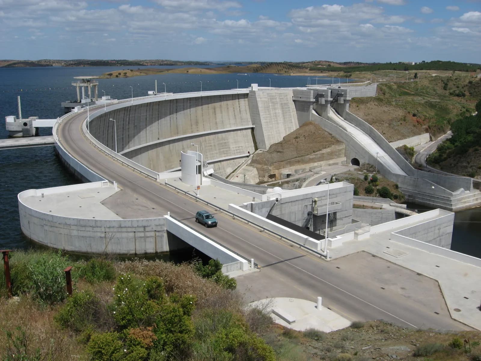
On 8 February 2002 the Guadiana stopped running free through the Alentejo. At a ceremony at the new dam near the village of Alqueva, the gates were closed and the water began to back up behind a concrete arch 96 metres high. The man who gave the order was António Guterres, a prime minister on his way out of office.
Not everyone came to celebrate. Environmental activists protested at the ceremony. They said the lake, about 80 kilometres long, would destroy the habitats of eagles and kites and some of the last Iberian lynxes. Engineers expected it to take about four years to fill.
Upstream, in the parish of Luz in the municipality of Mourão, the news landed differently. For decades the dam had come and gone, and the villagers had half decided it would never be built. Only when the gates shut, with their new village already nearly finished, did most of them accept that they would have to leave.
A dry third of Portugal
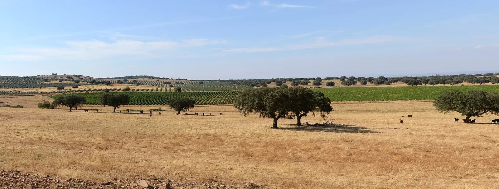
The Alentejo, the great southern plain, covers about a third of mainland Portugal but holds only 5% of its people. Its income per head is below the national average, and it gets too little rain. For generations its farming was rain-fed, what the Portuguese call sequeiro, and lack of water held back both farms and town supplies.
The obvious source of water was the Guadiana, the river that comes in from Spain across the eastern Alentejo. In 1957 the Estado Novo, Salazar's authoritarian regime, drew up a Plano de Rega do Alentejo, an irrigation plan for the region, which assumed a large dam at Alqueva.
For part of its course the Guadiana forms the border, and the tail of a reservoir at Alqueva would reach into that stretch and even into Spain. A Luso-Spanish convention of 1968 on the use of international rivers gave Portugal the hydraulic use of the border stretch, between the mouths of the Caia and the Cuncos.
Forty-five years from plan to floodgates
The project outlived the regime that drew it. In 1975, a year after the Carnation Revolution of 25 April 1974, the Council of Ministers approved the building of the dam. Preliminary works began in 1976: a cofferdam, a tunnel to divert the river and support works for the site. In 1978 they stopped.
For more than fifteen years the project went through cycles of advance and retreat, and the people of Luz, under threat of a move since the start, learned to doubt it.
An integrated environmental impact study was carried out in 1994 and 1995, and in 1995 the state set up EDIA, the Empresa de Desenvolvimento e Infra-estruturas do Alqueva, a company with public capital, to run the whole project, from the dam to the new village. Excavation restarted the same year.
In 1996 the government declared that it would go ahead “unequivocally”, with or without European money, and awarded the main contract for the dam and its power station. In 1997 the project was written into the Community Support Framework for 1994 to 1999, the plan through which EU structural funds reached Portugal. Concrete began to be poured in 1998, and the contract to build the new Aldeia da Luz was awarded in 1999.
1957
Alentejo irrigation plan
The Plano de Rega do Alentejo assumes a dam at Alqueva.
1968
Convention with Spain
Portugal gets the hydraulic use of the Guadiana between the Caia and the Cuncos.
1975
Council of Ministers approves the dam
1976
Preliminary works
Cofferdam, diversion tunnel and site infrastructure.
1978
Works stop
1995
EDIA founded
First-phase excavation resumes.
1996
Main contract awarded
The government commits to the dam with or without EU funding.
1998
Concreting begins
8 February 2002
Gates closed
The reservoir begins to fill. Later that year the first irrigation block opens and the people of Luz begin to move.
2004
Alqueva power station supplies the grid
12 January 2010
Full for the first time
The reservoir reaches 152 metres, its full storage level.
2016
First phase finished
Infrastructure for 120,000 hectares of irrigation completed.
The dam and the lake
- Dam
- Concrete arch, 96 m high, crest 458 m long
- Reservoir area when full
- 250 km²
- Length of the reservoir
- 83 km
- Total storage
- 4,150 million m³
- Usable storage
- 3,150 million m³
- Full storage level
- 152 m above sea level, first reached on 12 January 2010
- Shoreline
- 1,160 km (EDIA); RTP gives 1,100 km
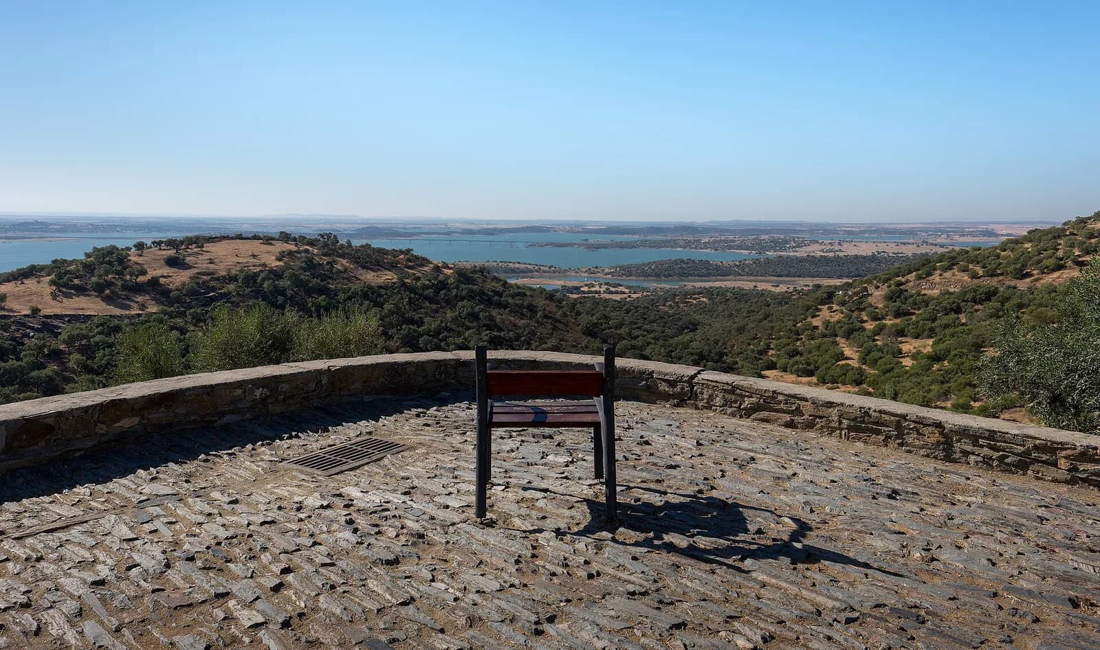
When full, the reservoir stretches 83 kilometres up the Guadiana valley across the municipalities of Moura, Portel, Mourão, Reguengos de Monsaraz and Alandroal. EDIA and RTP call it the largest artificial lake in Europe; Euronews says Western Europe. It holds nearly four times as much as Castelo do Bode on the Zêzere, now the second-largest reservoir in Portugal.
Sceptics had long said there was not enough water in the Guadiana to fill such a lake. The four-year forecast of 2002 proved optimistic, but the reservoir did fill: it first reached its full level of 152 metres on 12 January 2010, almost eight years after the gates closed. By February 2022 it had been full four times and had made three controlled releases.
“Twenty years ago people said there was no water, that it would never fill. It was a common myth. It filled, and it filled fast.”
Downstream, the smaller Pedrógão dam forms a counter-reservoir, which lets Alqueva's power station run in reverse and pump water back up. The power stations at Alqueva and Pedrógão began work in 2004 and 2006 and were let in concession to the electricity company EDP. EDIA says Alqueva produces more than 4% of Portugal's hydroelectric power.
The village under the water
Luz was a quiet village at the end of a road. The only thing beyond it was the Castelo da Lousa, a Roman building of recognised archaeological value. The village had a fifteenth-century parish church, a cemetery, a bullring and a sanctuary to Nossa Senhora da Luz, Our Lady of Light, who in the legend of its founding had appeared there. All of it lay below 152 metres.
How many people lived there depends on who counted. The anthropologist Clara Saraiva, who worked with the villagers through the move, gives about 300 inhabitants and 180 houses. The researcher André Pereira writes of about 200 people, and the news agency Lusa, marking Alqueva's twentieth anniversary, gave about 400.
The villagers refused cash compensation. They wanted to stay together, and their demand, in Saraiva's account, was simple:
“House for house and land for land.”
Building a new village was the answer, about 2 kilometres from the old one, with a street plan copied from it. That was not inevitable: another option was to ring old Luz with dikes. At Portugal's best-known drowned village, Vilarinho da Furna, flooded under the dictatorship in 1972, the people had simply been paid for their land and houses and had scattered.
The planning was painful. Families argued over the size of each room in their new houses, and old neighbours grew jealous of each other. EDIA, which was building both the dam and the village, became the enemy.
The people of Luz decided they would not abandon their “alminhas”, the souls of their dead, and that the dead must move before the living. In July 2002, over 13 days, the cemetery was emptied and every grave moved to the new village. The last festa of Nossa Senhora da Luz in the old village was held as usual on the first weekend of September.
Through September and October 2002 the families moved house. The prime minister, by then José Manuel Durão Barroso, inaugurated the new Aldeia da Luz on 19 November 2002, with most of its people already living there. That autumn and winter were wet. In early 2003 the rising water drove the last holdouts from the old village, and in February the old church and bullring were knocked down.
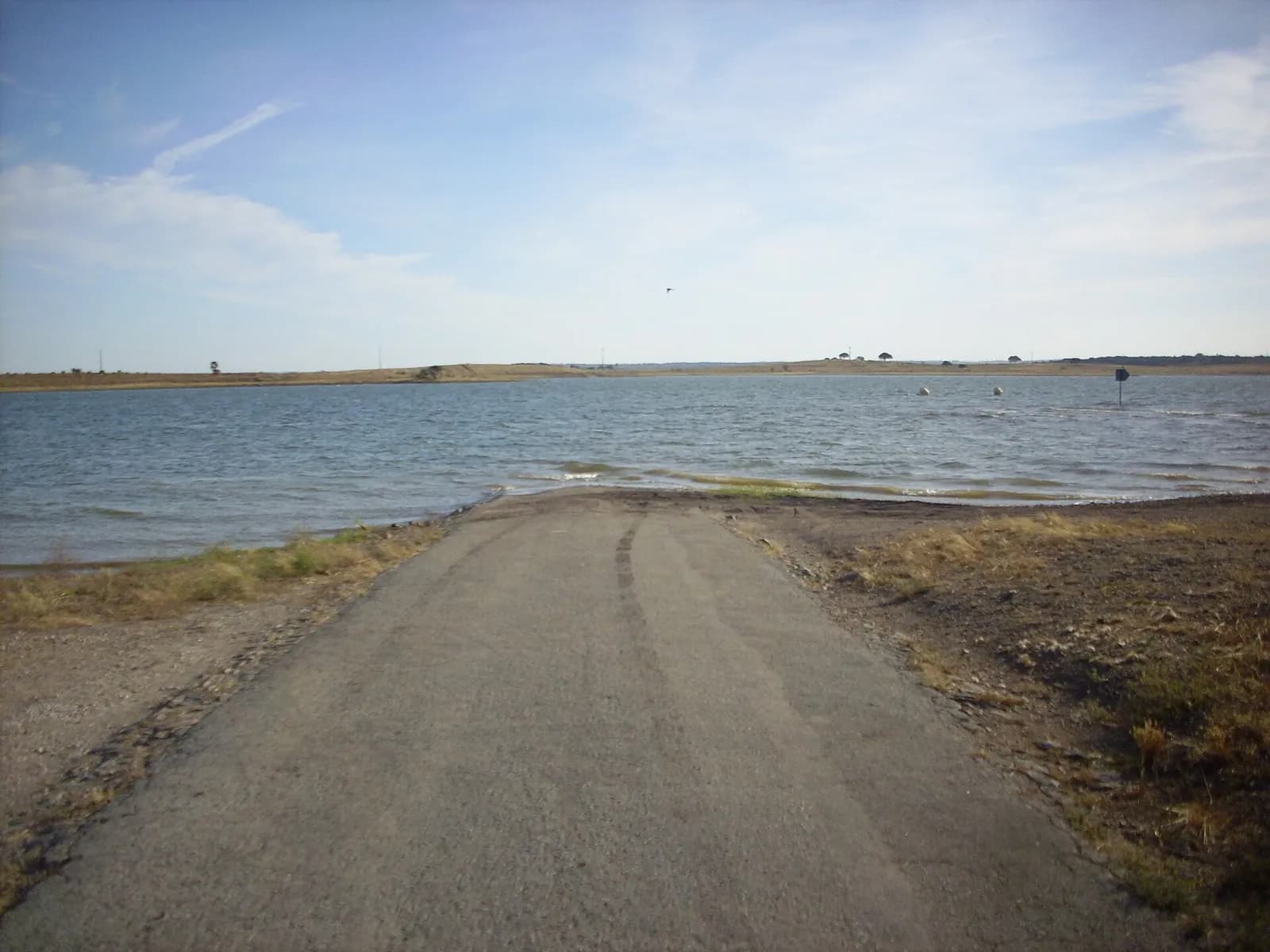
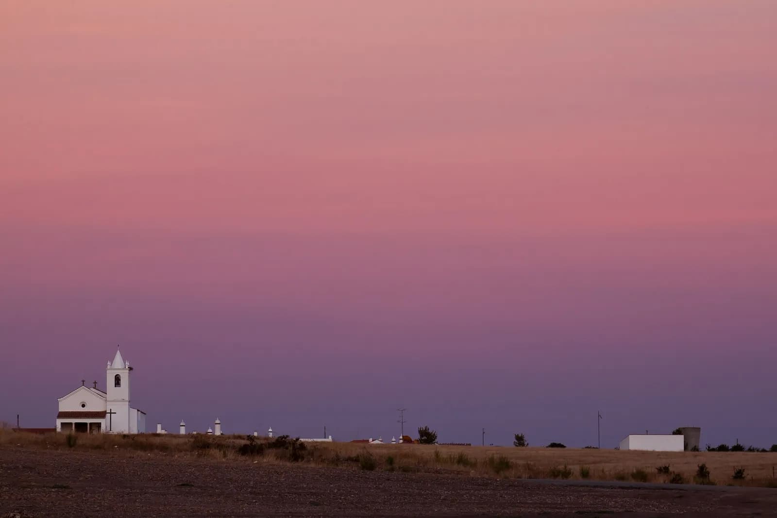
The old village was demolished on purpose, so that no ruins would show when the water dropped. Tiles, beams and slate benches were first stripped out to be returned or reused, and the work took from February to September 2003. A museum, which the villagers had asked for since a survey in the 1980s, opened in November 2003 on the first anniversary of the new Luz, between the rebuilt church and the transplanted cemetery.
The new houses did not mend everything. A survey four years after the move, by the sociologist João Pedro Reino and colleagues, found the residents on average disappointed with the new village and the community “fragmented”, despite efforts to keep up an appearance of cohesion.
Trees, lynx and rock art
The valley had to be cleared before it was flooded. On 12 February 2001 workers began felling about 1.3 million trees, according to a report at the time. The Liga para a Proteção da Natureza, one of Portugal's largest environmental groups, called it “one of the biggest acts of environmental destruction ever in Portugal” and said a forestry plan and a plan to evacuate wildlife had been ignored.
Quercus, another national group, attacked the economics. It argued that the price charged for the water would not match its real value, against European water rules, and that farming, a declining sector in the Alentejo, offered no long-term answer. The government promised 20,000 jobs, partly from golf courses for tourists.
Then came the rock art. In November 2000 the Spanish authorities reported engravings at the tail of the reservoir, and by July 2001 they had recorded 434 panels, most with Neolithic and later human figures and abstract signs. In April 2001 more were found on the Portuguese side, where a team of 20 combed 75 kilometres of the banks of the Guadiana and its tributaries that summer and recorded 200 panels. An internet petition demanded that they be saved.
In the 1990s Portugal had abandoned a dam on the Côa to save Palaeolithic engravings, and the archaeologist who had led that fight, João Zilhão, now ran the state's archaeology institute. This time he backed the dam. More than a hundred archaeologists had already tested or excavated 222 sites in the valley, and he argued the rock art was neither unique nor in great danger.
“The vast majority of the rock art of concern here is located in the river bed or in the floodplain, that is, it has been regularly under water, in the Winter, or variably covered by river sands and gravel, in the Summer, for several millennia.”
Environmental groups proposed a compromise: fill the reservoir only to 139 metres instead of 152. The government kept the full height. In 2002 the protesters at the dam were still warning about the lynx and the birds of prey.
From wheat to olives
The first irrigation block, in the Odivelas scheme, began working in 2002. From the main reservoir, a chain of dams, reservoirs and irrigation blocks carries water across an area of about 10,000 square kilometres in the districts of Beja, Évora, Portalegre and Setúbal. EDIA counts 72 dams and reservoirs in the system.
Alqueva irrigated area in operation
hectares
Milestones from EDIA's chronology; years without a milestone are left out. The first phase, 120,000 hectares, was finished in 2016, nine years ahead of the 2025 target; about 10,000 hectares of a second phase followed in 2022.
Show the data
| Area in operation | |
|---|---|
| 2012 | 52,000 |
| 2013 | 68,000 |
| 2016 | 120,000 |
| 2022 | 130,000 |
Most farmers took the water. EDIA put take-up of the irrigation at more than 97% in 2021, when 2,675 clients irrigated 117,595 hectares inside and outside the scheme. Over the years they moved from annual crops such as maize, cereals and vegetables to permanent ones, above all olive groves, which EDIA says pay better in the long run and suffer less from swings in price.
Spanish investors came first, bringing intensive, mechanised olive groves planted in dense hedgerows. Portuguese growers learned the system, and by 2025 they held 64% of the investment in olives against 31% for Spanish companies. Almonds followed, fastest from 2018.
Olive and almond groves irrigated by Alqueva
hectares
- Olive groves
- Almond groves
Area occupied by each crop in the Alqueva irrigation scheme, from EDIA's Anuário Agrícola de Alqueva 2025 (charts 16 and 19). Almonds peaked in 2023.
Show the data
| Olive groves | Almond groves | |
|---|---|---|
| 2017 | 39,403 | 4,235 |
| 2018 | 52,368 | 6,740 |
| 2019 | 59,054 | 10,615 |
| 2020 | 64,898 | 14,679 |
| 2021 | 66,246 | 18,261 |
| 2022 | 67,801 | 22,391 |
| 2023 | 71,045 | 23,859 |
| 2024 | 74,059 | 23,563 |
| 2025 | 76,728 | 22,728 |
| Crop | 2017 (hectares) | 2025 (hectares) |
|---|---|---|
| Olive groves | 39,403 | 76,728 |
| Almond groves | 4,235 | 22,728 |
| Vineyards | 3,949 | 5,293 |
| All permanent crops | 42,837 | 98,162 |
| All annual crops (cereals, maize, vegetables and others) | 19,504 | 15,191 |
| Permanent crops as a share of the total | 69% | 87% |
Areas in the Alqueva irrigation scheme. The permanent and annual totals and the shares exclude farms that draw water directly from the reservoir. EDIA's president gave Lusa a rounder figure of 63,000 hectares of olives for 2021.
For Portugal the result is measurable. EDIA says the new groves made the country self-sufficient in olive oil after decades of deficit, and its president says Alqueva now produces the largest share of Portugal's olive oil and more almonds than any other part of the country. The olive growers' association Olivum says olive oil exports have grown twelvefold in volume since 2002 and are worth about €900 million a year.
Why it still matters
EDIA calls Alqueva the largest investment ever made in the Alentejo: €2,427 million by the end of 2021, by its president's count. Since 2010 it has been linked to the reservoirs that supply drinking water to 13 municipalities, Beja and Évora among them, with more than 200,000 people, and in a drought it can top them up. RTP reported that in towns such as Serpa, where water once came at set hours, it is now something people can count on.
The argument about who benefits has not gone away. Euronews reported in 2025 that, by EDIA's figures, more than 80% of the water goes to intensive olive and almond plantations, and that a few large companies control most of the irrigated land. Teresa Pinto Correia, a professor at the University of Évora, says the price of water should cover the cost of the infrastructure, and Pedro Horta of the environmental group Zero calls the change to the countryside “an ecocide”. EDIA's president, José Pedro Salema, told Euronews that the dam secures the region's water supply and has brought jobs and investment.
Climate change raises a newer question. A study by the consultancy Agrogés expects the water needs of irrigated olive groves to rise by 5% to 21%, while average inflows to the reservoir fall by 5% to 10% by 2050. “We won't have enough water,” Pinto Correia warns. EDIA's president told RTP that the water stored can be managed over several years, and the company is still extending the irrigated area, by about 470 square kilometres according to Euronews.
FAQs
When did the Alqueva reservoir start filling?
The gates of the Alqueva dam were closed on 8 February 2002, at a ceremony presided over by the prime minister, António Guterres, and the reservoir began to fill that day. It first reached its full storage level of 152 metres on 12 January 2010.
How big is the Alqueva reservoir?
When full it covers 250 square kilometres, stretches 83 kilometres along the Guadiana, has more than 1,100 kilometres of shoreline and holds 4,150 million cubic metres of water, of which 3,150 million are usable. EDIA calls it the largest artificial lake in Europe; Euronews says Western Europe.
What happened to the village of Luz?
Luz, in the municipality of Mourão, lay below the reservoir's full level. Its people, between about 200 and 400 by different counts, moved to a new village built about 2 kilometres away in late 2002, after their cemetery had been moved in July; the last families left in early 2003. The old village was demolished between February and September 2003, and the Museu da Luz opened in the new village in November 2003.
What is Alqueva water used for?
Mainly irrigation: about 130,000 hectares in 2022, most of it olive and almond groves. It also tops up drinking water for more than 200,000 people in 13 municipalities and drives the Alqueva and Pedrógão hydroelectric stations.
Why was the Alqueva dam controversial?
Environmental groups objected to the felling of more than a million trees, the loss of habitat for species such as the Iberian lynx, the flooding of rock art and a water price that, Quercus argued, would not match its real value. Today the main criticism is that the water mostly feeds intensive olive and almond plantations owned by large companies.
On the timeline
Open the timelineNearby moments from portugal in europe (1986–today).
Death of Marshal Francisco da Costa Gomes in Lisbon, aged 87. Career soldier, Chief of Staff of the Armed Forces and President of the Portuguese Republic from 1974 to 1976, he was — alongside António de Spínola — the senior military figure of the Carnation Revolution and the man who guided Portugal through the most turbulent phase of decolonisation and the transition to democracy.
UNESCO inscribes the Alto Douro Wine Region on its World Heritage List as an 'evolving, living cultural landscape'. Its steep schist terraces, carved by hand over centuries along the Douro and its tributaries, produce port wine in a region demarcated in 1756, often called the world's first officially demarcated wine region.
Portugal's banks and shops open for the first full business day of the euro. Notes and coins had gone into circulation at midnight on New Year's Day, and the escudo, the currency of the Republic since 1911, was withdrawn from use at the end of February.
The Alqueva dam closes
The floodgates of the Alqueva dam on the Guadiana are closed, and the reservoir begins to fill. Covering some 250 square kilometres when full, it is often called the largest artificial lake in Western Europe. Its water brought irrigation and olive and almond groves to the parched Alentejo, and it drowned the old village of Luz, rebuilt nearby.
Death of José Travassos, one of Sporting's 'Cinco Violinos' (Five Violins), the forward line that ruled Portuguese football in the 1940s. Nicknamed 'Zé da Europa', in 1955 he became the first Portuguese player picked for a Rest of Europe XI, against Great Britain.
Portuguese legislative elections are held, won by the PSD under José Manuel Durão Barroso, who would later become President of the European Commission (2004–2014).
Portugal crash out of the World Cup in Incheon, beaten 1–0 by co-hosts South Korea after finishing with nine men. Striker João Pinto, sent off for a lunge on Park Ji-sung, punches the Argentine referee Ángel Sánchez in the stomach and is banned by FIFA for four months — an inglorious end for the 'Golden Generation' at its first World Cup.
Coming up in history
All long reads 10 February 1763The Treaty of Paris and the Fantastic War: Portugal, 1762 to 1763
 11 February 2007Portugal’s 2007 abortion referendum: a yes vote that did not bind
 12 February 2002José Travassos and the Cinco Violinos, Sporting's forward line
 13 February 1965Operation Autumn: how the PIDE murdered General Humberto Delgado, 1965
17 sources
Archives, scholarship and reporting this article was checked against.
- 1
Cronograma histórico do Empreendimento de Fins Múltiplos de AlquevaEDIA, Empresa de Desenvolvimento e Infra-estruturas do Alqueva
- 2
- 3
Um museu debaixo de água: o caso da Luz (Clara Saraiva)Etnográfica, vol. 11 (2), November 2007, pp. 441–470
- 4
Aldeias submersas em Portugal: Vilarinho da Furna, Aldeia da Luz e as “outras aldeias [que] ficaram debaixo de água”André Pereira, Análise Social, n.º 256 (2025)
- 5Barragem do Alqueva: 20 anos a encher a albufeiraRTP Notícias, 8 February 2022
- 6
- 7
The rock art of Guadiana, the Alqueva dam, and the UISPP “International Commission”: a personal clarification (João Zilhão, 19 September 2001)World Archaeological Congress, reproducing a statement by the director of the Instituto Português de Arqueologia
- 8
Protests at Alqueva openingInternational Water Power & Dam Construction, 2 March 2002
- 9
- 10
- 11
“An ecocide”: How olive oil giants are using a mega-dam to take over Portugal’s growing region (Marta Vidal)Euronews Green, 13 April 2025
- 12
Energia hídrica: aproveitamentos hidro-eléctricos em Portugal (conference “As energias do presente e do futuro”, 21–22 November 2005)António Gonçalves Henriques, Instituto Superior Técnico
- 13
Barragem de Castelo de Bode faz hoje 75 anos: a maior origem de água para abastecimento público (Nota à Comunicação Social n.º 006/2026, 21 January 2026)Agência Portuguesa do Ambiente (APA)
- 14
Alqueva enche há 20 anos, rega, produz energia e abastece populações (Lusa)Postal do Algarve, February 2022
- 15
- 16
Controversial new Portuguese reservoir will be one of Europe’s biggestedie, 16 February 2001
- 17
Image credits
- The Alqueva dam on the Guadiana in May 2007, five years after its gates were closed. Ceinturion, CC BY-SA 4.0, via Wikimedia Commons.
- Alentejo farmland near Elvas in September 2013: cork oaks over a harvested wheat field, with vines and olive trees behind. Alvesgaspar, CC BY-SA 3.0, via Wikimedia Commons.
- A road at Aldeia da Luz running into the Alqueva reservoir, June 2011. F nando, CC BY-SA 3.0, via Wikimedia Commons.
- The rebuilt church of Nossa Senhora da Luz on the edge of the new Aldeia da Luz, at dusk in October 2011. Paulo Valdivieso from Lisboa, Portugal, CC BY-SA 2.0, via Wikimedia Commons.
- The Alqueva reservoir seen from the castle of Monsaraz in October 2017. Jules Verne Times Two, CC BY-SA 4.0, via Wikimedia Commons.