

The earthquake of 28 February 1969: Portugal’s strongest of the century
For about a minute, the strongest earthquake to hit mainland Portugal in the twentieth century shook a sleeping country out of bed. It killed at least 13 people, wrecked villages in the western Algarve and became the reference event for studying the fault zone that may also have produced the earthquake of 1755.
At a glance
- At 3.41 in the morning, Portuguese time, on Friday 28 February 1969 (02:40 GMT, as Portugal then kept its clocks an hour ahead of Greenwich all year), an earthquake under the Atlantic about 190 kilometres south-west of Sagres shook all of mainland Portugal for about a minute.
- Its magnitude is given as 7.8 (Mw, in the ISC-GEM catalogue used by the US Geological Survey) to 8.0 (Mw, IPMA). The first official communiqué, issued that morning, said 7.3.
- IPMA counts 13 dead in mainland Portugal, 2 of them killed directly and 11 indirectly; a 2021 study of the newspapers found 16, 3 of them direct. There were more deaths in Morocco and Spain, and NOAA's database gives 25 in all.
- The worst damage was in the western Algarve, where villages such as Bensafrim, Barão de São João and Vila do Bispo lost dozens of old earth and rubble houses. In Lisbon chimneys and balconies fell on parked cars.
- A small tsunami, under a metre high on Portuguese tide gauges, reached Lagos and Cascais within about 40 minutes. The quake's thrust mechanism showed seismologists how Africa and Eurasia collide off Cape São Vicente.
“A minute that lasted hours”
At 3.41 on the morning of Friday 28 February 1969 the needles of the seismographs in Lisbon and Coimbra began to swing, and soon ran off the scale. Clocks stopped. In Faro, the clock on the Arco da Vila, the gate into the old town, stopped at 3.42.
The shaking went on long enough for people to understand what it was. In Lisbon men, women and children groped their way out to the street in the dark, because the electricity had failed, many in pyjamas and nightdresses. Whole families got into their cars and drove to open ground. Many spent the rest of a cold, drizzly night outside, wrapped in blankets.
“The earthquake, as well as its great intensity, was particularly violent because of its extraordinary duration: about a minute, a minute that lasted hours.”
In the hospital of the Misericórdia at Alhos Vedros, across the Tagus, a 20-year-old woman called Inácia da Silva was in labour with her first child. When the building began to shake, she and the midwife ran down the corridors and did not stop until they reached the square outside. Later, when the panic had passed, they went back in and she gave birth to a girl. Both were well.
Far out at sea, the crews of passing ships thought they had run aground or hit something. The Esso Newcastle, a 226-metre ship of 51,429 gross tons, was about 167 kilometres from the epicentre when her captain was shaken out of bed.
“A most unusual and frightening incident happened this morning. I was shaken out of bed by a severe shuddering, vibrating and rumbling noise, with a feeling as if the ship was lifting out of the water.”
A fault line under the sea, a regime in transition
Off the south-west corner of Portugal, the African and Eurasian plates converge at about 4 millimetres a year. The boundary there is not one clean fault but a band of deformation about 200 kilometres wide, with faults running from the Gorringe Bank, south-west of Cape São Vicente, towards the Strait of Gibraltar. The south of the country is where Portugal's seismographs record the most earthquakes.
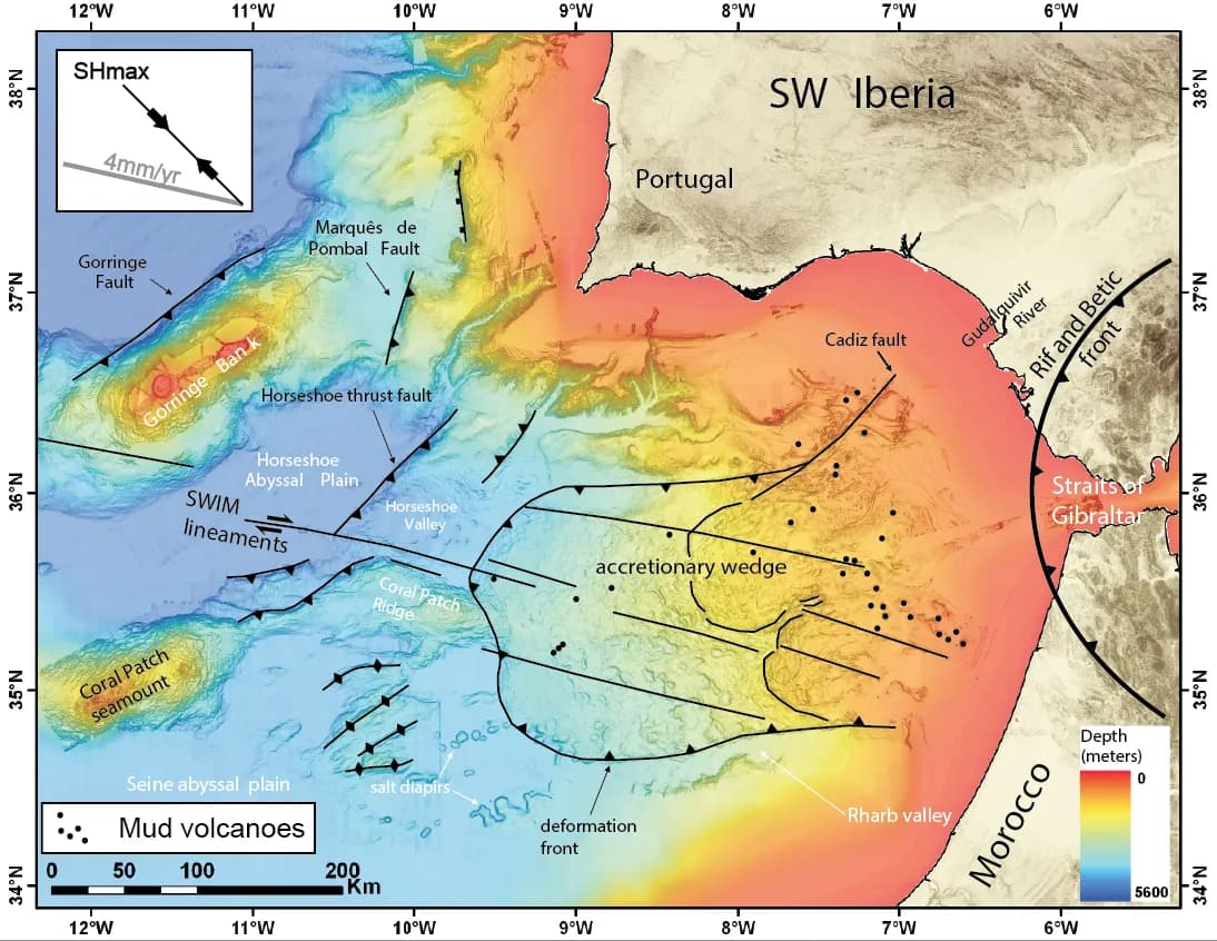
The same zone is the leading suspect for the great Lisbon earthquake and tsunami of 1 November 1755. Closer to living memory, the Benavente earthquake of 23 April 1909, on land in the Tagus valley, had killed more people than any other Portuguese earthquake of the century: 46 or 47 dead in the scholarly counts, though Observador puts the toll at 42.
Portugal had only three seismograph stations, in Lisbon, Coimbra and Porto. Its anti-seismic building rules dated from 1958 and applied only to buildings put up after that year. In 2019, according to Lisbon city council figures quoted by Observador, 67 per cent of the capital's buildings were older than those rules.
The shock: where, when and how big
The earthquake began at 02:40:32 Greenwich time under the Horseshoe Abyssal Plain, a deep stretch of ocean floor near the Gorringe Bank. Portuguese clocks read 3.40, because from 1966 to 1976 the country kept the former summer time, an hour ahead of Greenwich, all year; the waves reached the Lisbon seismograph under a minute later, at 3.41. The ISC-GEM catalogue places the epicentre 188 kilometres south-west of Sagres at a depth of about 15 kilometres; studies of the source in the 1970s and 1980s put the focus at 22 to 33 kilometres.
The first communiqué of the Serviço Meteorológico Nacional, the forerunner of today's IPMA, put the epicentre about 230 kilometres south-west of Lisbon and the magnitude at 7.3 on the Richter scale. By the afternoon the US national earthquake information centre in Washington had given 7.9. Later estimates, from the full international network, settled between 7.8 and 8.0.
| Estimate | Who | When |
|---|---|---|
| 7.3 (Richter) | Serviço Meteorológico Nacional communiqué | Morning of 28 February 1969 |
| 7.5 (Richter) | Diário de Lisboa, from early reports | Afternoon of 28 February 1969 |
| 7.9 (Richter) | US earthquake information centre, Washington | 28 February 1969 |
| Ms 7.9 and Mw 8.0 | IPMA, after integrating international data | Report of 2014 |
| Mw 7.8 | ISC-GEM catalogue, used by the USGS and NOAA | Current catalogues |
| Mw 7.9 | Research papers on the fault zone | 2013 to 2021 |
Richter magnitude, surface-wave magnitude (Ms) and moment magnitude (Mw) are different scales, so the figures are not strictly comparable. Mw is the scale seismologists now use for large earthquakes.
It was felt up to 1,300 kilometres away, in Bordeaux and the Canary Islands, across Spain and Morocco, and in Madeira, where an empty house collapsed. The strongest shaking, intensity VIII on the Mercalli scale, was in the western Algarve; Lisbon was given intensity VI. A 2021 reassessment on the modern European scale put the Algarve's maximum a degree lower, at VII.
The aftershocks came for weeks. The largest, of magnitude 6.2, struck at 04:25 Greenwich time, less than two hours after the main shock. That morning's communiqué noted another tremor felt in Lisbon at 5.28, much weaker there, at intensity III. Observador, citing IPMA's catalogue, counts 89 aftershocks on the first day and 256 by 11 March.
Lisbon and the rest of the country
In Lisbon countless chimneys came down, along with poorly built walls, cornices and balconies. In Rua de São Mamede ao Caldas, between the Costa do Castelo and Rua da Madalena, balconies fell onto the cars parked below. Parts of the city lost electricity and telephones. The 25 operators on duty at the telephone faults service in Rua da Trindade kept working through the crisis, and at 3am the next day 10,000 to 12,000 calls from Lisbon to the rest of the country were still waiting to be put through.
Vieira and Oliveira, who went through the newspapers and the fire brigade's call logs for the following month, identified 909 damaged private buildings in the city, most of them Pombaline houses built after 1755 and the taller “gaioleiro” blocks that went up from the mid-nineteenth century. At the Paços do Concelho, the city hall, the ceilings of three rooms fell in.
The Hospital de São José, the old central hospital, was among the worst hit. Wide cracks opened in the walls and ceilings of its surgical and orthopaedic wards, some ceilings partly fell, and patients had to be moved out. Its casualty department treated 60 people that night, for cuts from glass and stones, falls and “nervous crises”.
Panic did as much harm as masonry. In Faro, a 23-year-old bank clerk threw himself from a first-floor window and was taken to hospital with several fractures. In Nazaré a woman did the same. Across the river in Cova da Piedade, the roof of a house fell in on two families, and the ceiling boards held long enough to save them.
Damage reached far north of the capital. In Leiria chimneys fell and part of a roof collapsed. At the monastery of Batalha, pillars along the cornice of the main front shifted, the carved finials fell and the main tower cracked. In Covilhã, in the mountains of the interior, people ran into the street after a long tremor, but nobody was hurt.
The Algarve: villages of earth and rubble
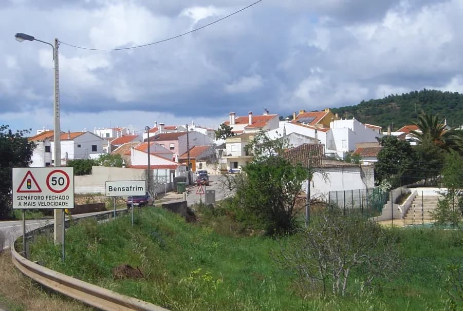
The Algarve was nearest the epicentre, and the western end of it, the Barlavento, took the worst. In Bensafrim, a village north-west of Lagos, more than 20 houses fell, according to IPMA's report; Vieira and Oliveira and the Diário de Notícias put the number at about 50. In Vila do Bispo and every village of its municipality many houses fell and others were badly damaged. In Fonte de Louzeiros, a hamlet in the municipality of Silves, only one of its 16 houses was left standing, and that one badly damaged.
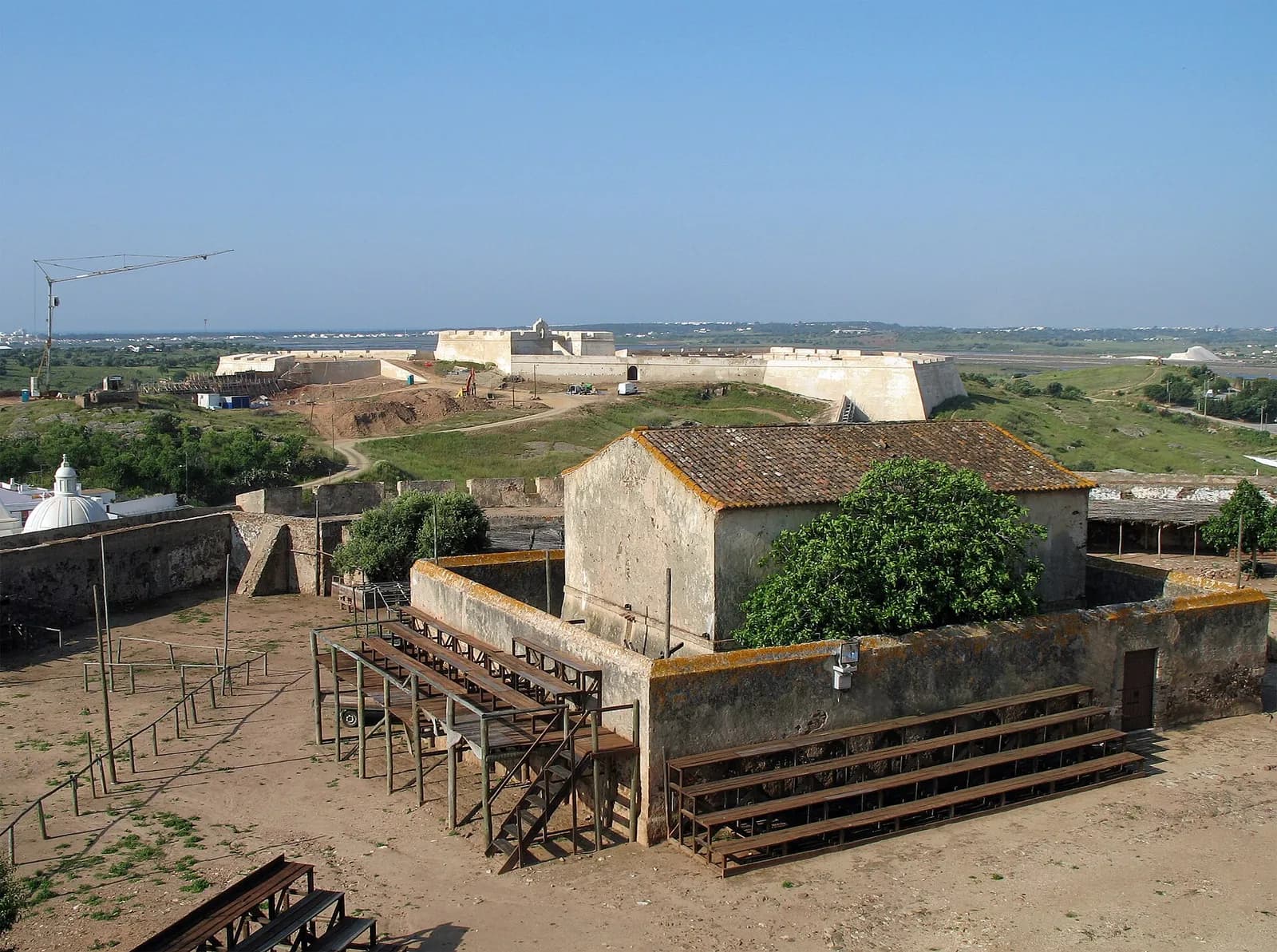
In Lagos many buildings had to be shored up, in Rua Afonso de Almeida and Rua Direita among others, and the upper floor of the town hall cracked and threatened to collapse. The town's Misericórdia hospital was, the Jornal do Algarve wrote, “cracked like a pomegranate”, with hardly an arch over a door or window left whole. Far to the east, near the Spanish border, the upper part of the north walls of Castro Marim's thirteenth-century castle fell.
Many of the houses that fell were built of taipa, rammed earth, or of rough stone. Vieira and Oliveira put such rural houses in the most vulnerable class of the European scale engineers use to grade damage. Heavy rain and thunderstorms followed the quake, and the water got in through the cracks and damaged roofs, putting weakened buildings further at risk. IPMA's report estimates that about 400 houses fell or were ruined; Observador gives 420.
Marcelo Caetano, five months into his premiership, visited the damaged São José hospital, as the Diário de Notícias reported on 2 March. On the afternoon of 7 March he flew to the Algarve with the Minister of Public Works, stayed the night and toured Portimão, Lagos, Bensafrim, Barão de São João, Barão de São Miguel and Vila do Bispo to see the damage for himself.
How many died
The papers on the afternoon of the 28th reported one death, near Lagos, where a house fell. IPMA's report says a person in Lagos died when a wall of the run-down house where they lived collapsed. The Jornal do Algarve reported that the ceiling of his house fell on João Gregório dos Reis, 61, of Barão de São João, a village in the municipality of Lagos.
Most of the dead were not crushed. IPMA counts 11 indirect deaths in mainland Portugal; Observador describes them as victims of the panic as people fled, and the Diário de Notícias wrote in 2019 that some had suffered “síncopes”, sudden collapses. Vieira and Oliveira count 16 deaths, 3 of them direct, and record a person killed by falling rock in Portimão. Abroad, the papers reported two dead and eight injured in Salé, in Morocco, and a man of 64 in Seville who died of a heart attack.
| Source | Dead | Injured |
|---|---|---|
| Diário de Lisboa, afternoon of 28 February 1969 | 1, near Lagos | Many dozens |
| IPMA report, 2014 | 13 in mainland Portugal (2 direct, 11 indirect); some in Morocco | 58 slightly injured in Lisbon |
| Vieira and Oliveira, 2021 | 16 in mainland Portugal (3 direct); about 8 in Morocco; 5 in Spain | About 70 in Lisbon and 150 in the Algarve; 11 in Morocco; 6 in Spain |
| NOAA NCEI database | 25 in all countries | 80 in all countries |
Indirect deaths are those caused by fright, falls or flight rather than by falling buildings. The counts differ because they draw on different newspapers and records, and because some authors include Spain and Morocco.
At sea: a seaquake and a small tsunami
The ship closest to the epicentre was the Norwegian Ida Knutsen, of about 32,000 tonnes, some 19 kilometres away. At 02:45 GMT she took a violent vertical blow from below. Her navigation and radio equipment was wrecked, her hull and frames buckled, and instruments were torn off the bulkheads. She had to put into Lisbon, and she was declared a total loss. The blow reached her through the water as a pressure wave, a “seaquake”, not as a breaking sea.
On the Portuguese ship Manuel Alfredo, the third officer, João Rocha, stopped the engines because he thought they had run aground. He told the Diário de Lisboa that it felt like climbing stairs, then huge waves of thick brown water broke over the bow. For hours afterwards the ship rolled in unusual swells.
Tide gauges along the coasts of Portugal, Spain and Morocco recorded a small tsunami. It reached Lagos and Cascais in under 40 minutes, the Tagus at Pedrouços in 52, and the Azores in a little over two hours. In Montijo a wave was seen running along the quay, at Cabedelo beach near Viana do Castelo the sea reached the dunes, and fishermen in Matosinhos and Fuseta noticed a sudden stir in the sea.
How long the tsunami took to reach Portuguese tide gauges
minutes after the shock
Travel times from the earthquake at 02:40 GMT to the first wave at each tide gauge, as listed in NOAA's Global Historical Tsunami Database. For comparison, the same database gives 40 minutes to Casablanca and 85 minutes to Cádiz.
Show the data
| Travel time | |
|---|---|
| Lagos | 38 |
| Cascais | 39 |
| Culatra (Olhão) | 42 |
| Pedrouços (Lisbon) | 52 |
| Terreiro do Paço (Lisbon) | 67 |
| Leixões | 85 |
| Aveiro | 109 |
| Angra do Heroísmo (Azores) | 138 |
| Horta (Azores) | 151 |
| Tide gauge | NOAA NCEI database | Other published figures |
|---|---|---|
| Pedrouços (Lisbon) | 0.70 m | |
| Terreiro do Paço (Lisbon) | 0.25 m | |
| Leixões | 0.45 m | |
| Faro-Olhão | 0.20 m | |
| Horta (Azores) | 0.76 m | |
| Cascais | No height given | 0.93 m (Florido, 2019) |
| Lagos | No height given | 0.84 m (Florido, 2019) |
| Casablanca | 0.90 m | 1.2 m (Ambraseys, 1985) |
Florido and Ambraseys are quoted by Vieira and Oliveira (2021). NOAA lists the Lisbon square under both its names, giving the height under Praça do Comércio and the travel time under Terreiro do Paço. The sources do not always say how heights were measured, so the figures vary. Observador, citing the journal Finisterra, gives 41 centimetres as the highest wave on the Portuguese coast and 60 centimetres at Casablanca.
What it taught seismologists
Seismologists abroad studied the records to work out how the fault had moved: López-Arroyo and Udías and McKenzie in 1972, Yoshio Fukao in 1973, and Buforn and colleagues and Grimison and Chen in 1988. At home, Porto had since 1963 had a station of the World-Wide Standard Seismograph Network.
They all found the same thing: a reverse, or thrust, fault, striking north-east to south-west and dipping about 50 degrees, with a small sideways component. One block had been pushed up over the other, as compression between Africa and Eurasia predicts. Fukao titled his paper “Thrust faulting at a lithospheric plate boundary”. The Porto station recorded 47 aftershocks by 24 March, and the mechanisms of the larger ones later helped pin down the plane of the fault.
- Fault type
- Reverse (thrust), strike about 40 to 70 degrees, dip about 50 degrees
- Rupture
- About 80 to 85 km long, 20 to 50 km wide
- Average slip
- About 4 m (Grandin and others, 2007)
- Seismic moment
- 6.3 × 10¹⁹ to 8.0 × 10²⁰ newton-metres, depending on the study
- Convergence rate
- About 4 mm a year between Africa and Eurasia
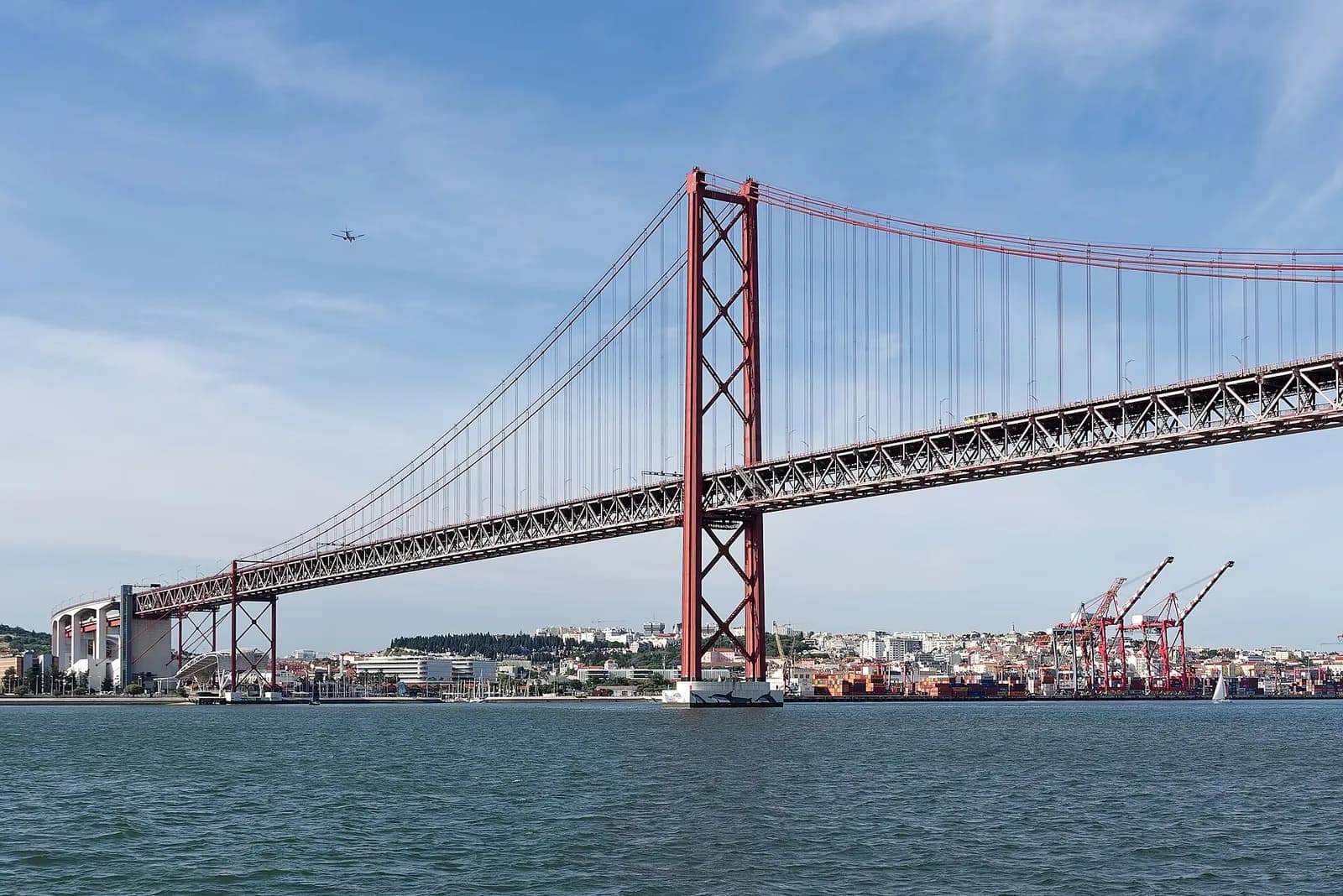
On land, the only record of the strong shaking that did not go off the scale came from an accelerograph the Laboratório Nacional de Engenharia Civil had installed in the north anchorage of the Tagus suspension bridge, today's Ponte 25 de Abril. IPMA calls it a complete record; Vieira and Oliveira say a power cut stopped it after 27 seconds.
After 1969 the national network improved considerably, in steps. Even so, the analogue network of the 1970s and 1980s could locate only 20 to 25 per cent of the local earthquakes it recorded, and only three or four stations reported to Lisbon in real time.
1909
Benavente earthquake
The country has one Milne horizontal pendulum, at Coimbra university's observatory.
1946
The weather service takes over
The Serviço Meteorológico Nacional, forerunner of IPMA, takes over the stations in Lisbon, Coimbra and Porto.
1963
Porto joins the world network
A World-Wide Standard Seismograph Network station is installed in Porto.
After 1969
Faro and Manteigas
A short-period station opens in Faro, and another in Manteigas in 1975, followed by five more stations, some with analogue telemetry.
1995 to 1996
Algarve regional network
Seven radio-linked stations, funded by the European Commission, transmit to a hub on the Fóia in the Serra de Monchique.
1998
Digital network
Fourteen digital stations on the mainland and in Madeira.
2006 to 2009
Broadband network
Twenty-two broadband stations with accelerometers send data to Lisbon within 4 to 10 seconds.
Since then, 1969 has been the yardstick for 1755. Almost every study of the great Lisbon earthquake compares it with 1969 and with a magnitude 6.0 quake of 12 February 2007 in the same area, which had the same mechanism and a similarly deep source. One 2021 study describes the 1969 tsunami as “centimetric” on the south-west coast, against waves several metres high in 1755, and cites earlier work putting the energy released in 1755 at 15 to 30 times that of 1969.
Which fault broke in 1969 is still argued over. Ocean-bottom seismometers laid near the Horseshoe fault in 2012 recorded quakes 40 to 60 kilometres down under the Horseshoe Abyssal Plain, in the mantle. In 2019 a team led from the University of Lisbon wrote that the 1969 earthquake's source and its capacity to generate tsunamis “remain largely unknown”, partly because no fault that could be responsible shows on the sea floor. In 2021 a team from Barcelona's Institute of Marine Sciences proposed a deep thrust under the plain as the most likely source of 1755 and of other recent large earthquakes in the area.
Why it still matters
In 2014 IPMA described 1969 as the last great earthquake on the Portuguese mainland, and the most important of the twentieth century once both magnitude and effects are counted. When it turned fifty in 2019, it was still the last quake to cause serious damage and deaths there.
Lagos, one of the worst-hit towns, marked the fiftieth anniversary in 2019 with a public session on seismic risk. The organisers, the town council and the Portuguese societies of earthquake engineering and of meteorology and geophysics, said the collective awareness of the risk fades with time and needs to be renewed.
The engineers' conclusion from 1969 is plain. The buildings that failed were the old ones: rural houses of rammed earth and rubble in the Barlavento, and older masonry in downtown Lisbon and Setúbal. Vieira and Oliveira single out the same types as the most fragile if a quake of similar or greater intensity strikes, which, they write, is inevitable.
FAQs
How strong was the 1969 earthquake in Portugal?
Current catalogues give a moment magnitude of 7.8 (ISC-GEM, used by the USGS) to 8.0 (IPMA). The first official figure, issued on the morning of 28 February 1969, was 7.3. It is the strongest earthquake to hit mainland Portugal in the twentieth century.
How many people died in the earthquake of 28 February 1969?
IPMA counts 13 deaths in mainland Portugal, 2 caused directly by the earthquake and 11 indirectly, most of them in the panic. A 2021 study found 16, 3 of them direct. There were also deaths in Morocco and Spain; NOAA's database gives 25 in all.
Where was the epicentre?
Under the Atlantic, on the Horseshoe Abyssal Plain near the Gorringe Bank, about 190 kilometres south-west of Sagres and Cape São Vicente and 230 kilometres south-west of Lisbon.
Did the 1969 earthquake cause a tsunami?
Yes, a small one. Tide gauges in Portugal, Spain, Morocco and the Azores recorded it; it reached Lagos and Cascais within about 40 minutes. Most readings on the Portuguese coast were under a metre, and it was far smaller than the tsunami of 1755.
Was the 1969 earthquake on the same fault as the 1755 Lisbon earthquake?
Possibly. Both are thought to have started in the same zone off Cape São Vicente, and one 2021 study proposes a deep thrust fault under the Horseshoe Abyssal Plain as the most likely source of 1755 and of later large earthquakes there. But the 1755 earthquake released 15 to 30 times more energy, and the exact faults are still debated.
On the timeline
Open the timelineNearby moments from dictatorship and the estado novo (1926–1974).
Marcelo Caetano takes office as President of the Council of Ministers, succeeding António de Oliveira Salazar, who had been incapacitated by illness. Caetano would be the Estado Novo's last leader, governing until the Carnation Revolution of 1974.
RTP's second channel, the 'Segundo Programa', goes on air on Christmas Day from a new UHF transmitter at Monsanto, reaching only the Lisbon area for a few hours each evening, mostly with repeats. It reached Porto in 1970; today it is RTP2.
Essayist and educationalist António Sérgio dies in Lisbon aged 85. Born in Damão, in Portuguese India, he was briefly education minister in 1923–24, was jailed and twice exiled by the dictatorship, championed the co-operative movement, and through his eight volumes of 'Ensaios' shaped generations of Portuguese democrats.
The earthquake of 1969
In the early hours, a magnitude 7.8 to 8.0 earthquake under the Atlantic southwest of Cape São Vicente shakes Lisbon and the Algarve, the strongest to hit the mainland in the 20th century. It cuts power and phone lines and raises a small tsunami. At least 13 people die on the mainland, most of them in the panic.
Birth in Montijo of Dulce Pontes, whose soaring reworkings of traditional song helped drive the 1990s revival of Portuguese music. Her 'Canção do Mar' found its way onto the soundtrack of the Hollywood film 'Primal Fear', and she later recorded and toured with Ennio Morricone.
At the inauguration of Coimbra University's new Mathematics building, student union president Alberto Martins asks President Américo Tomás for permission to speak and is refused. The snub sparks the 1969 academic crisis — months of strikes and exam boycotts that became one of the boldest challenges to the late Estado Novo.
Birth of Fernanda Ribeiro in Penafiel. The tenacious distance runner became world 10,000 m champion in Gothenburg in 1995 and won Olympic gold over the same distance in Atlanta in 1996, outkicking China's Wang Junxia in an Olympic record time.
Coming up in history
All long reads 1 March 1290How Portugal got its first university: King Dinis's charter of 1290
 2 March 1898Amélia Rey Colaço, the actress who ran Portugal's national theatre
 3 March 1803A classroom in a fort: the founding of the Colégio Militar, 1803
 4 March 1493Storm-driven into the Tagus: Columbus and João II, March 1493
22 sources
Archives, scholarship and reporting this article was checked against.
- 1
45 anos do sismo de 28 de Fevereiro de 1969Instituto Português do Mar e da Atmosfera (J. M. Miranda and F. Carrilho), 2014
- 2
Impacte do sismo de 28 de fevereiro de 1969 em algumas cidades. ComparaçõesTerritorium 28 (II), 2021 (Ana Luísa Vieira and Carlos Sousa Oliveira, Instituto Superior Técnico)
- 3
M 7.8, 188 km SW of Sagres, Portugal, 1969-02-28 02:40:32 UTCUS Geological Survey, Earthquake Hazards Program (ISC-GEM catalogue)
- 4
Tsunami event 1969-02-28, Portugal: event details and 32 tide-gauge observationsNOAA National Centers for Environmental Information, Global Historical Tsunami Database
- 5
República, 28 February 1969 (pages 1, 6 and 11)Hemeroteca Digital, Câmara Municipal de Lisboa
- 6
- 7
The Horseshoe Abyssal plain Thrust could be the source of the 1755 Lisbon earthquake and tsunamiCommunications Earth & Environment 2, 145 (2021) (Sara Martínez-Loriente, Valentí Sallarès and Eulàlia Gràcia)
- 8Há 50 anos o “fim do mundo” passou em Portugal: o dia em que um sismo devastador matou 13 pessoasObservador, 28 February 2019
- 9Sismo 1969. O mar borbulhou e o país saiu à rua em pijamaDiário de Notícias, 28 February 2019
- 10
Seismotectonics of the Gulf of Cadiz and Horseshoe Abyssal Plain: active faulting in continental and oceanic mantleGeophysical Research Abstracts 15, EGU2013-5799 (Ingo Grevemeyer and Luis Matias)
- 11
Evocação do Sismo de 28 de Fevereiro de 1969Câmara Municipal de Lagos, SPES and APMG, 2019
- 12
XII Encontro Nacional de Riscos: Risco sísmico. Aprender com o passadoTerritorium 26 (I), 2019 (Luciano Lourenço and Ana Gomes)
- 13
The Lower Tagus Valley (Portugal) earthquakes: Lisbon 26 January 1531 and Benavente 23 April 1909 (Paula Teves-Costa, Josep Batlló and João Cabral)Física de la Tierra 29 (2017), Universidad Complutense de Madrid
- 14
Diário do Governo, I série, n.º 229, 27 September 1968: Decreto n.º 48 597Imprensa Nacional, via Diário da República Eletrónico
- 15
Marcelo José das Neves Alves Caetano (Os Procuradores da Câmara Corporativa)Assembleia da República
- 16
- 17
Decreto-Lei n.º 47 233, 1 October 1966Diário do Governo, I série, via Diário da República Eletrónico
- 18
- 19
- 20
- 21
- 22
Image credits
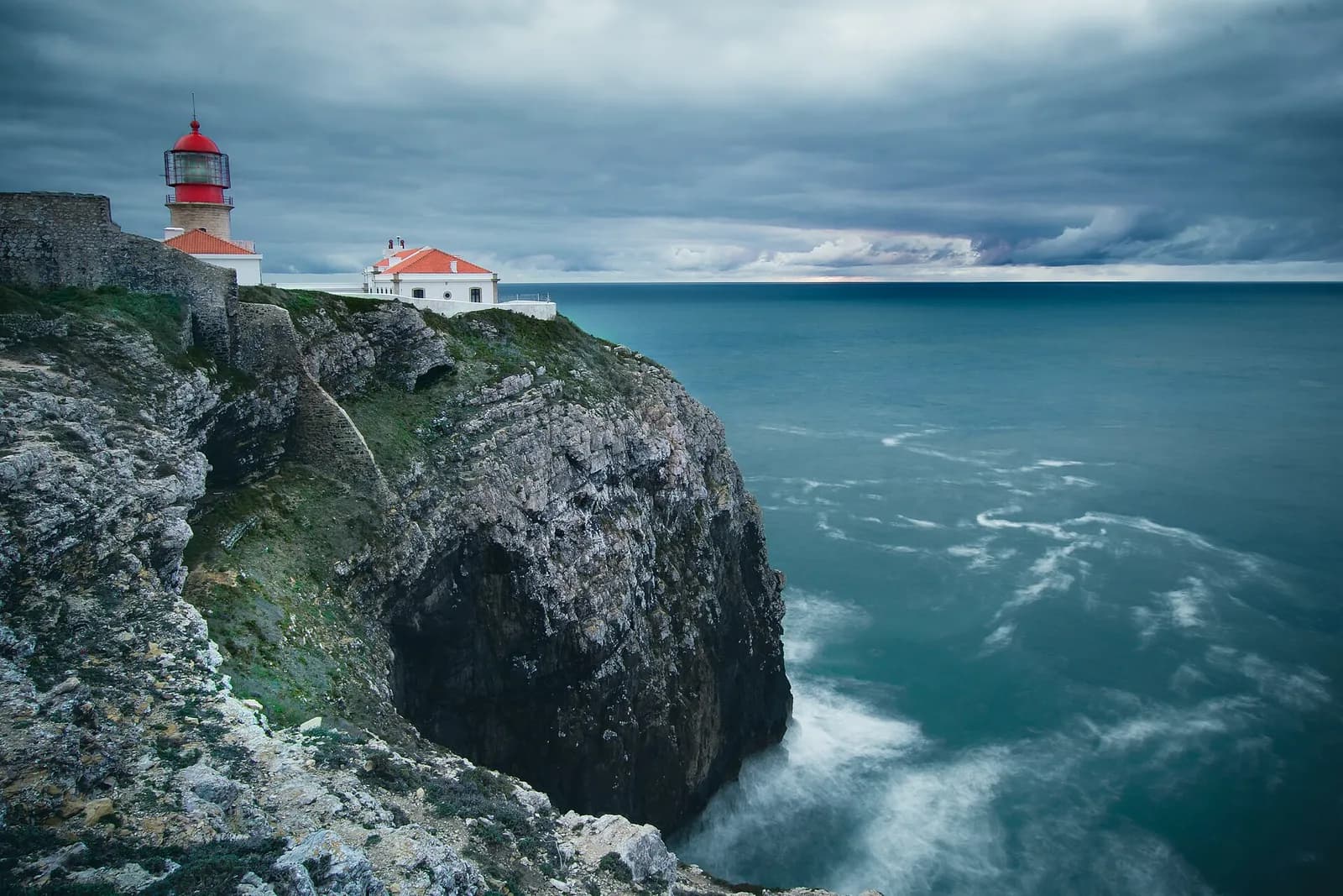
- The lighthouse on Cape São Vicente, the south-western tip of mainland Portugal, in January 2018. The 1969 earthquake started under the ocean floor about 190 kilometres south-west of the cape. Rui Glória, CC BY-SA 4.0, via Wikimedia Commons.
- The sea floor off south-west Iberia, from the Gorringe Bank to the Strait of Gibraltar, with the main mapped faults, in a tectonic map published on Commons in 2014. The 1969 earthquake started under the Horseshoe Abyssal Plain, left of centre; the map does not mark its epicentre. MAGutscher, CC BY-SA 4.0, via Wikimedia Commons.
- Bensafrim, near Lagos, in 2007. In 1969 dozens of its houses fell, and it was one of the villages Marcelo Caetano toured a week later. Francisco Santos (user: xuaxo), CC BY-SA 3.0, via Wikimedia Commons.
- Inside the castle of Castro Marim in 2007, looking towards the Forte de São Sebastião. In 1969 the upper part of the castle's north walls collapsed. Marc Ryckaert, CC BY-SA 4.0, via Wikimedia Commons.
- The Ponte 25 de Abril from the Tagus in 2025. Its main cables run down to the north anchorage on the Lisbon bank, at left, where an accelerograph made the only on-scale record of the 1969 shaking on the mainland. Jakub Hałun, CC BY 4.0, via Wikimedia Commons.