

1875: the French president's ruling that kept Delagoa Bay Portuguese
Britain and Portugal had argued for half a century over the southern shore of a bay in south-east Africa. The President of France settled it in about two printed pages. Twenty years later a railway from the bay reached the Boer capital, Pretoria.
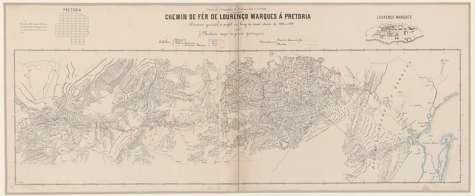
At a glance
- On 24 July 1875, at Versailles, the French president, Marshal Patrice de MacMahon, ruled that the territories of Tembe and Maputo and the islands of Inhaca and Elephant, on the south side of Delagoa Bay, belonged to Portugal.
- Britain had claimed the land since 1823, when a Royal Navy surveyor, Captain W. F. W. Owen, signed treaties of cession with local chiefs. The Portuguese town of Lourenço Marques, on the north shore, was never in dispute.
- Britain and Portugal agreed in a protocol signed at Lisbon on 25 September 1872 to let the President of the French Republic decide, finally and without appeal.
- Five months after the award, on 11 December 1875, Portugal signed a treaty with the Boer South African Republic (the Transvaal) that provided for a railway from Lourenço Marques to the Transvaal frontier. It was ratified only in 1882, and the line through to Pretoria opened on 8 July 1895.
- Lourenço Marques became a city in 1887 and capital of the colony in 1898. Renamed Maputo in 1976, it is the capital of independent Mozambique.
A marshal's signature at Versailles
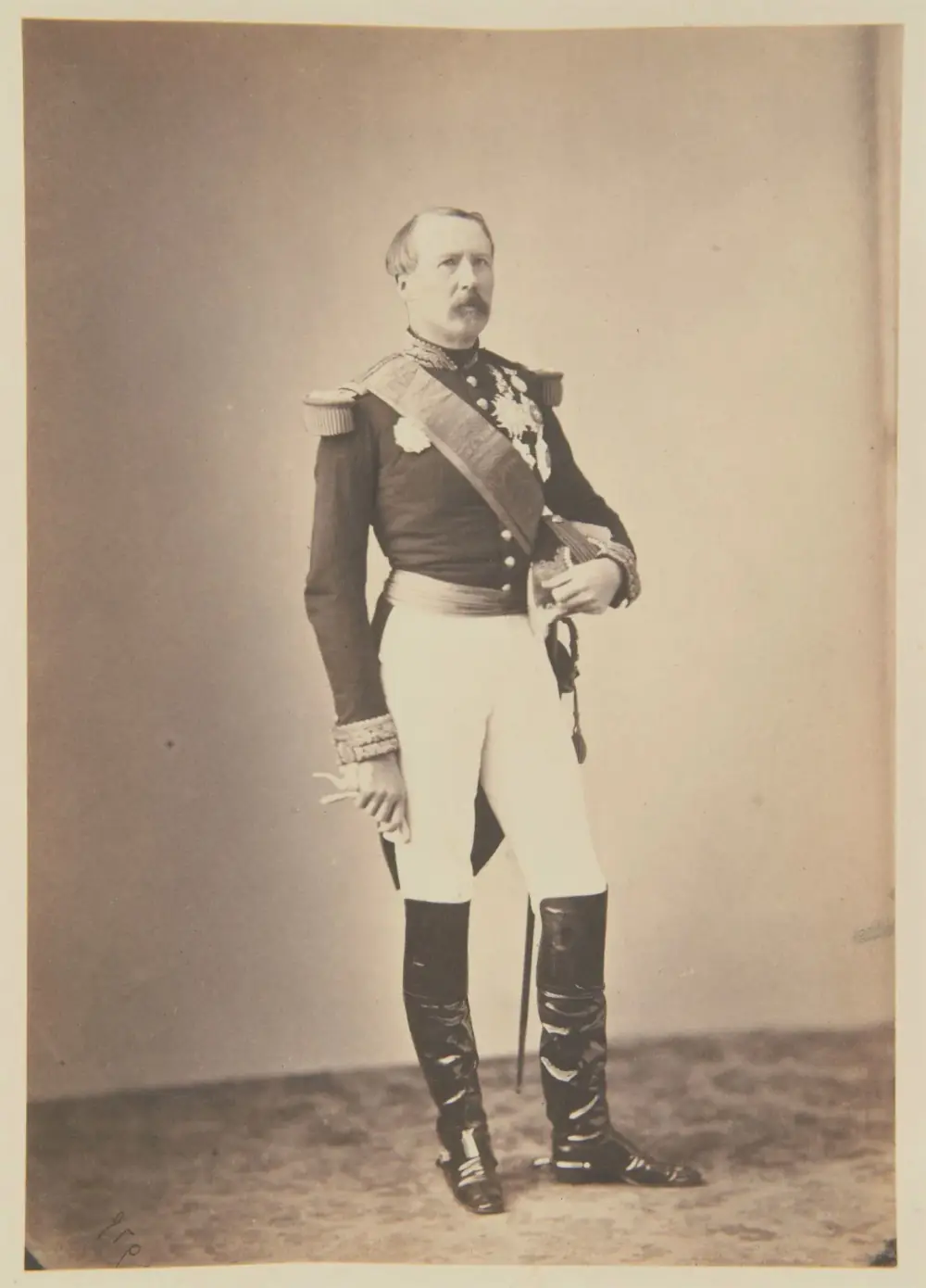
The award, written in French, opens in the first person (translated here): “We, Marie Edme Patrice Maurice de MacMahon, Duke of Magenta, Marshal of France, President of the French Republic”. It closes with a place, a date and a signature: Versailles, Saturday 24 July 1875, “Mal. de MacMahon, Duc de Magenta”. In between, the President of France settled a quarrel that had nothing to do with France.
MacMahon was 67 and had been head of state for two years. He had been asked to decide who owned the southern shore of Delagoa Bay, a wide inlet on the coast of south-east Africa, in a dispute pending between Britain and Portugal since 1823. A commission set up in March 1873 had studied the papers of both sides and reported its findings to him.
The award ran to about two printed pages of French. It named the land in question: the territory of Tembe, south of the estuary the Portuguese called the Espírito Santo and the British the English River, and the territory of Maputo, which took in the Inhaca peninsula and the islands of Inhaca and Elephant. It gave its reasons one by one, and ended in a single sentence.
“Therefore we have judged and decided that the claims of the Government of His Most Faithful Majesty to the territories of Tembe and Maputo, to the Peninsula of Inyack, and to the Isles of Inyack and the Elephants, are duly proved and established.”
His Most Faithful Majesty was the King of Portugal. Portugal had won everything it asked for. Its small town of Lourenço Marques, on the north bank of the estuary, had never been contested; now the southern shore and the islands that close the bay were Portuguese too. The town on the north bank is today Maputo, capital of Mozambique.
A bay, a fort and a landlocked republic
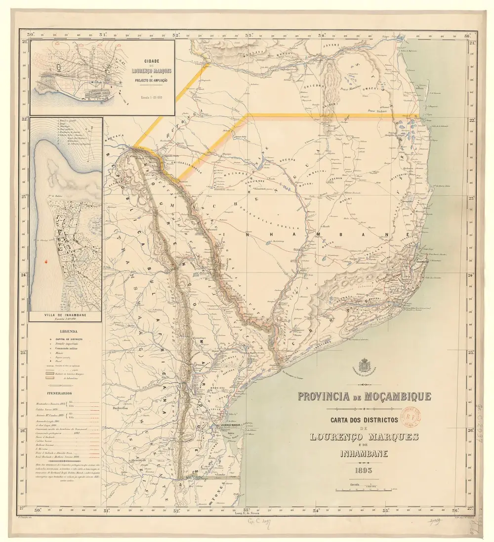
Delagoa Bay, now Maputo Bay, is more than 110 kilometres from north to south and about 30 wide. Its southern side is formed by the Inhaca peninsula and the islands beyond it. Several rivers meet in the estuary of the Espírito Santo, about halfway down the bay, and the Maputo river enters it in the south. Despite a bar and shallows, large ships could use it in any season.
The Portuguese had known it since the sixteenth century. In 1544 a navigator named Lourenço Marques was sent by the governor of Mozambique to explore its rivers, and the forts and trading posts the Portuguese set up, abandoned and reoccupied on the north bank of the estuary all took his name. In 1871 the town was described as a poor place of narrow streets, flat-roofed houses, grass huts, decayed forts and rusty cannon inside a newly built wall six feet high.
Others had wanted the bay. The Dutch East India Company kept a fort there from 1720 to 1730, and in 1781 Portugal used force against an Austrian venture. Outside the fort, though, Portuguese authority counted for little, and the chiefdoms of Tembe and Maputo to the south ran their own affairs.
Captain Owen's treaties
The British claim began with a survey. In 1822 the British government sent Captain W. F. W. Owen of the Royal Navy to chart the bay and its rivers, and recommended him to the good offices of the Portuguese government. In 1823, finding that the Portuguese exercised no jurisdiction south of their settlement, Owen signed treaties of cession with the chiefs of Tembe and Maputo, hoisted the British flag and claimed the country from the English River southwards.
When he returned in 1824 the Portuguese had made treaties of their own with the local chiefs. Owen raised the British flag again, and for decades neither power did much on the spot. Around 1860 the Royal Navy asserted the claim again, and Lisbon protested. The 1911 Encyclopaedia Britannica says Captain Bickford declared Inhaca and Elephant islands British in 1861; the Portuguese diplomat and historian José Calvet de Magalhães says Vice-Admiral Keppel, aboard the Brisk, announced British sovereignty over the south of the bay in 1860.
The Boers forced the question. In 1868 the Transvaal president, Marthinus Pretorius, claimed the land on both sides of the Maputo river down to the sea. A year later, on 29 July 1869, the republic signed a treaty with Portugal at Pretoria that drew Portugal's southern limit along a line running due west from 26° 30' south to the Lebombo mountains. That put the whole southern shore of the bay inside Portuguese territory, and London objected.
| Britain | Portugal | |
|---|---|---|
| Southern limit of Portuguese rule | The middle of the Lourenço Marques (Dundas) river, the English River and the little bay at their mouth | The parallel of 26° 30' south, as in the 1869 treaty with the Transvaal |
| Tembe, Maputo, Inhaca and Elephant | Ceded to the British Crown by their chiefs in 1823 | Portuguese since the bay's discovery; the chiefs had never been independent |
| Meaning of 'Lourenço Marques Bay' | Only the small inner bay at the mouth of the English River | Another name for the whole of Delagoa Bay |
From the extracts of the British case of September 1873 printed by Hertslet, and the summary of Portugal's claims in the award. The Portuguese case itself was not printed by Hertslet.
Referred to the President of France
Arbitration was not new between the two allies. In 1870 the American president, Ulysses S. Grant, had found for Portugal over the island of Bolama, in Guinea. After long negotiations they agreed to try it again. On 25 September 1872, at the Foreign Office in Lisbon, the British chargé d'affaires, William Doria, and the Portuguese foreign minister, João de Andrade Corvo, signed a protocol referring their claims to the President of the French Republic, to be settled finally and without appeal.
The president at the time was Adolphe Thiers. A commission to study the papers was set up on 10 March 1873, but on 24 May Thiers resigned and MacMahon, a soldier of monarchist views who had put down the Paris Commune in 1871, was elected president. The case passed to him.
Each side handed in its case on 15 September 1873 and its counter-case on 14 and 15 September 1874. In the House of Commons on 6 August 1874 a member, Alexander McArthur, asked the government to publish its correspondence, since Portugal had published its own despatches. The Under-Secretary for Foreign Affairs, Robert Bourke, said he knew of no recent Portuguese publication and that Britain's papers would stay unpublished until the arbiter had ruled.
1823
Captain Owen signs treaties of cession with the chiefs of Tembe and Maputo
1860–1861
Royal Navy officers reassert British sovereignty over the south of the bay
29 July 1869
Portugal and the Transvaal fix a border at 26° 30' south
25 September 1872
Protocol of Lisbon refers the dispute to the French president
10 March 1873
A commission is set up to study the papers
24 May 1873
MacMahon succeeds Thiers as president
15 September 1873
Britain and Portugal hand in their cases
14–15 September 1874
Counter-cases handed in
8 February 1875
Letters from both legations in Paris fix what the arbitrator must decide
14–24 June 1875
Notes on non-cession exchanged at Sintra and Lisbon
24 July 1875
MacMahon's award at Versailles
Why MacMahon found for Portugal
The award's reasoning was short. Portuguese navigators had discovered the bay in the sixteenth century, and Portugal had occupied points on its north shore and on Inhaca island in the seventeenth and eighteenth. It had always claimed the whole bay and the sole right to trade there, and had backed the claim with arms against the Dutch around 1732 and the Austrians in 1781, without protest from either.
Britain itself, the award went on, had not contested Portugal's title in 1817: the second article of their convention against the slave trade counted the whole bay among Portugal's possessions. It had recommended Owen to the Portuguese in 1822. If a passing weakness of Portuguese authority had misled him in good faith, his treaties still broke Portugal's rights; the chiefs had recognised Portuguese authority again almost as soon as his ships left. And the treaties had lapsed anyway, since Tembe's conditions were never met and Maputo's were for fixed terms that were never renewed.
- Signed
- Versailles, Saturday 24 July 1875
- Arbitrator
- Marshal Patrice de MacMahon, President of the French Republic
- Basis
- Protocol of Lisbon, 25 September 1872
- Territory
- Tembe and Maputo, the Inhaca peninsula, Inhaca and Elephant islands
- Southern edge of the disputed land
- The parallel of 26° 30' south, as the award defined the territory of Maputo
- Result
- Portugal's claims held duly proved and established
Britain hedged its bets. On 14 June 1875, six weeks before the award, Lord Lytton, the British minister at Lisbon, wrote from Sintra about the arbitrator's decision, “not yet officially declared”, and proposed that whichever side won would not entertain any offer for the territory from a third power before the loser had a chance to make a reasonable offer of its own. Andrade Corvo answered three days later.
“the fullest assurance as to the determination of the Portuguese Government of not ceding to any third Power the territory, the possession of which may be secured for it in virtue of the arbitration of Marshal McMahon”
Five months later, a treaty with the Boers
Portugal moved quickly. On 11 December 1875, in Lisbon, Andrade Corvo and the Transvaal president, Thomas François Burgers, signed a treaty of friendship and commerce that kept the 1869 border. A protocol attached to it promised a railway from Lourenço Marques to the frontier. Portugal would pay up to half the cost, give the land, let the materials in duty-free for 15 years and grant the builder the line for 99 years. The Transvaal would carry the line on to a centre of trade.
Burgers tried until 1877, without success, to get the railway built. On 12 April 1877, before the treaty was ratified, Britain's special commissioner, Sir Theophilus Shepstone, proclaimed the Transvaal British territory. War broke out in December 1880, and the Pretoria Convention of 3 August 1881 gave the Transvaal back self-government under British suzerainty. Only on 7 October 1882 were ratifications of the 1875 treaty exchanged in Lisbon, with Queen Victoria ratifying it as suzerain of the Transvaal.
In the meantime Portugal invested in the town. A public works expedition, sent to drain the marshes and build a hospital and a church, arrived in 1877; the 1911 Britannica dates its dispatch to 1876. That year Lourenço Marques had 110 houses and 304 Portuguese and foreign inhabitants, while the African population of the district was put at 50,000 to 80,000.
The award settled title, not control. The African population around the town lived in several separate polities, and Portuguese authority over the interior behind the bay was established only some time after 1875.
The railway to the Transvaal
On 14 December 1883 Lisbon granted a concession to an American, Colonel Edward McMurdo, to build the line. The discovery of gold on the Witwatersrand in 1886 made it urgent, and in 1887 McMurdo formed a company in London. The first stretch opened at the end of 1887, and the line reached the frontier shown on Portuguese maps of 1883 on 14 December 1888.
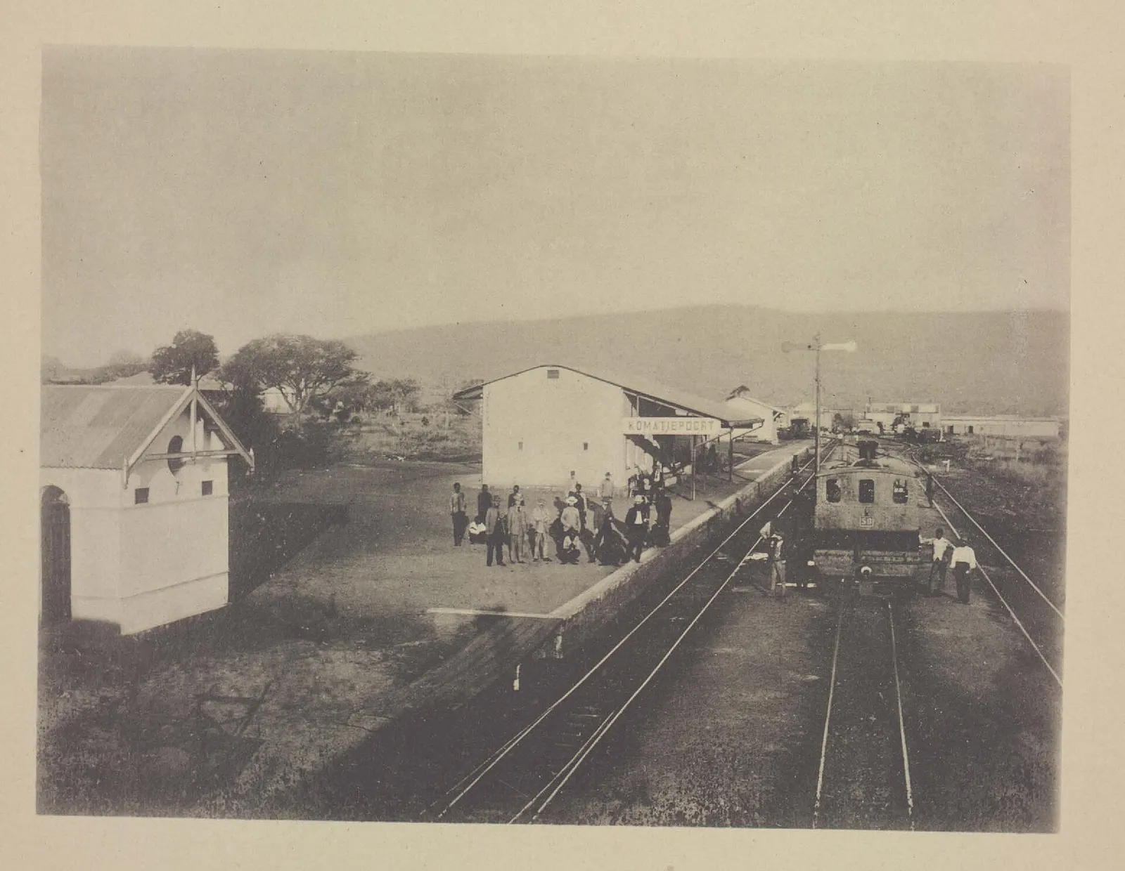
By then the border had been fixed at Komati Poort, five miles further from the coast, and Lisbon gave the company eight months, five of them in the rainy season, to finish the extra stretch. It failed. On 25 June 1889 Portugal seized the railway and cancelled the concession, apparently under pressure from the Transvaal. Britain and the United States protested on behalf of the investors, and Portugal agreed to let three Swiss jurists fix the compensation.
Their award, issued at Berne on 29 March 1900, ordered Portugal to pay 15,314,000 Swiss francs plus interest, on top of £28,000 paid in 1890. The money went to the company's bondholders, among them Mrs McMurdo, represented by the United States. Meanwhile the line had been carried on from Komati Poort; the link to Pretoria was finished on 20 October 1894, and President Paul Kruger formally opened it on 8 July 1895.
Rail distance from Johannesburg to the sea, about 1910
miles
Distances given in the 1911 Encyclopaedia Britannica. The other four ports were in the British colonies of Natal and the Cape. The same encyclopaedia's entry on Lourenço Marques gives 396 miles by the route via Pretoria.
Show the data
| Distance by rail | |
|---|---|
| Lourenço Marques | 364 |
| Durban | 483 |
| East London | 659 |
| Port Elizabeth | 714 |
| Cape Town | 957 |
From a fort to a capital
The railway and the trade it promised changed the town. Lourenço Marques was raised to a city on 10 November 1887, and that December the colony's director of public works, Major António José de Araújo, proposed a plan to extend it, against the common view that a town ringed by marshes should not grow. In 1898 it became the capital of the colony.
Alfredo Freire de Andrade, a Portuguese officer who would later govern the colony, gave the figures in a lecture at the Ateneu Comercial do Porto on 13 March 1897. Customs revenue had risen from 3 contos in 1868 and 47 in 1880 to 600 contos in 1896. He blamed the town's swamps for its fevers, but he had no doubt about its harbour.
“I say fortunately, because it is to them that we owe keeping that splendid port still in our hands, the only one on the eastern coast in the whole stretch from the Cape to Mozambique.”
Ships entering the port of Lourenço Marques, 1892 to 1896
ships
Figures given by Alfredo Freire de Andrade in 1897. The through line to Pretoria opened in July 1895. Of the 433 ships in 1896, 287 were British.
Show the data
| Ships entered | |
|---|---|
| 1892 | 228 |
| 1893 | 252 |
| 1894 | 265 |
| 1895 | 363 |
| 1896 | 433 |
| Year | Population | Who was counted |
|---|---|---|
| 1864 | 83 | Europeans and Indians |
| 1877 | 304 | Portuguese and other foreigners, in 110 houses |
| 1893 | 1,017 | Europeans and Asians; Freire de Andrade thought the count too low |
| 1897 | At least 4,000 | Europeans and Indians, by Freire de Andrade's estimate |
| 1904 | 9,849 | Including 4,691 Europeans and 1,690 Asians |
The early counts left out most of the African population; in 1877 the African population of the whole district was estimated at 50,000 to 80,000. The figures come from different sources and are not strictly comparable.
The bay stayed a prize. After the British Ultimatum of 1890, the Anglo-Portuguese treaty of 11 June 1891 let Portugal extend its influence south of Delagoa Bay, as far as the latitude where the Pongolo river joins the Maputo, and gave each country first refusal if the other ever parted with territory south of the Zambezi. In 1899, as the Boer War approached, Britain wanted arms for the Transvaal stopped at Lourenço Marques.
Why it still matters
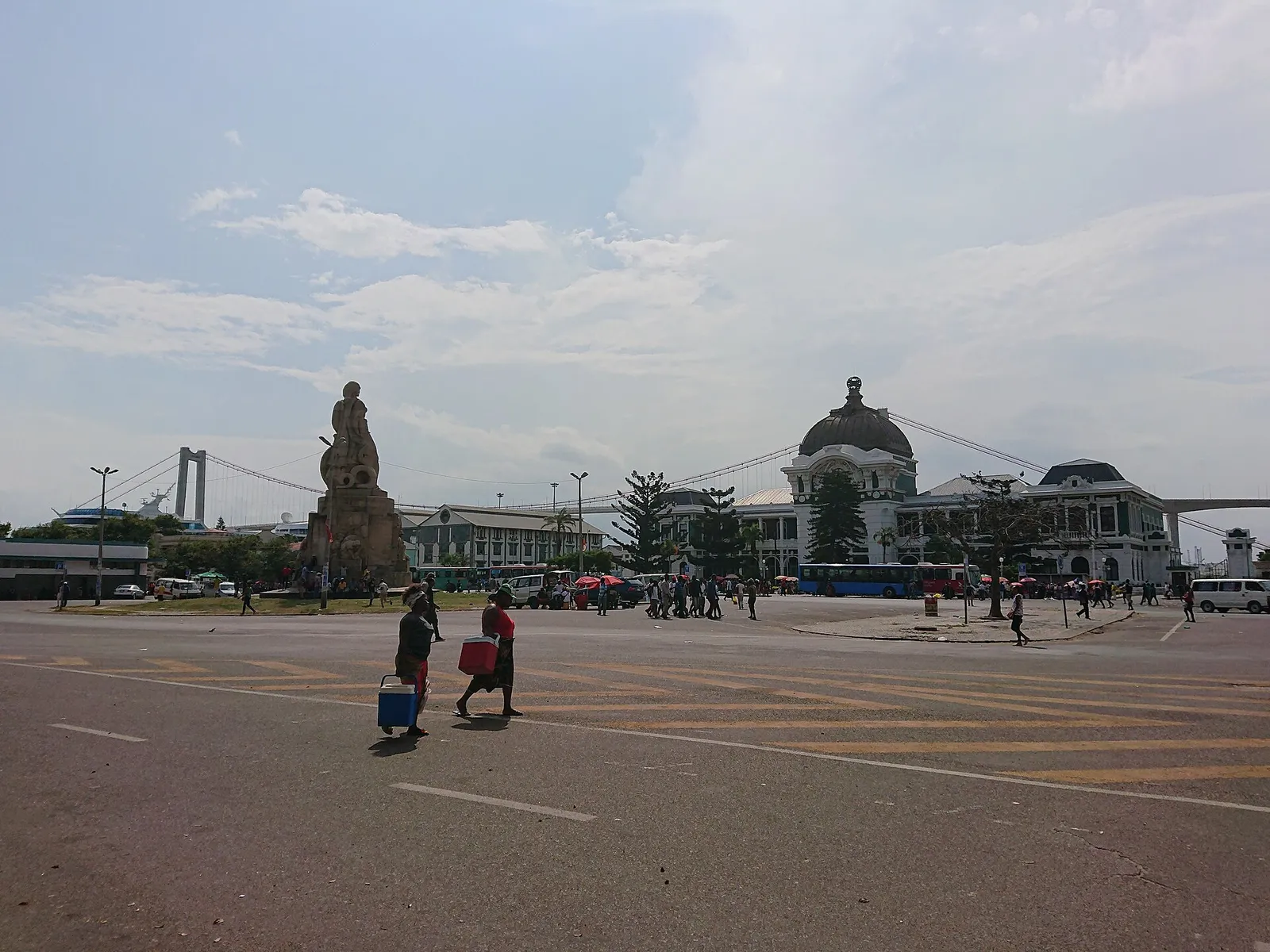
Mozambique became independent in 1975, and in 1976 its capital, Lourenço Marques, was renamed Maputo. The marshal's name had stayed in the city for a time: the square in front of the railway station was once Praça Mac-Mahon, and it is now Praça dos Trabalhadores.
Had MacMahon found for Britain, the far bank of the estuary, facing the town, and the islands that close the bay would have been British. His award gave Portugal the territories of Tembe and Maputo, the Inhaca peninsula and the islands of Inhaca and Elephant, the whole southern shore of the bay.
FAQs
What was the Delagoa Bay arbitration?
It settled a dispute between Britain and Portugal over the territories of Tembe and Maputo and the islands of Inhaca and Elephant, on the south side of Delagoa Bay in south-east Africa. Under a protocol signed at Lisbon in 1872 both sides let the President of France decide, and on 24 July 1875 Marshal MacMahon found for Portugal.
When was the MacMahon award on Delagoa Bay?
The award is dated Versailles, 24 July 1875. The 1911 Encyclopaedia Britannica gives 19 April 1875, a date some later works repeat, but the text of the award printed in British and Foreign State Papers and by the United Nations carries 24 July.
What is Delagoa Bay called today?
Maputo Bay. The Portuguese town on its northern shore, Lourenço Marques, became capital of Mozambique in 1898 and was renamed Maputo in 1976, the year after independence.
Why is a Mozambican beer called 2M?
The beer takes its name from the MacMahon brewery, which opened in what is now Maputo in 1950. The brewery shared the name of the French president whose 1875 award confirmed Portugal's possession of the bay.
What did the award have to do with the Delagoa Bay railway?
Five months after the award, on 11 December 1875, Portugal signed a treaty with the Transvaal that promised a railway from Lourenço Marques to the frontier. The treaty was not ratified until 1882, and McMurdo's company was formed only in 1887. After a dispute over the seizure of the line in 1889, the through route to Pretoria opened on 8 July 1895.
On the timeline
Open the timelineNearby moments from regeneration and the last kings (1851–1910).
The novelist Júlio Dinis, author of 'As Pupilas do Senhor Reitor', dies of tuberculosis in Porto at only 31 years of age.
The first telegrams pass between Recife and London over the new submarine cable from Carcavelos beach, west of Lisbon, by way of Madeira and Cape Verde; its last section had been laid the day before. News that had taken 15 to 40 days to cross the Atlantic by steamer can now appear in Brazilian papers the next day.
António Egas Moniz is born in Avanca, near Estarreja. Neurologist, foreign minister and head of Portugal's delegation to the Paris Peace Conference, he pioneered cerebral angiography and the prefrontal leucotomy, which brought him Portugal's first Nobel Prize, in 1949.
The Delagoa Bay award of 1875
Asked to arbitrate between Portugal and Britain, French President Patrice de MacMahon rules that the land and islands on the south side of Delagoa Bay, today's Maputo Bay, are Portuguese, leaving the whole bay to Portugal. Its town, Lourenço Marques, is now Maputo, where a brewery named MacMahon gave the beer '2M' its name.
The Caixa Geral de Depósitos is created by law in Lisbon, at first to safeguard the deposits that courts and public bodies were required to lodge. Wholly owned by the state ever since, it grew into the country's largest bank and a fixture of every Portuguese high street.
The Dona Maria Pia railway bridge over the Douro between Porto and Vila Nova de Gaia is inaugurated. Built by Gustave Eiffel's Paris firm, its wrought-iron crescent arch, 160 metres across, was then the longest iron arch in the world; it carried trains until 1991 and is a National Monument.
Birth in Guarda of Carolina Beatriz Ângelo, Portugal's first woman surgeon. In 1911, as a widow and 'head of household', she won a court case that let her become the first woman to vote in Portugal — prompting the Republic to rewrite the electoral law in 1913 to bar women explicitly.
Coming up in history
All long reads 26 July 1582The Battle of Ponta Delgada, 26 July 1582: the Azores fight for Dom António
 27 July 1970The death of Salazar, 27 July 1970: the dictator who was never formally told
 28 July 1723Mariana Alcoforado, the nun of Beja and the Portuguese Letters
 29 July 1180Fuas Roupinho and the sea fight off Cape Espichel, 1180
18 sources
Archives, scholarship and reporting this article was checked against.
- 1
Award on the claims of Great Britain and Portugal to certain territories formerly belonging to the Kings of Tembe and Mapoota, on the eastern coast of Africa, including the islands of Inyack and Elephant (Delagoa Bay or Lorenzo Marques), decision of 24 July 1875United Nations, Reports of International Arbitral Awards, vol. XXVIII, pp. 157–162
- 2
The Map of Africa by Treaty, 3rd edition, vol. III, by Sir Edward HertsletHis Majesty's Stationery Office, 1909 (digitised by Internet Archive)
- 3
- 4
Delagoa BayEncyclopaedia Britannica, 11th edition (1911), vol. 7, transcribed on Wikisource
- 5
- 6
As obras de saneamento e o traçado das primeiras avenidas em Lourenço Marques, Moçambique (Lisandra Franco de Mendonça)Pós, Revista do Programa de Pós-Graduação em Arquitetura e Urbanismo da FAUUSP, vol. 25, no. 45 (2018), pp. 132–148
- 7
Colonisação de Lourenço Marques: conferencia feita em 13 de março de 1897 (Alfredo Augusto Freire de Andrade)Porto, Typographia de A. J. da Silva Teixeira, 1897 (Project Gutenberg edition)
- 8
Portugal e Inglaterra: de D. Fernando ao mapa cor-de-rosa (II) (José Calvet de Magalhães)Janus 1999-2000, Universidade Autónoma de Lisboa and Público
- 9
Patrice de Mac-MahonPrésidence de la République (Élysée)
- 10
MaputoLex.dk (Den Store Danske)
- 11
Delagoa Bay railway line is officially openedSouth African History Online
- 12
The Cape Colony: the boundary at Delagoa Bay (question), HC Deb 6 August 1874UK Parliament, Hansard
- 13
Decision and final award of the Delagoa Bay court of arbitration, Berne, 29 March 1900Foreign Relations of the United States, 1900, Document 1041, Office of the Historian, US Department of State
- 14
- 15
A Estação Central de Maputo no contexto das políticas de preservação do património edificado de Moçambique: estudo de caso (Bruno J. Navarro)Historiæ, Rio Grande, vol. 3, no. 1 (2012), pp. 171–200
- 16
- 17
Declaração de Independência de Moçambique, de 25 de Junho de 1975: mensagem da proclamação da independência proferida pelo Presidente Samora Machel no Estádio da MachavaCEDIS, Faculdade de Direito da Universidade Nova de Lisboa
- 18
Mozambique: profits at CDM brewer almost tripled in 2024 year on year to €24MClub of Mozambique, 22 May 2025
Image credits
- The railway from Lourenço Marques to Pretoria as surveyed between 1882 and 1884 by Major J. Machado of the Portuguese engineers, published by the Lisbon Geographical Society. Delagoa Bay, with Inhaca island, is at the right; insets at the top show Pretoria and Lourenço Marques. J. Machado, cartographer; Sociedade de Geografia de Lisboa, publisher, Public domain, via Wikimedia Commons.
- Patrice de MacMahon in a marshal's uniform, photographed by the Paris studio Mayer et Pierson. Napoleon III made him a marshal and Duke of Magenta after the battle of Magenta in 1859. Mayer et Pierson, Public domain, via Wikimedia Commons.
- Komatipoort station, on the Transvaal side of the border with Portuguese territory, in the commemorative book printed for the opening of the Delagoa Bay railway in 1895. Hendrik Petrus Berlage, Public domain, via Wikimedia Commons.
- The Portuguese districts of Lourenço Marques and Inhambane in 1893, drawn for the Lisbon cartography commission. Delagoa Bay is near the bottom; the inset at top left shows Lourenço Marques with its planned extension. Commissão de Cartographia (Lisbon); L. Couceiro, draughtsman, Public domain, via Wikimedia Commons.
- Maputo's railway station and the Praça dos Trabalhadores, the former Praça Mac-Mahon, in 2019. The Maputo–Katembe bridge across the bay is behind. Claus Wonnemann, CC BY-SA 4.0, via Wikimedia Commons.