

The Treaty of Lisbon, 1864: the Portugal–Spain border
After nine years of surveying and haggling, Portugal and Spain wrote down, rock by rock, where one kingdom ended and the other began. Three villages that lived between the two crowns became Spanish; three cut in half by the line became Portuguese.
At a glance
- On 29 September 1864, in Lisbon, Portugal and Spain signed a 31-article treaty fixing their frontier from the mouth of the Minho to the point where the Caia flows into the Guadiana.
- It rested on nine years of fieldwork by a joint boundary commission of diplomats and army engineers, which first met in September 1855 and mapped the disputed stretches in detail.
- The Couto Misto, three villages in Ourense province whose people chose their own nationality, paid almost no taxes and sent no soldiers, passed to Spain, except about 350 hectares of upland pasture that went to Portugal.
- In return the three “promiscuous villages” cut in half by the old line, Soutelinho, Cambedo and Lamadarcos, became wholly Portuguese. Both handovers took place in June 1868.
- The southern stretch, from the Cuncos to the mouth of the Guadiana, was fixed only in 1926. The river frontier beside Olivença, between the Caia and the Cuncos, was left out of both treaties.
Houses marked E or P
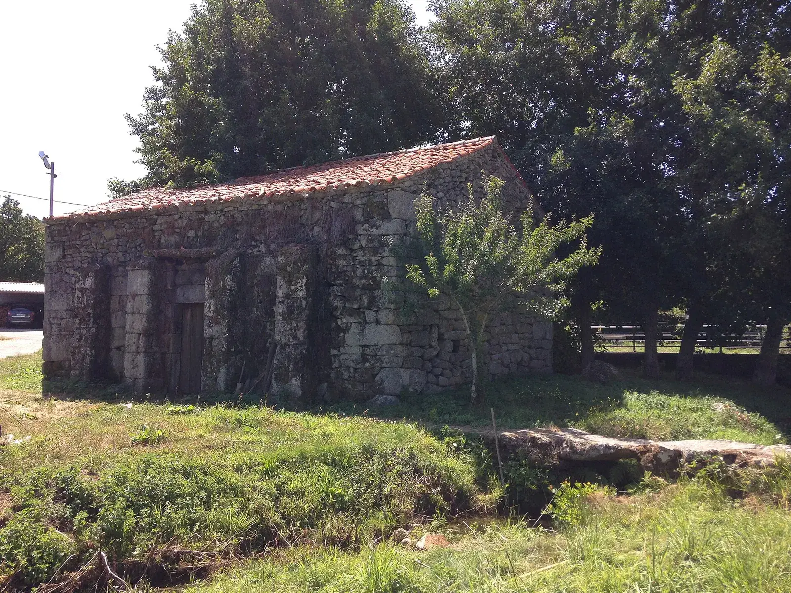
In the valley of the Salas, in the Galician province of Ourense, a family could change its nationality by telling the judge. An agreement of 1819 had ordered every house in the three villages of Santiago, Rubiás and Meaus marked E or P, for Spanish or Portuguese. A road of about 6 km ran from them to the Portuguese village of Tourém, and on it no customs guard of either kingdom could arrest anyone for smuggling.
On 23 June 1868 Spanish officials took the villages over, without trouble worth recording.
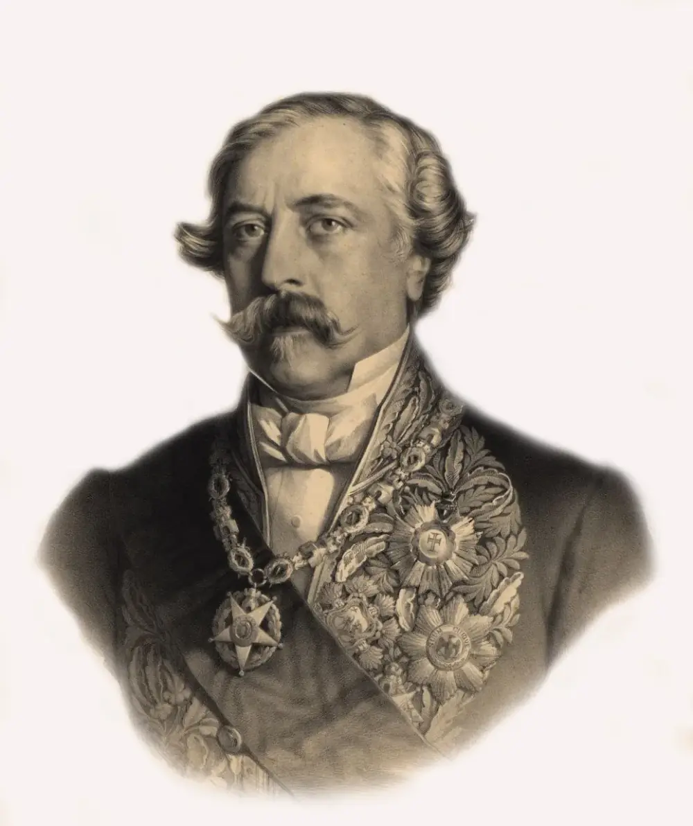
They were carrying out a treaty signed almost four years earlier. On Thursday 29 September 1864, in Lisbon, four men signed and sealed two copies of the same long document. For Isabel II of Spain signed the Marquis de la Ribera, her envoy at the Portuguese court, and Facundo Goñi, a former deputy to the Cortes. For Luís I of Portugal signed the Duke of Loulé, who was both president of the council of ministers and foreign minister, and Jacinto da Silva Mengo, head of the first department of his ministry.
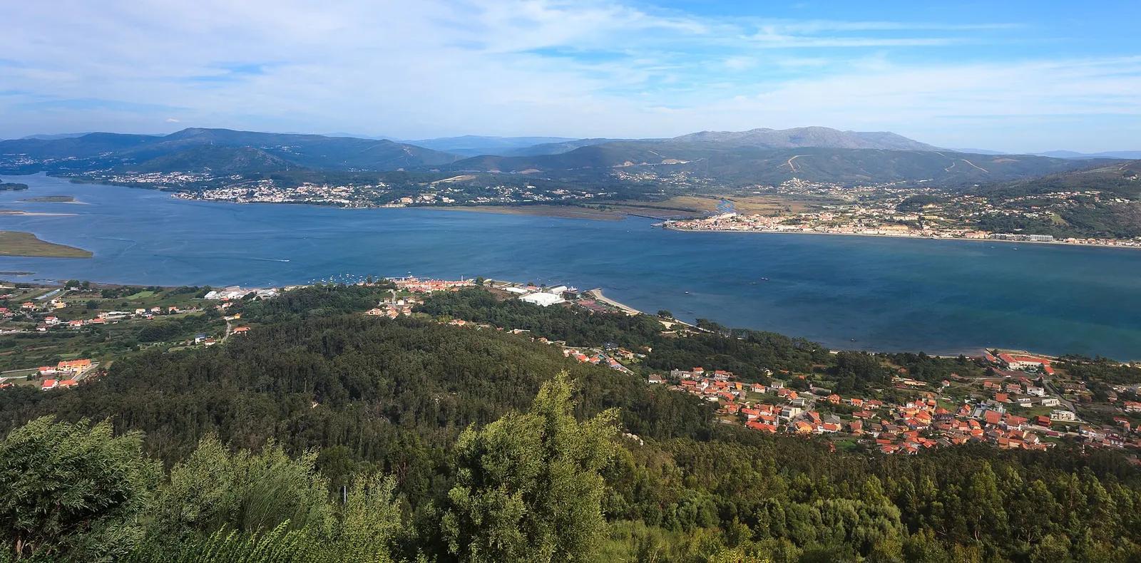
Most of the treaty's 31 articles read like directions for a very long walk. The line was to start at the mouth of the Minho, between the Spanish province of Pontevedra and the Portuguese district of Viana do Castelo, and follow “the centre of the principal stream” upriver. It then climbed into the Serra do Laboreiro and ran from one named rock, cairn and pass to the next, followed stretches of the Douro and the Tagus, and ended where the Caia empties into the Guadiana, between the province of Badajoz and the district of Portalegre.
One article dealt with people rather than rocks. Under Article VII, Portugal renounced in favour of Spain all the rights it might have to the land of the Coto Mixto, in Portuguese the Couto Misto, and to the villages in it.
An old border with loose ends
Portugal's frontier with Castile, and then Spain, had run roughly where it runs today since the Middle Ages; the Treaty of Alcañices of 1297 had settled much of it. What had never existed was a precise, agreed description of the line. Old Portuguese boundary books, the tombos, described it in their own terms, and Spanish commissioners refused to accept them because no Spanish official had been present when they were drawn up.
On the ground that meant quarrels. Villages on either side fought over pastures, water, firewood and, on the Minho, islands and fishing grounds. Each side impounded the other's livestock, which was the main wealth of the hill villages. José de Castro López, a Spanish staff officer who surveyed the Ourense frontier in the 1860s, wrote that land there was so prized that each side defended its claim “with an energy and decision that leads them even to violence”.
The liberal governments established in Spain in 1833 and in Portugal in 1834 wanted more than peace between villages. They wanted customs posts that worked, laws that applied everywhere and a frontier drawn as a single continuous line. In Portugal the treaty belonged to the Regeneração, the calmer period that began in 1851, alongside the first civil census in 1864 and the first modern maps of the kingdom. Smuggling across a frontier that nobody had precisely marked cost both treasuries money.
Spanish officials described it in harsher words. In 1845 the civil governor of Ourense called its people a gathering of “semi-savages” who sheltered bandits and smugglers from both countries, and the ministry's report recommended abolishing its privileges and annexing it, even suggesting that Spain occupy it by force to push Portugal into talks. Nothing happened for a decade. The case was still waiting when the two governments agreed to settle the frontier from the Minho to the Caia.
Nine years on the frontier
In October 1854 Madrid and Lisbon began to set up a joint boundary commission for the stretch from the Minho to the Caia. Its first meeting was on 9 September 1855, and it began where the treaty would begin, at the mouth of the Minho. The Spanish section was led by a diplomat, Fidencio Bourman; the Portuguese by an artillery brigadier, Frederico Leão Cabreira, with an army engineer as his secretary.
The first commission held its last meeting in July 1857, after a dispute over the line between São Vicente and Segirei, in Trás-os-Montes, had cost the Portuguese president his post. A second met from October 1858. Its Portuguese president was Alexandre José Botelho de Vasconcelos e Sá, a military engineer who had already mapped the Trás-os-Montes frontier in 1840.
From 1861 the Spanish side had its own surveyor, José de Castro López. Using compass, theodolite and the Portuguese network of survey triangles, the two men mapped the whole line and drew detailed plans of the main disputes; Castro's own series, at about 1:100,000, dates from 1862 and 1863.
The maps were weapons as well as tools. Spanish commissioners leaned on Domingo Fontán's map of Galicia of 1845, which showed the Couto's villages as if surrounded by Spanish land; in March 1860 Lisbon gave the Spanish ambassador a plan surveyed by its own commissioners to prove the map wrong. Castro's map of the Ourense stretch alone identified eighteen disputes. The line was later marked with 801 numbered boundary marks, and the geographers Jacobo García Álvarez and Paloma Puente count 348 of them in the 225 km of that one province.
1518
Concord of Bragança and Monterrei
A settlement between two noble houses that the historian Tamar Herzog sees as one root of the Couto's status.
21 October 1819
Privileges confirmed
An agreement with the Couto's judge orders every house to be marked E or P.
1842–1845
Spanish inquiry
Ourense's governors investigate the Couto; Madrid's report urges abolition.
October 1854 – July 1855
Commission set up
Presidents named and instructions approved for a joint commission from the Minho to the Caia.
9 September 1855
First meeting
Fieldwork starts at the mouth of the Minho.
August 1856
First visit to the Couto
All members agree it cannot remain in its “exceptional and anomalous state”.
2 July 1862
Residents petition
Fifty-six householders ask the King of Portugal to keep the Couto, or else make it Portuguese.
30 December 1863
Diplomats take over
Plenipotentiaries begin drafting the treaty in Lisbon.
29 September 1864
Treaty signed
Lisbon.
19 May 1866
Ratifications exchanged
The treaty comes into force.
23 and 27 June 1868
Handovers
The Couto to Spain, then the shared villages to Portugal.
1 December 1906
General Act of demarcation
The marked line is approved in Lisbon.
What the treaty said
The preamble set out the problem as both governments saw it: towns on the frontier lived in a “state of uneasiness” because no treaty defined it.
“To end the anomalous situation in which, under the shadow of ancient feudal traditions, some towns bordering on the dividing line of the two States have remained until now, to the manifest and common disadvantage of the said States.”
Articles I to XXIII described the line itself. Where neighbours had both claimed a piece of hill, the treaty often split it down the middle: the land disputed by Manín in Spain and Lindoso in Portugal, for instance, was divided “into two equal parts”. Islands in the Minho were shared out by name. In the Alentejo, three commons used jointly by Alburquerque in Spain and Arronches and Ouguela in Portugal were divided so that each state received an equal share overall.
| Articles | What they did |
|---|---|
| I | Line up the centre of the Minho's main stream from its mouth to the Barjas or Troncoso; islands named for each side |
| II–VI, VIII–IX, XII–XXIII | Line over mountains, streams and rivers to the Caia's mouth on the Guadiana; disputed commons divided, often in equal parts |
| VII | Couto Misto to Spain, apart from the strip south of a line from the Castillo de la Picoña to Monteagudo and on to Porto de Bancelos |
| X–XI | Soutelinho, Cambedo and Lamadarcos wholly to Portugal; Soutelinho gains a strip 90 to 100 m wide on the Spanish side |
| XXIV–XXV | Boundary marks to be set up and described geometrically; annual inspection by municipal delegates each August |
| XXVI | Villages keep their shared right to cut grass on the Minho island of Canosa; rules to come for works on river banks |
| XXVII | A year for people in the transferred villages to declare that they keep their old nationality |
| XXVIII–XXIX | Common use of frontier roads, waters and springs; boundary bridges owned half each; fines only for straying livestock, with no more than one animal in ten held as security |
| XXX–XXXI | Earlier conventions void where they conflict; ratifications to be exchanged in Lisbon |
Summarised from the English translation in the United Nations Treaty Series. Spanish and Portuguese texts are both authentic.
The end of the Couto Misto
About 250 households lived in the Couto in the early 1860s, by Castro's count: 60 in Meaus, 90 in Santiago and 100 in Rubiás, on 2,505 hectares in all. Portuguese members of the commission put the number of inhabitants at anything from 667 to 1,200. Castro thought them about half Spanish and half Portuguese, though the numbers moved, because a family could change sides by telling the judge.
Everyone on the commission agreed in August 1856 that the Couto had to go. Dividing it was harder. Portugal first proposed splitting it along the river Salas, giving Meaus to Spain and Santiago and Rubiás to Portugal. Madrid wanted all of it, arguing that the villages were enclosed by Spanish land and that Portugal's claim rested on lapsed feudal rights of the House of Bragança. Vasconcelos e Sá offered other lines in 1862 and 1863; Castro argued that any east–west cut would rob the villages of the slopes they lived on.
The villagers spoke once. On 2 July 1862, 56 householders petitioned the King of Portugal to keep the Couto as it was, with small changes, or else to make all three villages Portuguese. They pointed to Andorra, which Spain and France still allowed to exist in the Pyrenees.
“The very small State of Andorra has more independence and greater prerogatives, and the government of Her Catholic Majesty, in agreement with the Emperor of the French, continues to preserve it on the frontier between those two nations in the southern Pyrenees.”
The deal was struck in February 1864. Spain's negotiators wrote home on 27 February describing the Couto as “a kind of small republic” living an existence “incompatible now with the conditions of the present age”. They accepted a solution close to Castro's: Spain took the villages and almost all their land, and Portugal took the high pastures on the Serra de Pena, which its villages of Padroso and Sabuzedo grazed alongside Santiago and Rubiás.
The Spaniards admitted the point was to give the cession “a certain character of division” that Lisbon could defend in parliament and the press.
In Lisbon only one deputy protested. António José de Barros e Sá, deputy for his home town of Montalegre, whose judge had jurisdiction over the Couto's Portuguese households, told the chamber on 11 February 1865 that whole villages had been handed over “without asking their will”, as “a lord disposes of his flocks”. In Madrid the foreign minister, Antonio Benavides, told the Senate the Couto had gone to Spain for “the very simple reason” that it reached more than a league into Spanish territory.
After the handover of June 1868, Article XXVII let inhabitants who were “really Portuguese subjects” keep that nationality if they declared it within a year. According to Delfín Modesto Brandón, one of the Couto's last judges, all the inhabitants of Rubiás and Santiago chose to stay Portuguese, and did so for at least three decades, mainly because Portuguese nationality exempted them from Spanish military service.
The villages cut in half
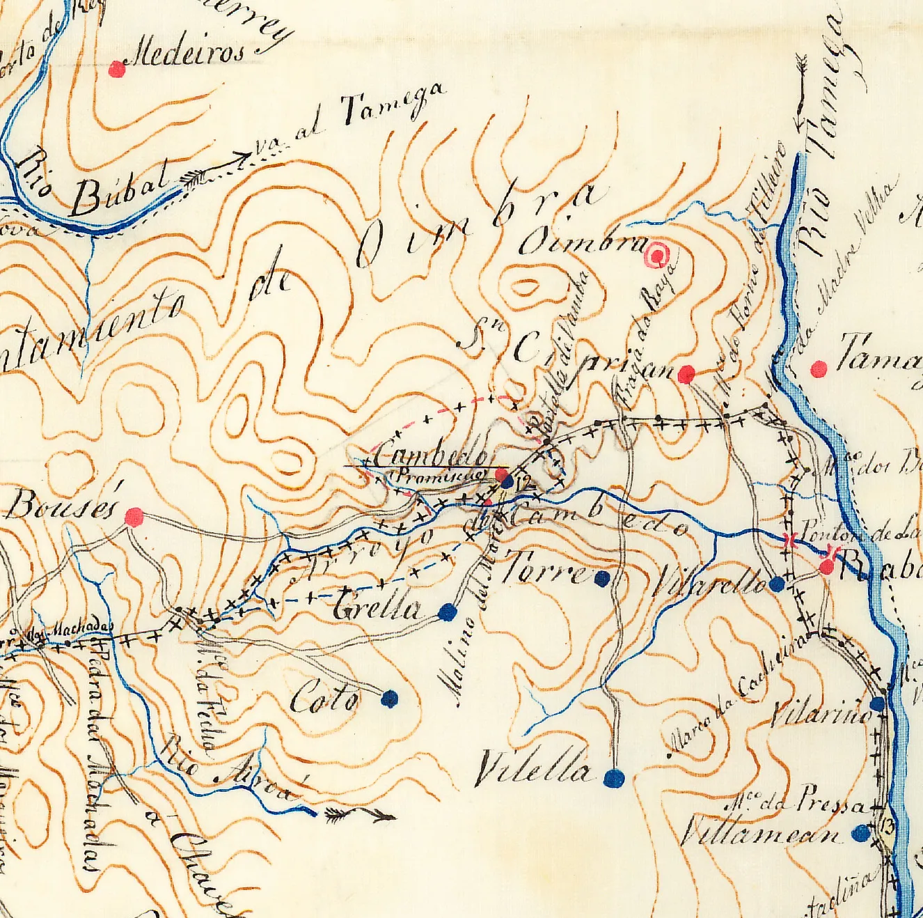
Further east, on the border between Ourense and the Portuguese district of Vila Real, in the hills above the Tâmega valley near Chaves, the problem was the opposite. The frontier was clear, but it ran through the middle of three villages, across their streets and squares and even through some houses. The commissioners called them pueblos promiscuos, “mixed villages”; in Portuguese they are the povos promíscuos. A Spanish ministry note of December 1856 said the arrangement favoured smuggling and was “all too often” a cause of conflict between frontier officials.
Households in the three shared villages, early 1860s
households
- Spanish part
- Portuguese part
Households (vecinos) counted by José de Castro López for his 1863 description of the Ourense frontier, as given by García Álvarez (2019), note 4. In all 231 households: 69 on the Spanish side and 162 on the Portuguese.
Show the data
| Spanish part | Portuguese part | |
|---|---|---|
| Soutelinho | 16 | 90 |
| Cambedo | 25 | 15 |
| Lamadarcos | 28 | 57 |
Portugal's first idea, in 1856, was to give each village to whichever country held more of its houses, which would have sent Cambedo to Spain. Spain would accept that only if Portugal gave up all claim to the Couto. In the end the two questions were settled together, and all three villages went to Portugal, “with their present boundaries”, and the line was moved round them. Soutelinho, whose Spanish quarter had no land of its own, also gained a strip 90 to 100 metres wide beyond its houses.
| Village | Before the treaty | Households, early 1860s | Hectares | After 1868 |
|---|---|---|---|---|
| Meaus | Couto Misto | 60 | 482 | Spain |
| Santiago | Couto Misto | 90 | 835 | Spain |
| Rubiás | Couto Misto | 100 | 1,188 | Spain |
| Soutelinho | Split by the line | 106 (16 Spanish, 90 Portuguese) | 600 | Portugal |
| Cambedo | Split by the line | 40 (25 Spanish, 15 Portuguese) | 500 | Portugal |
| Lamadarcos | Split by the line | 85 (28 Spanish, 57 Portuguese) | 806 | Portugal |
Households from José de Castro López; areas of the Couto villages from Castro and of the shared villages from Vasconcelos e Sá, all as given by García Álvarez (2019). The Couto's three villages add up to 250 households and 2,505 hectares, the area Spain's negotiators quoted in 1864; of this Spain kept about 2,200 hectares and Portugal took about 350 of upland pasture, both figures approximate. Lamadarcos's Spanish and Portuguese parts are given as 525 and 280 hectares, which add up to 805, not 806.
Portuguese officials took over the shared villages on 27 June 1868. Article XXVII let their genuinely Spanish inhabitants keep Spanish nationality, as the Couto's Portuguese could keep theirs. On paper the swap looked even: about 250 households and 2,200 hectares to Spain, 231 households and 1,900 hectares to Portugal. But 162 of the 231 households Portugal gained had been on its side of the line already.
Stones, signatures and the southern stretch
Both parliaments debated the treaty in February 1865, and both approved it. Isabel II sanctioned it on 13 July 1865 and Luís I on 27 March 1866, and ratifications were exchanged in Lisbon on 19 May 1866. Two annexes followed on 4 November 1866, one on the frontier rivers and one on impounded livestock, and general instructions for marking the line were agreed the same year.
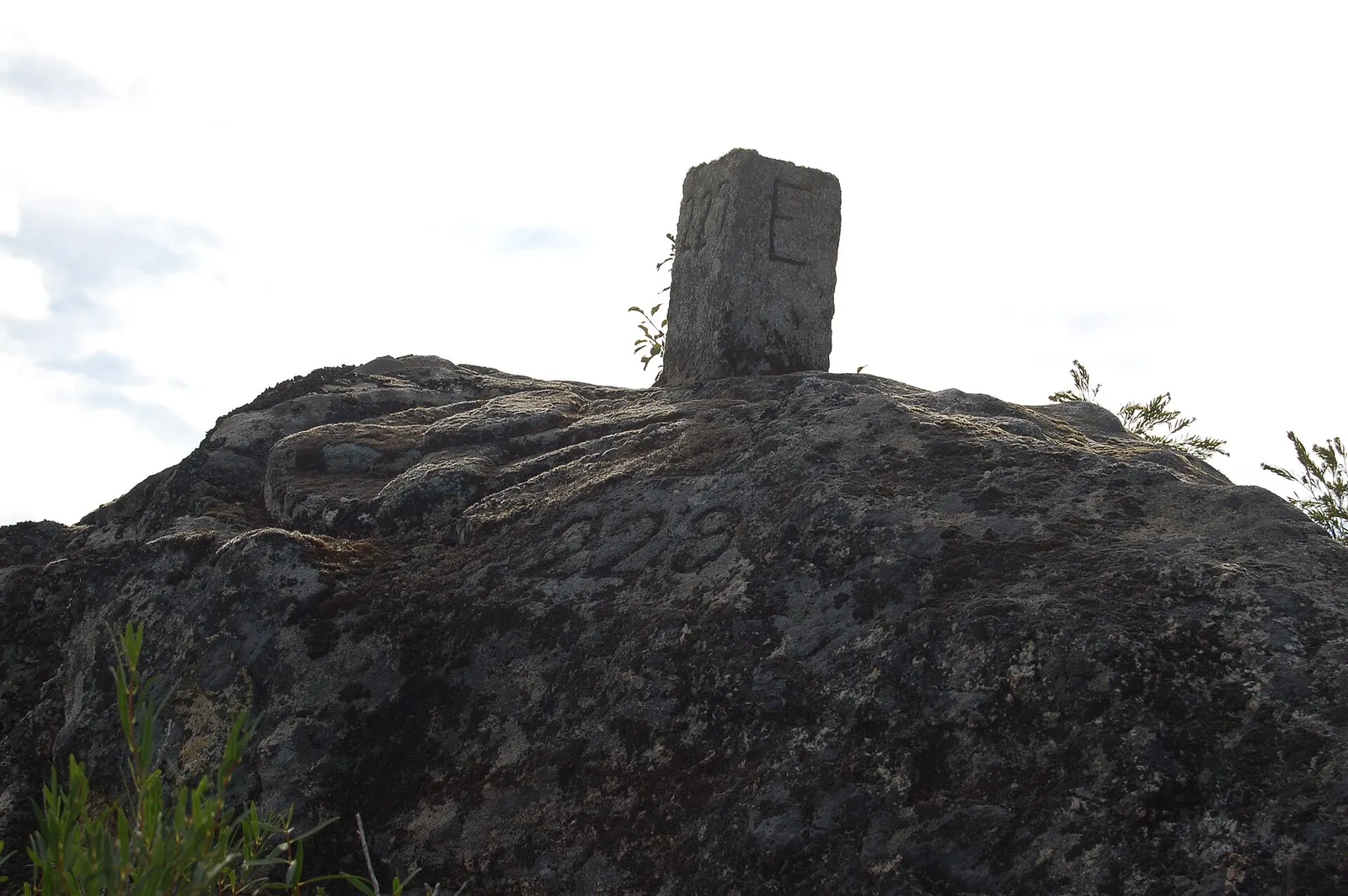
Agreeing the line had taken nine years; marking it on the ground took forty. Between late 1866 and early 1873 the commission set stones along the Galician frontier and handed over the Couto and the shared villages. Then work stopped for almost a decade, and the Spanish section ceased to exist. When army staff officers resumed in 1882, some of the first marks had been destroyed. The General Act of demarcation, describing every numbered mark with distances and bearings, was signed in Lisbon on 1 December 1906.
- Signed
- Lisbon, Thursday 29 September 1864
- Signatories
- Marquis de la Ribera and Facundo Goñi (Spain); Duke of Loulé and Jacinto da Silva Mengo (Portugal)
- Stretch
- Mouth of the Minho to the confluence of the Caia and the Guadiana
- Text
- Preamble and 31 articles
- In force
- 19 May 1866, on exchange of ratifications
- Annexes
- 4 November 1866: frontier rivers; impounded livestock
- Demarcation completed
- General Act signed in Lisbon, 1 December 1906
South of the Caia the frontier was still undefined. A separate convention of 27 September 1893 divided the Dehesa de la Contienda, a common shared by Moura in Portugal and Aroche and Encinasola in Spain. The rest waited until 29 June 1926, when a convention signed in Lisbon fixed the line from the confluence of the Cuncos with the Guadiana to the river's mouth at the Atlantic. Spain's dictator, Miguel Primo de Rivera, presented it to the king as settling the disputed lands of Pasada del Abad, Val de Grou and Galiana.
Neither treaty covers the stretch in between, the Guadiana beside Olivença, which Spain has held since 1801 and Portugal has never accepted as Spanish; the commissions stopped at its edge in 1864 and started again south of it in 1926.
Why it still matters
The line agreed in 1864 and marked by 1906 is still the frontier from the Minho to the Caia. At Spain's request the treaty and its 1866 annexes were filed and recorded with the United Nations in 1982, and the text is reprinted in Spain's 2005 collection of its frontier agreements with Portugal and France. With the 1926 convention it gives almost the whole of a border that one geographer measures at close to 1,250 km a precise legal description.
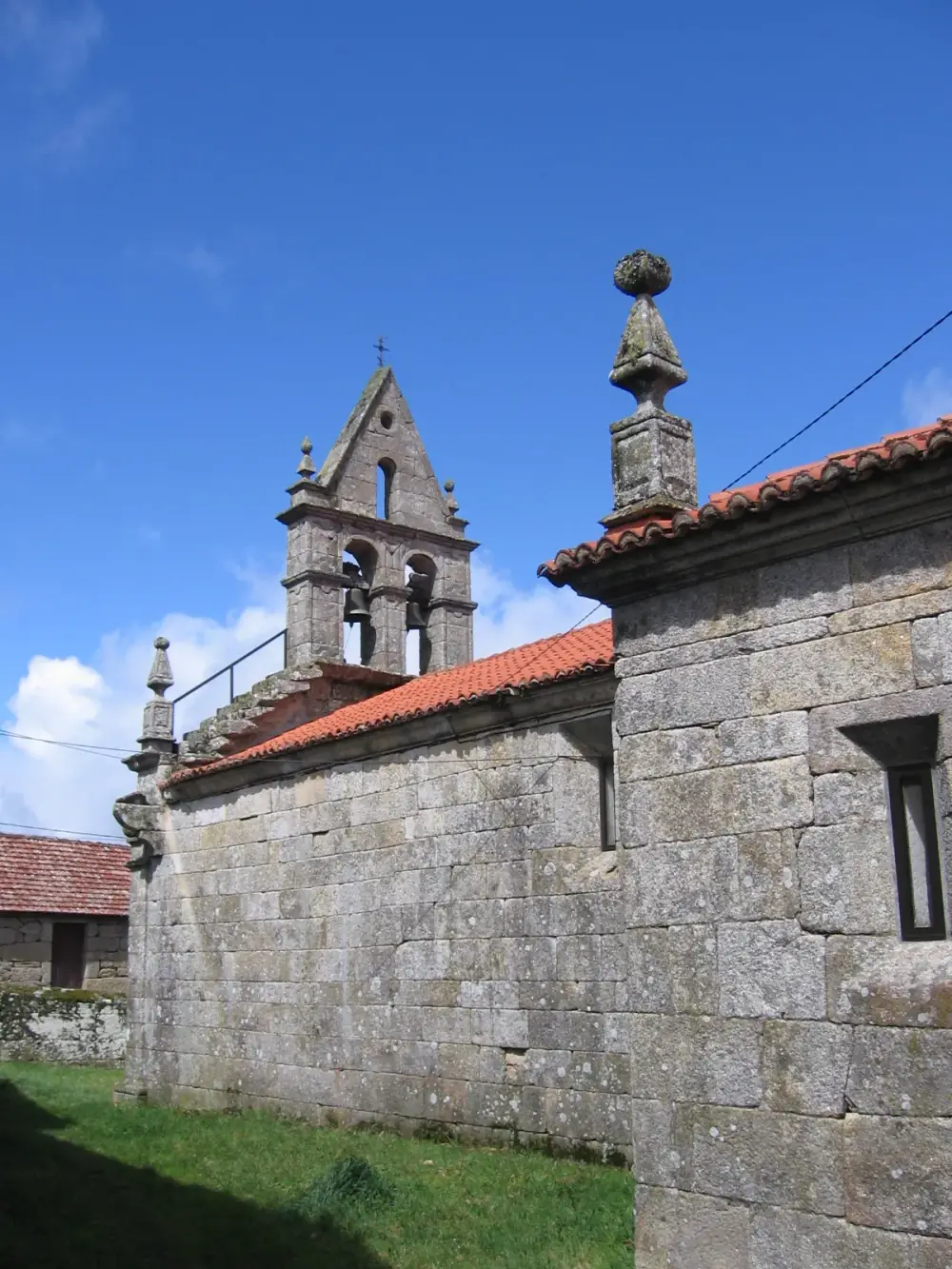
The Couto Misto has had a second life. Literary works by Xosé Luís Méndez Ferrín and Antón Riveiro and a history by Luis Manuel García Mañá revived interest from the 1990s, and some writers now present it as a lost model of self-government. The Asociación de Amigos do Couto Mixto names honorary judges of the Couto. Those it honoured at Santiago de Rubiás on 6 July 2019 included the poet Suso Díaz Estévez and the mayor of Melgaço, on the Portuguese side of the frontier.
FAQs
What did the Treaty of Lisbon of 1864 do?
Signed on 29 September 1864, it fixed the frontier between Portugal and Spain from the mouth of the Minho to the confluence of the Caia and the Guadiana, divided disputed commons, gave the Couto Misto to Spain and the three villages split by the line to Portugal, and set rules on shared roads, waters, bridges and livestock. It came into force on 19 May 1866.
What was the Couto Misto?
Three villages in the Salas valley of Ourense, Santiago, Rubiás and Meaus, whose households chose Spanish or Portuguese nationality, elected their own judge and owed almost no taxes or military service. The 1864 treaty gave the villages and most of their land to Spain and about 350 hectares of upland pasture to Portugal. Spain took over on 23 June 1868.
What were the povos promíscuos?
Soutelinho, Cambedo and Lamadarcos, near Chaves, are three villages through which the frontier ran, dividing streets and even houses. The treaty gave them wholly to Portugal, which took them over on 27 June 1868.
Does the 1864 treaty cover the whole Portugal–Spain border?
No. It stops at the Caia. The line from the mouth of the Cuncos to the mouth of the Guadiana was fixed by a convention of 29 June 1926, and the stretch between them, beside Olivença, was left out of both.
Is this the same as the EU's Treaty of Lisbon?
No. The 1864 treaty is a border treaty between Portugal and Spain alone. The European Union's Treaty of Lisbon, which reformed the EU's own treaties, was signed in Lisbon on 13 December 2007.
On the timeline
Open the timelineNearby moments from regeneration and the last kings (1851–1910).
Portugal and the Tokugawa Shogunate sign a Treaty of Peace, Amity and Commerce in Edo (present-day Tokyo), establishing formal diplomatic relations and reopening trade more than two centuries after the Portuguese were expelled from Japan in 1639.
King Pedro V dies of typhoid fever at the Necessidades Palace in Lisbon, aged just 24, after a reign of eight years. Two of his brothers, the infantes Fernando and João, also died that year, plunging the country into mourning.
The future King Carlos I of Portugal is born at the Ajuda Palace in Lisbon, son of Luís I and Maria Pia of Savoy. A noted oceanographer, he reigned from 1889 until his assassination in Lisbon in 1908.
The Treaty of Lisbon, 1864
Portugal and Spain sign the Treaty of Lisbon, fixing their frontier from the mouth of the Minho to the confluence of the Caia and Guadiana rivers and handing Spain the three villages of the Couto Misto, whose people had long chosen their own nationality and paid almost no tax.
The 'Diário de Notícias' appears in Lisbon for the first time, with a specimen issue. Founded by the journalist Eduardo Coelho and the printer Tomás Quintino Antunes, it grew into one of the country's leading newspapers and is still published today.
The army doctor José António Marques founds the Portuguese Commission for Relief of Wounded and Sick Soldiers in Time of War, the body that became the Portuguese Red Cross, months after representing Portugal at the 1864 Geneva conference.
Lisbon's Santa Apolónia station is inaugurated on the riverfront below the Alfama. Its neoclassical building and 117-metre train shed replaced the makeshift terminus in the old convent of Santa Apolónia that had served since Portugal's first railway opened in 1856, and it remains the capital's oldest railway terminus.
Coming up in history
All long reads 1 October 1777The Treaty of San Ildefonso: Portugal and Spain redraw South America, 1777
 2 October 1969Mr Five Per Cent's museum: the Gulbenkian opens in Lisbon, 1969
 3 October 1910Miguel Bombarda: the shooting at Rilhafoles on the eve of the Republic
 4 October 1582The ten days Portugal never had: the calendar change of October 1582
15 sources
Archives, scholarship and reporting this article was checked against.
- 1
Treaty on boundaries between Spain and Portugal from the mouth of the Minho River to the junction of the river Caya with the Guadiana, signed at Lisbon on 29 September 1864; Final Act approving annexes, signed at Lisbon on 4 November 1866 (No. 906)United Nations Treaty Series, vol. 1288 (1982), English translation
- 2
Geopolíticas de la territorialidad moderna: el Tratado hispano-portugués de Límites de 1864 y la extinción del Couto Mixto (1840–1868) (Jacobo García Álvarez)Boletín de la Asociación de Geógrafos Españoles, 82 (2019), article 2798
- 3
Las Comisiones Mixtas de Límites y las representaciones geográficas de la frontera hispano-portuguesa (1855–1906) (Jacobo García Álvarez and Paloma Puente Lozano)Revista de Historiografía, 23 (2015), pp. 67–100, Universidad Carlos III de Madrid
- 4
Acta general de demarcación entre España y Portugal desde la desembocadura del río Miño hasta la confluencia del Caya con el Guadiana, Lisbon, 1 December 1906Gaceta de Madrid, no. 354, 20 December 1906 (Boletín Oficial del Estado historical collection)
- 5
- 6
- 7
El Couto Mixto, una aproximación historiográfica (Juan Manuel Galiña Lorenzo)Minius, 28 (2023), pp. 75–99, Universidade de Vigo
- 8
Sobre o Tratado de Limites Espanha-Portugal (Tratado de Lisboa, 1864) nos 150 anos da sua celebração (José Viriato Capela)Forum, 49–50 (2014/2015), pp. 255–260, Universidade do Minho
- 9
- 10
- 11
El incordio ibérico: Oliven(z/ç)a, el lobby ultranacionalista portugués y la frontera irredenta (c. 1936–1968) (Carlos Píriz)Rubrica Contemporanea, vol. XI, no. 22 (2022), Universitat Autònoma de Barcelona
- 12Nuno Melo defende que Olivença “é portuguesa”Observador (Lusa)
- 13
- 14
Discurso, Xuíz Honorario do Couto Mixto (Suso Díaz Estévez), Santiago de Rubiás, 6 July 2019Asociación de Escritoras e Escritores en Lingua Galega
- 15
Treaty of Lisbon amending the Treaty on European Union and the Treaty establishing the European Community, signed at Lisbon, 13 December 2007 (OJ C 306, 17.12.2007)Official Journal of the European Union, via EUR-Lex
Image credits
- The mouth of the Minho, seen in 2014 from Santa Trega above A Guarda in Galicia, with Caminha in Portugal on the far bank. The Treaty of Lisbon's frontier line starts here and runs up the centre of the river's main stream. Luis Miguel Bugallo Sánchez (Lmbuga), CC BY-SA 4.0, via Wikimedia Commons.
- Nuno José Severo de Mendonça Rolim de Moura Barreto, Duke of Loulé, prime minister and foreign minister when he signed the treaty for Portugal. Lithograph by João António Correia, about 1867. João António Correia, Public domain, via Wikimedia Commons.
- Cambedo, labelled “Promiscuo”, on the map of the Ourense frontier that José de Castro López drew at about 1:100,000 and dated Badajoz, September 1863. Lines of small crosses mark the boundaries; the Portela de Vamba, named in Article XI, is lettered just to the right of the village. José de Castro López, Public domain, via Wikimedia Commons.
- The Camiño Privilexiado, the privileged road on which neither kingdom's guards could arrest anyone, where it crosses a brook at Rubiás, one of the Couto's three villages. Photographed in 2017. Pementa, CC BY-SA 4.0, via Wikimedia Commons.
- Boundary mark 229 at the Portela de Vamba, on the path between Cambedo and San Ciprián, photographed in 2020. The 1906 demarcation act describes it as a natural mark carved into rocks north of the path. The squared post on top is lettered E, for España. Estevoaei, CC BY-SA 4.0, via Wikimedia Commons.
- The church of Santiago de Rubiás, in the former Couto Misto, photographed in 2008. A chest in the parish church held the Couto's archive until it burned in 1809, as French troops passed through. CorreiaPM, Public domain, via Wikimedia Commons.