

The Treaty of San Ildefonso: Portugal and Spain redraw South America, 1777
For almost a hundred years Portugal and Spain fought over a walled smuggling town on the River Plate. A new queen in Lisbon and a Spanish army in Brazil brought the quarrel to a signature, though not to an end.
At a glance
- On 1 October 1777, at the Spanish royal palace of San Ildefonso, Portugal and Spain signed a preliminary treaty of 25 articles on their borders in South America.
- Portugal ceded Colónia do Sacramento, its fortified trading town on the River Plate founded in 1680, and gave up its claim to the mission lands east of the Uruguay river.
- Spain handed back the island of Santa Catarina, which a Spanish expedition had seized in February 1777, and recognised Portuguese rule over Rio Grande de São Pedro.
- The deal followed the death of King José I in February 1777 and the fall of his minister Pombal. Maria I ratified it at Queluz on 10 October 1777.
- In March 1778 a second treaty gave Spain the islands of Annobón and Fernando Pó in the Gulf of Guinea. The boundary commissions never finished, and war in 1801 left the Sete Povos in Portuguese hands.
Colónia, 3 June 1777
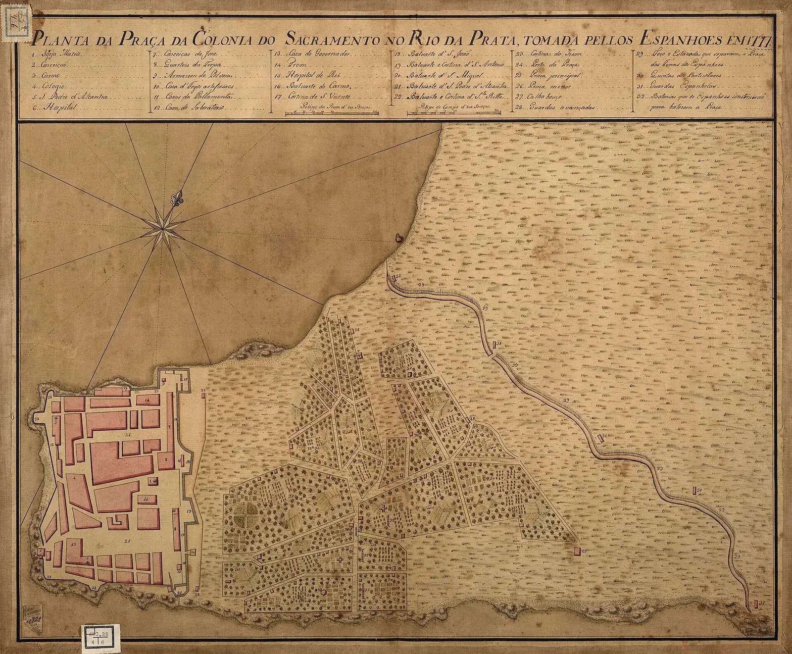
On 3 June 1777 the Portuguese garrison of Colónia do Sacramento lined up unarmed in the main square, packs on their backs. Outside the walls a Spanish army had dug in around the town. When the siege began, the garrison had food for about five days. Their governor, Colonel Francisco José da Rocha, had decided to hand the town over before its defenders and people starved.
Father Pedro Pereira Fernandes de Mesquita, the bishop's vicar in Colónia and chaplain of its cavalry regiment, watched them go. He wrote his account in Buenos Aires the following year.
“On 3 June the whole garrison formed up unarmed in the middle of the square with their packs on their backs; they went out through the land gate, watering the road with their tears, between two lines of Spanish troops that stretched from the gate to the beach, and there they were put aboard some ships made ready for them and taken to Buenos Aires.”
According to a Spanish diary of the siege, the next day a Spanish marshal, Victorio de Navia, took possession of the town in the name of Charles III. A Te Deum was sung in the parish church and on 7 June the demolition of the walls began. For almost a century Colónia had been Portugal's foothold on the River Plate.
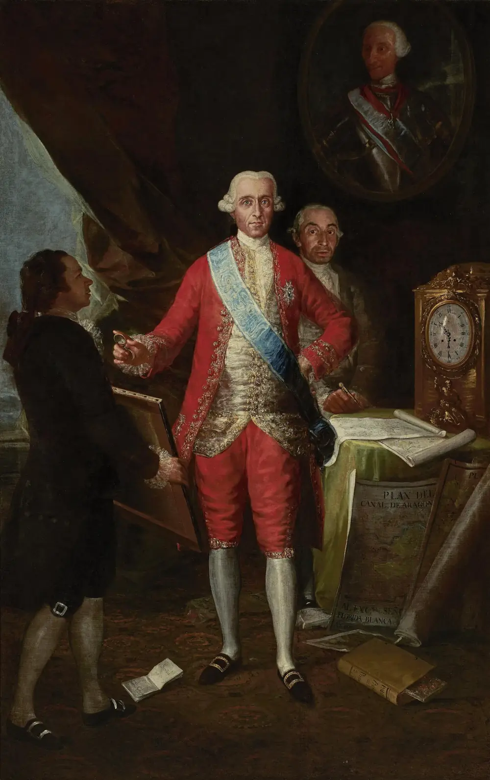
Four months later, on 1 October 1777, two diplomats signed a treaty at San Ildefonso, a Spanish royal palace near Segovia. One was Francisco Inocêncio de Sousa Coutinho, Portugal's ambassador to Madrid. The other was the Count of Floridablanca, Spain's first secretary of state. Their 25 articles turned the loss of Colónia into law and drew a new line across South America.
A line that kept moving
The quarrel was old. In 1494 the Treaty of Tordesillas had split the world outside Europe between the two crowns along a north–south line in the Atlantic. On paper, the Amazon lay on Spain's side. In practice, Portuguese settlers and soldiers in Brazil pushed far beyond the line, and by the eighteenth century it no longer matched anything on the ground.
Colónia was the sharpest point of that push. Manuel Lobo founded it in 1680 on the northern shore of the River Plate, in what is now Uruguay, on the orders of the prince regent Pedro. The aim was to reach the silver of Potosí, smuggled down the estuary and shipped to Lisbon through Brazilian ports. Spanish colonial troops and Guarani soldiers from the Jesuit missions destroyed it eight months later.
Then a pattern set in. Portugal lost the town in war and won it back at the peace table: by a provisional treaty in 1681, at Utrecht in 1715 and at Paris in 1763. In between, Buenos Aires besieged it from October 1735 to September 1737 and kept a fortified blockade line around it for decades. Smugglers sold silver, hides, horn, tallow and yerba mate through its gates.
| Treaty | Date | Colónia do Sacramento | The south and the missions |
|---|---|---|---|
| Tordesillas | 7 June 1494 | Did not exist yet | Line in the Atlantic left the Amazon and most of the continent to Spain |
| Provisional Treaty | 1681 | Returned to Portugal after its destruction in 1680 | No change |
| Utrecht (Portugal–Spain) | 6 February 1715 | Returned to Portugal after its loss in 1705 | No change |
| Madrid | 13 January 1750 | To be ceded to Spain | The seven missions east of the Uruguay to pass to Portugal; borders by uti possidetis |
| El Pardo | 12 February 1761 | Stays Portuguese | Treaty of Madrid annulled; the missions stay Spanish |
| Paris | 10 February 1763 | Returned to Portugal after Cevallos took it in 1762 | Spain keeps Rio Grande, taken in 1763 |
| San Ildefonso | 1 October 1777 | Ceded to Spain for good | Rio Grande to Portugal; missions stay Spanish; Santa Catarina returned to Portugal |
| El Pardo | 11 March 1778 | Extends the 1777 treaty | Portugal cedes Annobón and rights to Fernando Pó in Africa |
| Badajoz | 6 June 1801 | Not mentioned | Silent on America, so Portugal keeps the missions it took in 1801 |
Colónia was destroyed in 1680 and abandoned in 1705, in each case months or years before the treaty that gave it back. The dates of the 1715 and 1763 treaties come from article I of the 1777 treaty, which confirmed them, and that of Tordesillas from its article XXI.
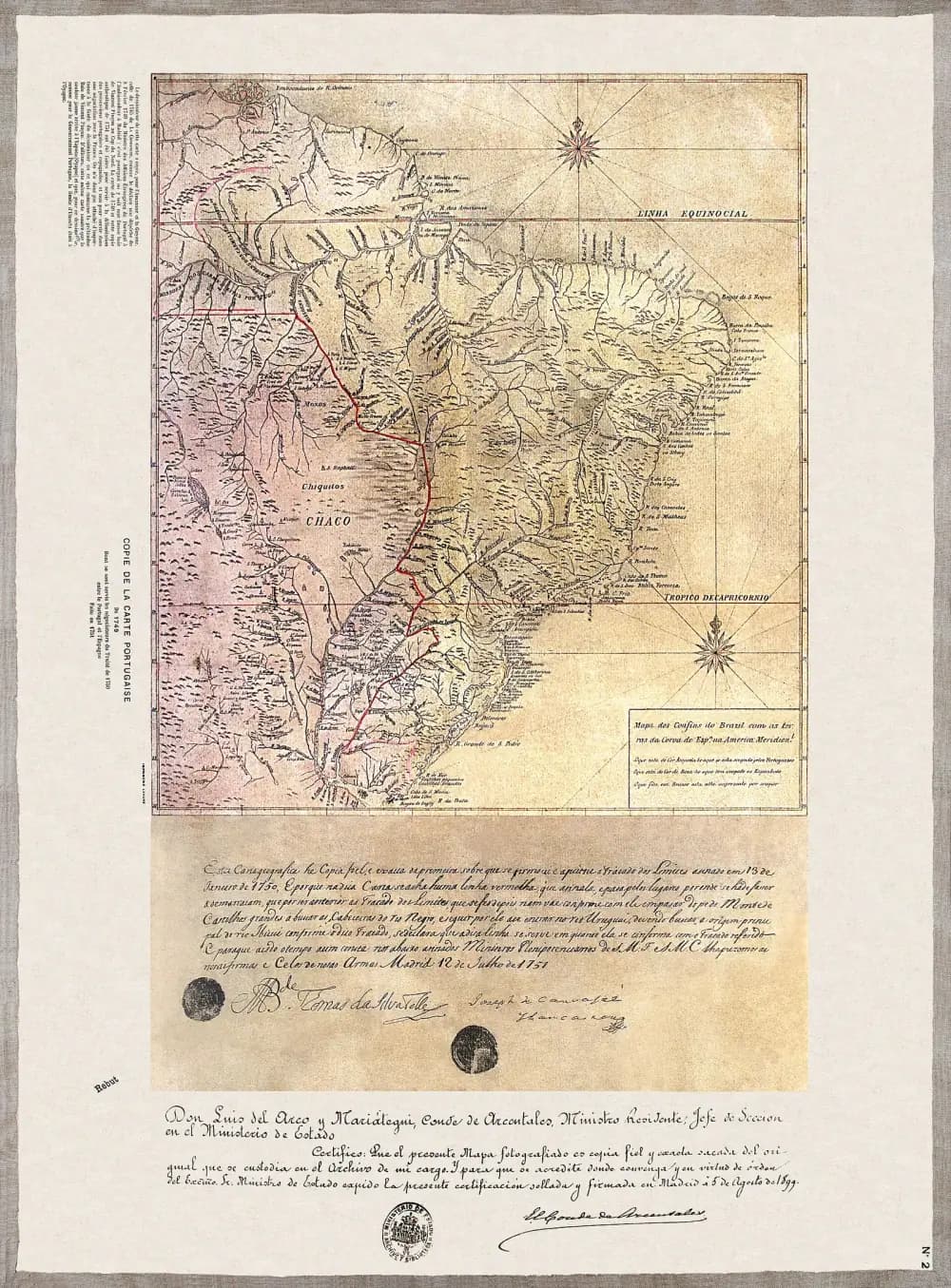
In 1750 the two crowns tried a clean break. The Treaty of Madrid, signed on 13 January, scrapped Tordesillas and adopted uti possidetis: each side kept what it actually held, with borders following big rivers and mountain ridges. That gave Portugal most of the Amazon and Spain the River Plate. Portugal also agreed to swap Colónia for seven Jesuit mission towns east of the Uruguay river, the Sete Povos das Missões.
The Guarani refused to go. In February 1753 their militia stopped the first boundary party at Santa Tecla, a ranch belonging to the town of São Miguel. In the war that followed, a joint Spanish and Portuguese army killed the Guarani leader Sepé Tiaraju on 7 February 1756 and won the battle of Caiboaté three days later. The two armies then occupied the mission towns.
“They tell us we must abandon our lands, our crops, our houses and even our homeland. This is not an order from God but from the Devil. … Why does our king not give the Portuguese Buenos Aires, Santa Fe, Corrientes and Paraguay?”
In Portugal people protested at giving up Colónia. In Spain they protested at giving up the missions. The death of Ferdinand VI in 1759 brought Charles III to the Spanish throne and a change of course, and on 12 February 1761 the Treaty of El Pardo annulled it. The border went back to where it had been before 1750, with Spain in the missions and Portugal in Colónia.
Cevallos sails
Peace did not last. In the Seven Years' War, when Spain and Portugal fought on opposite sides, the governor of the River Plate, Pedro de Cevallos, took Colónia in 1762 and the Portuguese town of Rio Grande de São Pedro, at the mouth of the Lagoa dos Patos, in 1763. The Treaty of Paris forced Spain to return Colónia, but Spain kept Rio Grande, arguing that the Portuguese had built it on Spanish land.
Portugal took Rio Grande back in an offensive of the mid-1770s, with large numbers of men recruited in Brazil and Portugal. The build-up frightened Buenos Aires. At the end of 1776 the governor of Colónia reported that the Spanish city had only a hundred paid soldiers and was in “great unrest and fear” of a Portuguese invasion.
Madrid answered with an invasion force. A fleet left Cádiz on 13 November 1776 with more than 11,500 men on board, under Cevallos, now named viceroy of the River Plate. In February 1777 it anchored off the island of Santa Catarina, on the coast of southern Brazil. The garrisons of the island's forts left their posts and fled to the mainland, and 523 Portuguese soldiers were taken as prisoners of war.
Storms scattered the fleet off Rio Grande and saved the town. While still at Santa Catarina, Cevallos heard that the king of Portugal had died. Expecting the two courts to make peace and stop him, he sailed at once for Colónia, which his ships had already cut off from Rio de Janeiro. Captured letters told him how short of food the town was.
Rocha surrendered in early June. The historian Paulo Possamai, citing J. C. Rego Monteiro's 1937 history of Colónia, writes that Rocha held a secret order from Pombal to give up the town after putting up a show of defence. Cevallos then shipped the civilians across the river and scattered them to frontier villages such as Luján, Areco, Arrecifes and Pergamino. Colónia's soldiers were sent inland to Córdoba, and the men captured at Santa Catarina to Mendoza.
A new queen, a fallen minister
The news that Cevallos heard was true. King José I had died at Ajuda, in Lisbon, on 24 February 1777. Throughout his reign his chief minister, Sebastião José de Carvalho e Melo, Marquis of Pombal, had run Portugal, rebuilt Lisbon after the 1755 earthquake and expelled the Jesuits. The new queen was José's daughter, Maria I, and Pombal was soon banished to his estates at Pombal.
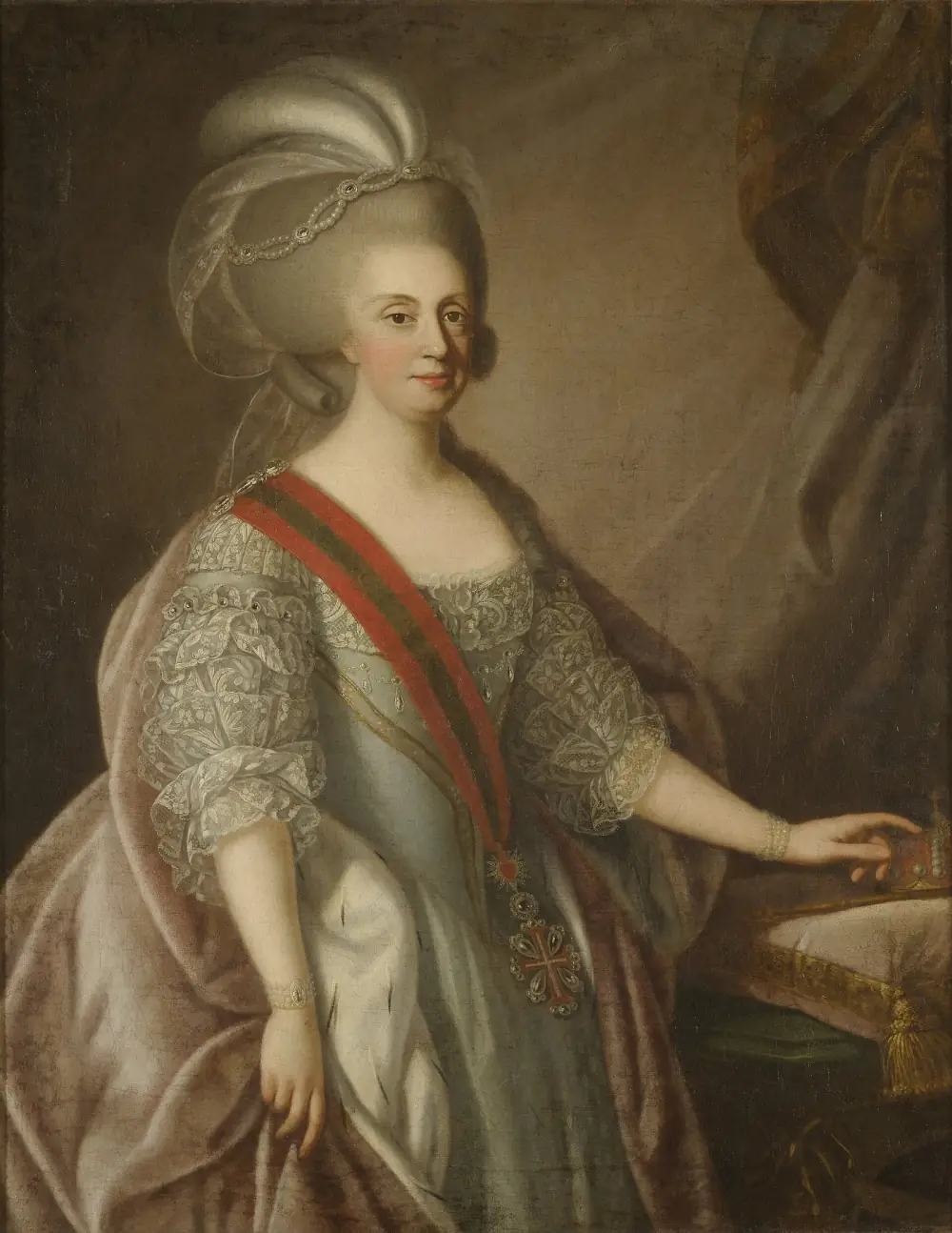
Maria's family pulled towards Madrid. Her mother, Mariana Vitória, was a Spanish princess, a daughter of Philip V. Her match with José was arranged in 1727 and the wedding held in January 1729. That made Charles III of Spain the new queen's uncle, and in her letter of ratification Maria called him “my good brother and uncle”. The historian Simei Torres describes the change of reign as the moment Portugal, weakened, set out to mend relations with its neighbour.
Portugal was in no position to bargain. Colónia had fallen and Spanish troops held Santa Catarina. Peace in the south would cost Lisbon most of what it had fought for on the River Plate.
Twenty-five articles
- Full name
- Preliminary Treaty of Peace and Limits in South America
- Signed
- 1 October 1777, San Ildefonso (La Granja), Spain
- For Portugal
- Francisco Inocêncio de Sousa Coutinho, ambassador in Madrid
- For Spain
- José Moñino, Count of Floridablanca, first secretary of state
- Length
- 25 articles
- Ratified by Portugal
- Maria I at the Palace of Queluz, 10 October 1777
The preamble spoke of ending discord that had lasted “almost three centuries” over the two crowns' lands in America and Asia. It called itself preliminary: a basis for a definitive treaty to be written once the frontier had been surveyed. Article I declared perpetual peace by land and sea, with “total forgetting of the past”, and confirmed the peace treaties of 1668, 1715 and 1763. Article II freed all prisoners.
| Article | Portugal | Spain |
|---|---|---|
| III | Cedes Colónia do Sacramento, the island of San Gabriel and every post on the north shore of the River Plate | Sole navigation of the Plate and the Uruguay, and the land on both banks, up to the mouth of the Pepiri-guaçu |
| IV | Sole navigation of the entrance to the Lagoa dos Patos and Rio Grande; land south to the Taim stream | The missions on the Uruguay stay Spanish |
| V | Gives up the Chuí guard post, the Castillos Grandes bar and Fort San Miguel | Gains those posts; the Mirim and Mangueira lagoons and the land between them and the sea stay neutral, occupied by neither crown |
| XXI | Drops any claim to the Philippines and Marianas under Tordesillas or the 1529 Saragossa agreement | Keeps its Asian islands |
| XXII | Gets back Santa Catarina and the nearby mainland within four months; promises to bar foreign warships and merchant ships | Withdraws from Santa Catarina |
Article VI added neutral strips along the rest of the frontier where neither side could build towns or forts. Article VII let the people of Colónia leave with their goods or stay.
In the south the line broadly followed 1750, but without the swap. Spain kept Colónia and the missions, and the Plate became a Spanish river. Portugal kept Rio Grande and the coast up to Santa Catarina. Between them lay a no man's land of lagoons and coastal strips. Further north, the treaty traced the border along the Iguaçu, Paraná, Paraguay, Guaporé and Madeira rivers to the Amazon, close to the 1750 line.
The Santa Catarina clause shows what worried Spain. Portugal had to promise that at no time, in peace or in any war it took no part in, would it let a foreign squadron, warship or merchant ship into the harbour of Santa Catarina or the nearby coast, above all ships of a power at war with Spain or suspected of smuggling.
In the nineteenth century the Brazilian historian Francisco Adolfo de Varnhagen judged the deal harshly.
“The articles of the treaty were dictated by Spain almost with weapons in hand, and the facts could not fail to look like those of the lion with the timid sheep.”
Islands in Africa
Spain wanted one more thing, and got it in a second treaty signed at El Pardo on 11 March 1778. Article 13 said that, to “compensate in some way” for the cessions, restitutions and renunciations Spain had made in 1777, Portugal ceded the island of Annobón and its rights to the island of Fernando Pó, now Bioko, in the Gulf of Guinea.
The main purpose was the slave trade. The article opened by saying both monarchs wished to promote the buying and selling of enslaved Africans by their subjects without the harmful contracts once given to Portuguese, French and English companies. Spain's colonies in America needed labour, and Spanish ships could now trade on the African coast opposite the islands, in the Gabon and Cameroon rivers.
The Spanish expedition sent in April 1778 under the Count of Argelejo to take possession achieved almost nothing, and the islands' reputation for disease kept Spain away for decades. Spanish rule over Fernando Pó and Annobón was only imposed by Juan José de Lerena's expedition of 1843. The islands are now part of Equatorial Guinea.
Drawing the line on the ground
Article XV ordered joint commissions to walk the frontier, mark it and map it. The two courts split the work among four parties, from the Atlantic coast in the south to the Amazon in the north. Each was meant to have two principal commissioners, two engineers, two geographers and two local guides.
They were slow to start. Spanish officials later complained that Madrid named its commissioners in 1778 and Lisbon not until 1783. Lisbon replied that its men had sailed with the Spanish officers in 1782 and that its first commissioner had been in Rio Grande as governor since 1781. Guarani from the mission towns helped locate the line, supplied the survey parties and patrolled the undivided lands between the two crowns.
In the Amazon a Portuguese party of about 500 people gathered on the Rio Negro in October 1780. The Spanish team of about 300, under Colonel Francisco Requena, arrived from Maynas, in today's Peru, in April 1781. The two parties made the village of Ega, on the Solimões, their base and spent a decade arguing over rivers, until the Spanish withdrew in 1791 with the work unfinished.
In the south the dispute was over which stream was the Pepiri-guaçu. In 1788 the Spanish commissioners found a river further east and claimed that the surveyors of 1759–60 had picked the wrong one. Their river would have moved the border well to the east, across the land between the Uruguay and Iguaçu rivers. The question was still open when war came.
13 November 1776
Fleet leaves Cádiz
More than 11,500 men under Pedro de Cevallos.
February 1777
Santa Catarina falls
The forts are abandoned; 523 Portuguese soldiers are taken prisoner.
24 February 1777
José I dies
Maria I succeeds; Pombal is banished to his estates.
3–4 June 1777
Colónia surrenders
The garrison marches out; the Spanish take possession the next day.
1 October 1777
Treaty signed
Sousa Coutinho and Floridablanca sign at San Ildefonso.
10 October 1777
Portugal ratifies
Maria I signs the ratification at the Palace of Queluz.
11 March 1778
Treaty of El Pardo
Portugal cedes Annobón and its rights to Fernando Pó.
1780–1781
Commissions meet in the Amazon
Portuguese and Spanish parties reach the frontier and settle at Ega.
1788
Pepiri-guaçu dispute
Spanish surveyors claim a river further east.
1791
Amazon work ends
The Spanish commission withdraws to Maynas.
25 February 1801
Spain declares war
Hostilities spread to the South American frontier.
6 June 1801
Peace of Badajoz
Ends the war without restoring the 1777 line.
Aftermath: the war of 1801
Colónia's people paid first. Rocha stayed with his men in Buenos Aires until August 1778, then led those who wanted to leave back overland to Rio Grande. In Rio de Janeiro his own officers accused him over the surrender. He was sent to Lisbon, tried and sentenced to death, and the sentence was commuted to exile for life in Angola, where he died.
So many families from Colónia arrived in Rio Grande in 1779 that the governor, José Marcelino de Figueiredo, wrote in May that he had nothing to give them. He shared out land, some of it on the plains by the São Gonçalo channel. Settlers from Colónia and the Atlantic islands there later asked for a parish of their own, and in 1812 São Francisco de Paula was created, the nucleus of today's city of Pelotas.
The treaty itself died in 1801. On 25 February Spain declared war on Portugal and ordered its officers in South America to open hostilities against Brazil. Luso-Brazilian forces overran the whole east bank of the Uruguay above the Quaraí river, including the old mission towns, and pushed south to the Jaguarão river and the Mirim lagoon.
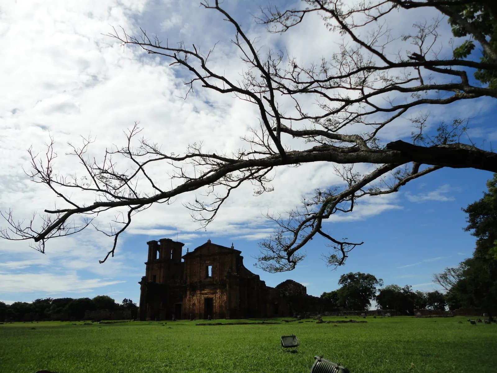
The peace signed at Badajoz on 6 June 1801 said nothing about America. It neither restored the situation before the war nor revived the 1777 treaty, so Portugal kept what it had taken. The Sete Povos, which the Guarani had died defending in 1756, became part of Brazil after all.
Why it still matters
Look at a map of Brazil's far south today and you can still read the 1777 line in places. The Plate is not Brazilian, Colónia is a town in Uruguay, and the Lagoa Mirim, part of the 1777 buffer zone, has been split between Brazil and Uruguay since a treaty of 1909. Santa Catarina island, handed back under article XXII, is home to Florianópolis, the capital of the state of Santa Catarina.
The treaty also outlived itself in court. When Brazil and Argentina argued in the 1880s and 1890s over the land between the Uruguay and Iguaçu rivers, now in the west of Santa Catarina state, the case turned on which river was the Pepiri-guaçu, the question the surveyors of 1788 had left open. Brazil's advocate, the Baron of Rio Branco, argued among much else from an authenticated copy of the Mapa das Cortes, the map used for the 1750 treaty, and on 5 February 1895 the arbitrator, US president Grover Cleveland, found for Brazil.
For Portugal, 1777 marked the end of a long gamble on the River Plate. The smuggling base it had fought over for almost a century was gone, and the future of the south lay in Rio Grande, settled in part by the people expelled from Colónia.
FAQs
What was the Treaty of San Ildefonso of 1777?
It was a preliminary treaty of 25 articles signed on 1 October 1777 at the Spanish palace of San Ildefonso by Portugal and Spain, to settle their borders in South America. Portugal ceded Colónia do Sacramento and its claims on the River Plate; Spain returned the island of Santa Catarina and recognised Portuguese Rio Grande.
Why did Portugal give up Colónia do Sacramento?
A Spanish expedition under Pedro de Cevallos had taken Santa Catarina in February 1777 and Colónia in June. King José I had died in February and the new queen, Maria I, wanted peace with her uncle Charles III of Spain. Giving up Colónia was the price of getting Santa Catarina back and ending the war.
What happened to the Sete Povos das Missões?
The seven mission towns east of the Uruguay river were to pass to Portugal under the 1750 Treaty of Madrid, but their Guarani people fought the transfer and the treaty was annulled in 1761. The 1777 treaty left them to Spain. Luso-Brazilian forces occupied them in the war of 1801, and they have been part of Brazil ever since.
What did the Treaty of El Pardo of 1778 add?
Signed on 11 March 1778, it confirmed the peace and, to compensate Spain for what it had given up in 1777, Portugal ceded the island of Annobón and its rights to Fernando Pó (Bioko) in the Gulf of Guinea, so Spain could trade in enslaved Africans. Spain only took effective control of the islands in 1843.
Did the 1777 treaty fix Brazil's southern border?
Not for good. The boundary commissions never finished their work, and when Spain went to war with Portugal in 1801 the Peace of Badajoz did not revive the treaty, so Portugal kept the land it had conquered. Disputes it left open, such as the identity of the Pepiri-guaçu river, were settled only in 1895.
On the timeline
Open the timelineNearby moments from earthquake and enlightenment (1750–1807).
The poet Manuel Maria Barbosa du Bocage, the finest Portuguese exponent of Arcadian verse and a celebrated satirist and improviser, is born in Setúbal.
Nicolau Nasoni, the Tuscan-born architect whose Baroque works include Porto's Clérigos Church and its landmark tower, dies in poverty in the city aged 82 and is buried in the Clérigos Church he designed.
King José I dies in Lisbon after a 27-year reign. Within weeks his daughter and successor, Maria I, removed the all-powerful Marquis of Pombal and freed many of his political prisoners — the change of course remembered as the 'Viradeira'.
The Treaty of San Ildefonso, 1777
By the Treaty of El Pardo, Portugal hands Spain the islands of Fernando Pó (Bioko) and Annobón in the Gulf of Guinea, in return for settling the borders of southern Brazil. They become the nucleus of Spanish Guinea — today's Equatorial Guinea, where Annobón still speaks a Portuguese-based creole.
Birth in Castelo de Vide of José Xavier Mouzinho da Silveira, the liberal jurist whose sweeping decrees of 1832, issued in the Azores and besieged Porto during the civil war, abolished tithes, the medieval 'forais' (feudal charters and dues) and small entailed estates. Historians often credit him with laying the legal foundations of modern Portugal.
The Marquis of Pombal dies in disgrace at Pombal, aged 82. Virtual ruler of Portugal under King José I from 1750 to 1777, he rebuilt Lisbon after the 1755 earthquake and expelled the Jesuits, but was banished from court after Maria I took the throne.
Coming up in history
All long reads 3 October 1910Miguel Bombarda: the shooting at Rilhafoles on the eve of the Republic
 4 October 1582The ten days Portugal never had: the calendar change of October 1582
 5 October 1910The morning Portugal became a republic: 5 October 1910
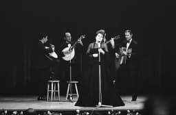 6 October 1999Amália Rodrigues, the voice of fado, dies in Lisbon: 6 October 1999
18 sources
Archives, scholarship and reporting this article was checked against.
- 1
Tratado preliminar de paz, e de limites na America Meridional, relativo aos estados que nella possuem as coroas de Portugal, e de Hespanha (Lisbon, Regia Officina Typografica, 1777)Biblioteca Brasiliana Guita e José Mindlin, Universidade de São Paulo
- 2
A última guerra pela Colônia do Sacramento (1777) (Paulo Cesar Possamai)Cuadernos de H Ideas 14 (2020), Universidad Nacional de La Plata
- 3
O Barão do Rio Branco e o traçado das fronteiras do Brasil (Renato Barbosa Rodrigues Pereira)Revista Brasileira de Geografia 7 (2), 1945, IBGE
- 4
Cartografia da Guerra Guaranítica (Tau Golin)Anais do I Simpósio Brasileiro de Cartografia Histórica, Universidade Federal de Minas Gerais
- 5
Dominios y fronteras en la Amazonía colonial. El Tratado de San Ildefonso (1777–1790) (Simei Maria de Souza Torres)Fronteras de la Historia 8 (2003), Instituto Colombiano de Antropología e Historia
- 6
A execução do tratado de Santo Ildefonso e as atuações indígenas na fronteira platina (Karina Moreira Ribeiro da Silva e Melo)Revista Brasileira de História & Ciências Sociais 10 (19), 2018, Universidade Federal do Rio Grande
- 7
Crónicas portuguesas de la Guerra Civil de España. Los informes del vicecónsul portugués en Fernando Poo (Manuel Burgos Madroñero)Aldaba 31, Universidad Nacional de Educación a Distancia
- 8
De “rebeldes, traidores, infieles, desleales y desobedientes” a vassalos d’El Rei: o princípio da devolução de índios no Rio da Prata colonial (1750–1763) (Hevelly Ferreira Acruche)IHS. Antiguos jesuitas en Iberoamérica 3 (2), 2015
- 9
Palacio Real de La Granja de San IldefonsoPatrimonio Nacional
- 10
Missões jesuíticas dos Sete Povos e o Tratado de Madri (1750): protagonismo, resistência e autodeterminação dos índios na luta pela terra (Mateus Brunetto Cari and Paula Faustino Sampaio)Tellus 19 (38), 2019, Universidade Católica Dom Bosco
- 11
D. José IPortugal: Dicionário Histórico, Corográfico, Heráldico, Biográfico, Bibliográfico, Numismático e Artístico, vol. III (1904–1915), online edition
- 12
Formas de arte efémera no duplo consórcio Bragança-Bourbon em 1785 (Joaquim Jaime B. Ferreira-Alves)Revista da Faculdade de Letras, Ciências e Técnicas do Património, Universidade do Porto, 2004
- 13
La cruz de distinción de Fernando Poo (Javier de Granda Orive)Revista General de Marina, December 2012, Armada Española
- 14
Ficha país: Guinea EcuatorialOficina de Información Diplomática, Ministerio de Asuntos Exteriores, Unión Europea y Cooperación (Spain)
- 15
Demarcações de limites e circulações nas fronteiras da Amazônia ibérica (c.1780–c.1790) (Carlos Augusto Bastos)Revista Maracanan 16 (2017), Universidade do Estado do Rio de Janeiro
- 16
The Gardens and National Palace of QueluzParques de Sintra – Monte da Lua
- 17
Palácio da EgaArquivo Histórico Ultramarino, Direção-Geral do Livro, dos Arquivos e das Bibliotecas
- 18
Image credits
- “Plan of the stronghold of Colónia do Sacramento on the River Plate, taken by the Spanish in 1777”, an anonymous manuscript plan drawn after the town fell, now in the Biblioteca Nacional do Brasil. The key marks the churches, the governor's house and the bastions, the palisade that cut the town off from Spanish land, the Spanish guard posts and the batteries the Spanish built to bombard it. Unknown author, Public domain, via Wikimedia Commons.
- A copy of the “Mapa das Cortes”, the map drawn in Lisbon in 1749 for the negotiators of the 1750 Treaty of Madrid. This print reproduces an authenticated copy signed in Madrid on 12 July 1751 by the two negotiators, with a further certificate from Spain's foreign ministry dated Madrid, 5 August 1899. Alexandre de Gusmão (1749), Public domain, via Wikimedia Commons.
- Maria I, who came to the throne in February 1777, in a portrait of 1783 at the National Palace of Queluz, attributed to Giuseppe Troni or to Thomas Hickey. She ratified the treaty at Queluz on 10 October 1777. Attributed to Giuseppe Troni, Public domain, via Wikimedia Commons.
- José Moñino, Count of Floridablanca, who signed for Spain as Charles III's first secretary of state, painted by Francisco de Goya in 1783. Goya included himself on the left, showing the count a canvas. Francisco Goya, Public domain, via Wikimedia Commons.
- The ruined church of São Miguel das Missões, in Rio Grande do Sul, Brazil, photographed in 2015. São Miguel was one of the Sete Povos that Portugal agreed to take in 1750, left to Spain in 1777 and occupied in 1801. Ricardogauderio, CC BY-SA 3.0, via Wikimedia Commons.