

The Lines of Torres Vedras: where Masséna's march on Lisbon stopped, 1810
For a year, thousands of Portuguese labourers dug forts across the hills north of Lisbon under a handful of British engineers. In October 1810 a French army marching on the capital ran into them near Sobral de Monte Agraço, and got no further.
At a glance
- On 11 October 1810 French cavalry under General Montbrun reached Sobral de Monte Agraço, north of Lisbon, and found the hills ahead lined with redoubts and troops.
- The Lines of Torres Vedras were chains of earthwork forts between the Atlantic and the Tagus, ordered by Wellington in a memorandum of 20 October 1809 and built mostly by Portuguese militia and paid or conscripted peasants.
- When the army moved in, in October 1810, there were 126 enclosed works with 427 guns; by 1812 there were 152 works with 534 guns, according to the engineer John Jones. The local heritage association gives 600 guns and about 85 km of defences.
- Masséna's Army of Portugal skirmished at Sobral from 12 to 14 October, waited a month, fell back to Santarém on 14–15 November and began its retreat from Portugal in March 1811, having lost just under 25,000 men.
- Portuguese civilians paid heavily for the scorched-earth policy that went with the Lines: in the diocese of Coimbra alone, a church report built on parish priests' returns counted about 3,000 people killed by soldiers and at least 35,000 dead of disease.
Rain, a village on a knoll and a wall of hills
On the morning of 11 October 1810, after three days of marching in torrential rain, French cavalry under General Louis-Pierre Montbrun rode down the rough road from Alenquer towards Lisbon. They pushed back a few British dragoon pickets and came to the village of Sobral de Monte Agraço, on its knoll, held by the outposts of Sir Brent Spencer's division.
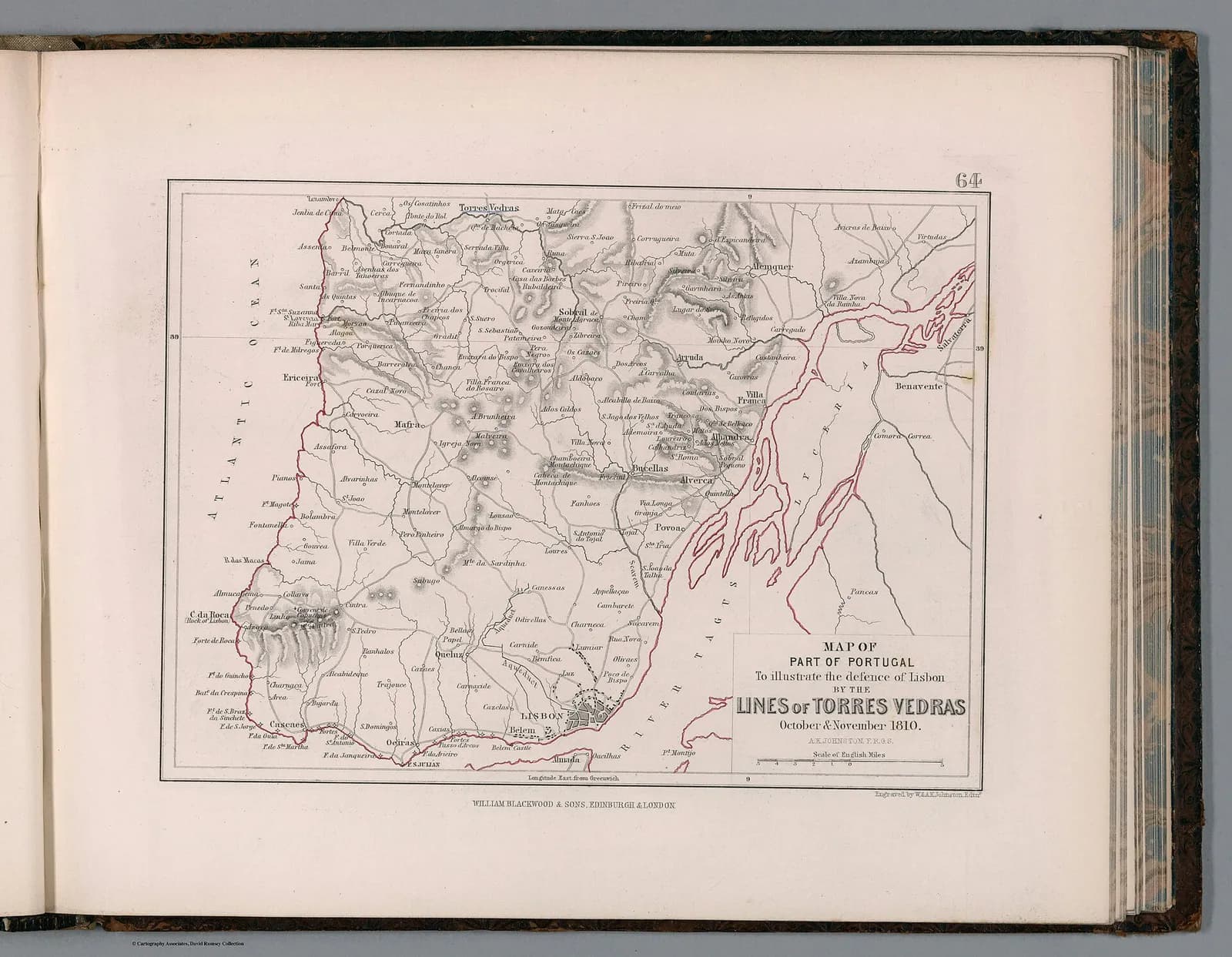
Montbrun did not attack. His scouts had seen, on the heights behind Arruda and Zibreira, redoubts and solid lines of infantry. Further east, his light horse had found the same thing above Alhandra, on the Tagus. He sent word back to his commander, Marshal André Masséna, that a continuous line of fortifications ran from the river westward to some point not yet found.
Masséna came to look for himself on 14 October, in time to watch a sharp fight for a barricade on the road out of Sobral. On one of his rides along the front, a single shot from British redoubt No. 120 struck a wall on which he was resting his telescope. The engineer John Jones, who dates it to 16 October, says the marshal took off his hat to acknowledge the warning and moved on; the historian Charles Oman puts it on the 14th.
“On arriving at Sobral, instead of the “undulating accessible plateaux” that we had been told to expect, we saw steeply scarped mountains and deep ravines, a road-passage only a few paces broad, and on each side walls of rock crowned with everything that could be accomplished in the way of field fortifications garnished with artillery.”
The French had marched the length of Portugal to take Lisbon. They would get no closer.
A kingdom without its king, invaded three times
Portugal tried to stay neutral in the war between France and Britain, its old ally. Napoleon would not allow it, and in 1807 he ordered Portugal's ports closed to British ships and sent an army under General Jean-Andoche Junot to occupy the country. In November 1807 Junot reached Lisbon just in time to see the royal family sail down the Tagus for Brazil. An Anglo-Portuguese army beat Junot at Roliça and Vimeiro in August 1808, and the French left under the Convention of Cintra.
Prince Regent João now governed from Brazil. In Lisbon a council of governors, the Regency, ran the kingdom, and in practice it was more and more subordinated to the needs of the British army; from 1810 the British minister in Lisbon, Charles Stuart, sat on it. A second invasion, under Marshal Soult, took Porto in March 1809 before an Anglo-Portuguese army drove it back into Spain.
The third invasion began in July 1810. Masséna's Army of Portugal, about 65,000 strong, took the Spanish border fortress of Ciudad Rodrigo in July and the Portuguese one at Almeida on 28 August, then marched for Lisbon. Wellington, the British commander, did not try to stop him at the border. He planned to fight on ground of his own choosing and then fall back on the capital.
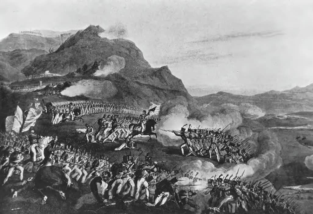
He chose the ridge of Buçaco, north of Coimbra. On 27 September 1810 about 50,000 allied troops, almost half of them Portuguese, threw back the French columns that climbed it. Masséna found a country road round the north of the ridge, and Wellington retired south, as he had always intended, towards the fortifications nobody in the French army had heard of.
A memorandum, an engineer and a year of digging
Wellington rode over the hills north of Lisbon with his chief engineer, Lieutenant-Colonel Richard Fletcher, in October 1809. On the 20th he gave Fletcher a written memorandum. Its starting point was simple.
“The great object in Portugal is the possession of Lisbon and the Tagus, and all our measures must be directed to that object.”
The memorandum asked for less than was finally built. The army would first stand behind the Castanheira stream near the Tagus, with entrenched posts on its flank at Torres Vedras, Sobral and Arruda. If pressed, it would fall back to the hills from Alhandra through Bucelas to Montachique. Wellington also wanted a safe place to embark the British troops in case of defeat, which became the works around the fort of São Julião da Barra.
Work on a Castanheira position began in January 1810, but on a second visit in February Wellington saw that it could be turned and had it abandoned. The main line was traced instead from Quintela on the Tagus through Bucelas, Montachique and Mafra to the mouth of the São Lourenço river on the Atlantic, partly on maps of the area by a Portuguese officer, Major Neves Costa. Masséna was slow to come, and the extra months let the engineers turn the outposts into a second, longer front.
Digging began in November 1809: at São Julião on the 3rd, on the Monte Agraço on the 4th and at the fort of São Vicente, above Torres Vedras, on the 8th. Jones says there were never more than seventeen engineer officers on the works at once, eleven British, two from the King's German Legion and four Portuguese. The labour came from Lisbon militia regiments, brought up in pairs, and from peasants. Oman counts 5,000 to 7,000 hired at a time, plus men conscripted from southern Estremadura within forty miles.
Gangs of 1,000 or 1,500 labourers worked under a single engineer officer, sometimes a subaltern with a few British soldiers who spoke no Portuguese. Jones, who took charge of the works when Fletcher left to join the army in July 1810, noted that in a year of forced labour, often forty miles from home while their own fields went untended, the workers caused not one riot. He put the output down to their “regular habits of persevering labour”.
The works were closed earthen redoubts on hilltops, most for three to six guns and two or three hundred men, with ditches about 16 feet (5 m) wide and 12 feet deep. Between them the engineers dammed the Sizandro to turn six miles of its valley into bog, blasted 2,000 yards of hillside above Alhandra into a cliff and choked ravines with felled olive trees. Houses, walls, vineyards and woods in front of the forts were cleared so that attackers would have no cover; owners were compensated.
| Line | Runs from and to | Length | Purpose |
|---|---|---|---|
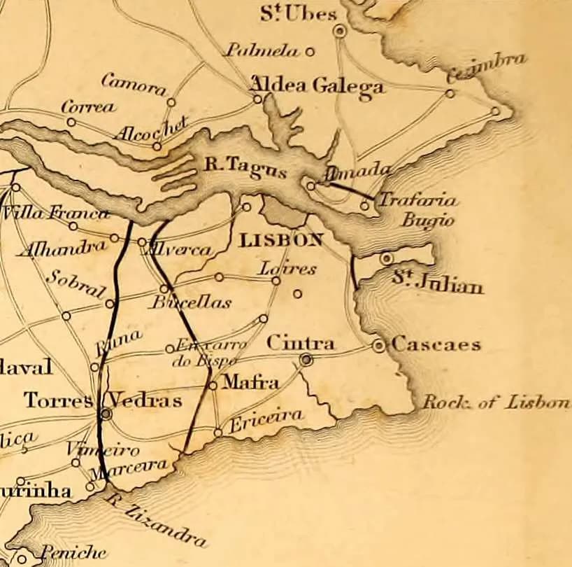
| First (outer) | Alhandra on the Tagus, by Arruda, the Monte Agraço above Sobral and Torres Vedras, to the mouth of the Sizandro | 29 miles (about 47 km) along the hills; 25 miles in a straight line | Began as outposts; became the front Masséna faced in October 1810 |
| Second (main) | Quintela on the Tagus, by Bucelas, Montachique and Mafra, to the mouth of the São Lourenço | 24 miles (about 39 km) along the hills; 22 miles in a straight line | The line Wellington first planned to hold; complete by September 1810 |
| Third | Around São Julião da Barra and Oeiras, west of Lisbon | 3,000 yards (about 2.7 km) round | Cover for the British army to embark if the other lines fell |
| Almada (south bank) | Heights of Almada opposite Lisbon | Not given | To stop an enemy coming from the south from reaching the river opposite the city |
Lengths are John Jones's (1829); Charles Oman (1908) gives about two miles for the third line and adds up 53 miles in all, while the Rota Histórica das Linhas de Torres gives about 85 km. The Almada works were added later; they are described in the association's school worksheets and in Jones's note on costs.
- Ordered
- Memorandum of 20 October 1809 from Wellington to Fletcher
- First works begun
- São Julião (3 November 1809), Monte Agraço (4 November) and Torres Vedras (8 November)
- Works when the army moved in
- 126 enclosed works and 427 guns (October 1810), not counting São Julião
- Works when finished
- 152 works and 534 guns (Jones, 1812); 600 guns by the RHLT's count
- Garrisons needed
- 29,751 men in October 1810 and 34,125 in 1812, by Jones's calculation
- Cost
- About £100,000 by October 1810, doubled by the end of the war
- Signals
- Five semaphore stations; a message crossed the first line in seven minutes
How the Lines grew
works or guns
- Enclosed works (forts and redoubts)
- Guns mounted in them
Number of enclosed works and of guns mounted in them, all counted by John T. Jones in his Memoranda relative to the Lines (1829). July 1810: the second (main) line alone, 59 redoubts and 232 guns, as built to the original plan when Fletcher handed the works to Jones (p. 15). October 1810: the whole Lines when the army moved in, 126 works and 427 guns (p. 107). 1812: the whole Lines when Jones judged them finished, 152 works and 534 guns (p. 107). Jones counts the embarkation works at São Julião separately (94 more guns in 1810), so none of the bars includes them.
Show the data
| Enclosed works (forts and redoubts) | Guns mounted in them | |
|---|---|---|
| July 1810 (second line only) | 59 | 232 |
| October 1810 (all lines) | 126 | 427 |
| 1812 (all lines) | 152 | 534 |
The secret held. Jones thought it “highly creditable to all concerned that scarcely a vague paragraph respecting the lines found its way into the public prints”. According to Masséna's aide Pelet, the French first heard of the Lines from prisoners taken at Pombal on 5 October 1810, less than a week before they saw them.
Emptying the land in front of the enemy
The forts were half of Wellington's plan. The other half was hunger. French armies lived off the country they marched through, so the population in Masséna's path was ordered to leave and to take or destroy food, carts and animals, break bridges and mills and burn ferry boats. The device was an old Portuguese one, used against Spanish invaders as late as 1762.
Members of the Regency, led by the Principal Sousa, brother of the Prince Regent's most influential minister, opposed it. Sousa wanted the war fought at the frontier and warned that destroying the mills would devastate the land and make the government hated. Wellington blamed him for all his difficulties in the campaign.
On the ground the policy was patchy. Peasants often hid their grain rather than burn it, and French foragers found many of the stores. Raimundo Nogueira, one of the governors, later wrote that the order to destroy food was never actually given, so the French found the granaries of the Ribatejo full and could stay in the region for some five months.
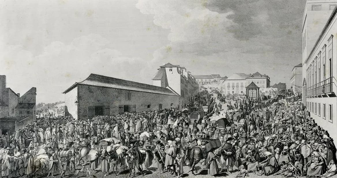
Coimbra, a city of about 40,000, emptied in two days after Buçaco, its people streaming south on the roads or down the Mondego to take ship for Lisbon. The French entered on 1 October and spent two days plundering it. Behind the Lines, Lisbon filled with refugees. Relief came first from the city's Senado and then mostly from alms raised by the Principal Sousa himself.
The refugees and the people who stayed behind died in great numbers, mostly of disease. The provisor of the diocese of Coimbra, the bishop's deputy, summing up parish priests' reports in December 1811 in a report printed in 1812, reckoned that about 3,000 people had been killed by soldiers and at least 35,000 had died in the epidemic that followed. At Figueira da Foz, which the French never entered, 4,135 locals and refugees died of illness.
The diocese had about 285,000 inhabitants in 1801, so the historian Fernando Dores Costa puts the losses at around 1 per cent murdered and one in eight dead of disease. Counts differ: Dores Costa gives 2,969 killings in the printed report, while Maria Antónia Lopes counted 3,305 in the parish returns. Lopes found the worst violence came during the French retreat in 1811, when hunger drove the soldiers hardest.
“Deserted villages, the whole territory untilled, a frightful solitude, with neither beasts nor birds to be seen, houses burned or wrecked, heaps of filth, the living in their death throes, walking skeletons.”
Four days at Sobral
Wellington's army filed into the Lines in the second week of October; Craufurd's Light Division went in on the night of the 10th. It was bigger than at Buçaco: about 35,000 British troops present under arms, 24,500 Portuguese regulars, 8,200 militia infantry and two Spanish divisions of about 8,000 men who arrived on the 25th. The redoubts were garrisoned by militia, gunners and marines, so the field army could wait behind them in two masses, ready to hit any column that broke in.
Sobral sat in front of the weakest stretch of the first line, between the great redoubt on the Monte Agraço and the Portelo heights, where few works had been built when the French arrived. Wellington crammed more than 20,000 men into it and dug new redoubts as fast as he could.
10 October
First sightings
The RHLT dates the first French sight of the Lines to this day; Oman dates Montbrun's discovery to the next morning. The Light Division falls back into the Lines that night.
11 October
Montbrun at Sobral
French cavalry reach Sobral, see redoubts behind Arruda and Zibreira and above Alhandra, and report a continuous line.
12 October
Sobral taken
Junot's 8th Corps drives Spencer's outposts out of the village; they stop on the far side of a ravine, about 300 yards away.
13 October
Skirmish west of Sobral
Portuguese line regiments, the 11th and 23rd, help hold off French skirmishers near Dois Portos.
14 October
The barricade
The 71st Regiment beats back an attack on its barricade below Sobral. Masséna arrives, watches and calls off the attack.
Sources differ on the cost. Charles Oman, using regimental returns, counted 19 British casualties on the 12th and 67 on the 14th, against roughly 120 French on the 14th. The RHLT's account speaks of more than a hundred dead on each side on the 12th alone. Either way, the fighting was small beside Buçaco.
That night, at his headquarters in Alenquer, Masséna is said to have heard Junot urge an assault and Ney and Reynier argue against it. He sided with them. The report General Foy drew up for him and presented to Napoleon said that the marshal would compromise the emperor's army if he attacked such lines, held by 30,000 British and 30,000 Portuguese with 50,000 armed peasants behind them.
A month of waiting, a winter of hunger
For exactly one month, from 14 October to 14 November, Masséna stayed in front of the Lines, hoping for reinforcements from Spain. His foragers stripped the country bare. Men went into hospital by the thousand, and Junot's conscript battalions, camped in the rain on the hill at Sobral, suffered worst.
Wellington would not attack. “Famine should do the work,” in Oman's summary of his thinking, “and no lives should be wasted.” On the night of 14 November, under a thick fog, the French slipped away north to Santarém. When the fog lifted at ten the next morning, the Light Division found that the sentries facing it at Arruda were men of straw in old French shakos.
The French held Santarém through the winter. On the night of 5 to 6 March 1811 the last of them pulled out and the long retreat began, marked by burned villages and murdered civilians. Masséna was back across the Spanish frontier in early April. The French garrison he had left in Almeida broke out on the night of 10 to 11 May, blowing up the walls behind it.
The Army of Portugal wastes away
men
Strength of Masséna's Army of Portugal at three dates, all from Charles Oman, A History of the Peninsular War, vol. IV (1911): 65,050 officers and men when it set out in September 1810; 44,407 on 15 March 1811, early in the retreat; and 39,546 effective sabres and bayonets on 15 April 1811, back in Spain. The drop is not the whole loss: allowing for 3,225 reinforcements received and about 4,315 men sent back to Spain, Oman puts the real loss at just under 25,000 men, about 38 per cent.
Show the data
| Army of Portugal strength | |
|---|---|
| September 1810 | 65,050 |
| 15 March 1811 | 44,407 |
| 15 April 1811 | 39,546 |
Of those 25,000, Oman reckoned, some 8,000 had been taken prisoner, including 4,000 men captured in the hospital at Coimbra on 7 October 1810. Not more than 2,000 died in action. The rest perished, in Oman's phrase, “by the sword of famine”, which in practice meant hunger and the sickness that came with it. The army also lost 5,872 of its 14,000 horses and came back with 36 wagons.
November 1807
First invasion
Junot reaches Lisbon as the royal family sails for Brazil.
August 1808
Roliça and Vimeiro
Junot is beaten and leaves under the Convention of Cintra.
February–March 1809
Beresford and Soult
Beresford takes over the Portuguese army; Soult's second invasion takes Porto.
20 October 1809
The memorandum
Wellington gives Fletcher his instructions for the defence of Lisbon.
3–8 November 1809
First spadework
Work starts at São Julião, on the Monte Agraço and at the fort of São Vicente, Torres Vedras.
July 1810
Third invasion
Masséna crosses into Portugal; Almeida falls on 28 August.
27 September 1810
Buçaco
The French are repulsed but march on round the ridge.
11–14 October 1810
Sobral
The French reach the Lines and decide not to attack.
14–15 November 1810
To Santarém
Masséna falls back under cover of fog.
5–6 March 1811
Retreat
The French leave Santarém and head for Spain.
Early April 1811
Out of Portugal
The Army of Portugal recrosses the frontier.
Forts on the hills today
Jones's accounts show money still being spent on repairing the works until the end of the war in 1814. After that they were left alone for almost two centuries, and bringing them back meant surveys, archaeological digs, clearing vegetation and structural repairs.
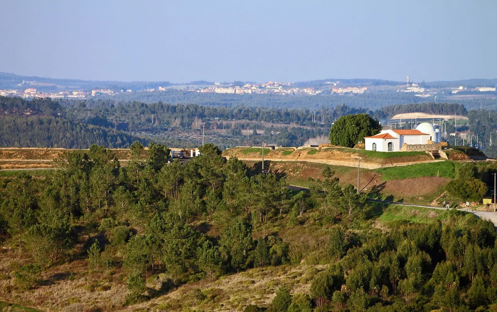
Six municipalities north of Lisbon, Arruda dos Vinhos, Loures, Mafra, Sobral de Monte Agraço, Torres Vedras and Vila Franca de Xira, formed an association, the Rota Histórica das Linhas de Torres, to clear and restore the forts. Much of the work was done for the bicentenary in 2010 and cost about €6 million, including several interpretation centres. In 2014 the project won a European Union Prize for Cultural Heritage / Europa Nostra Award in the conservation category, one of 27 winners chosen from 169 entries.
On 17 October 2014 the Assembleia da República voted unanimously to make 20 October, the date of Wellington's memorandum, the National Day of the Lines of Torres Vedras. In March 2019 the President signed the government decree classifying the first and second lines as a National Monument: 114 of the 128 structures put forward, the other 14 being too ruined or gone. Lusa reported in 2019 that the Lines received about 10,000 visitors a year.
FAQs
What were the Lines of Torres Vedras?
A system of earthwork forts, redoubts, flooded valleys, cut slopes and military roads built across the hills north of Lisbon in 1809 and 1810 to stop a French army reaching the capital. There were two main lines between the Atlantic and the Tagus, a third around São Julião da Barra to cover an evacuation, and works at Almada on the south bank. By 1812 they had 152 works.
Who built the Lines of Torres Vedras?
Wellington ordered them and his chief engineer, Richard Fletcher, directed the work with John Jones; there were never more than seventeen engineer officers on the works at once, four of them Portuguese. The labour came from Lisbon militia regiments and thousands of Portuguese peasants, some hired and some conscripted.
Did the French ever attack the Lines?
Only at the outposts. Between 12 and 14 October 1810 there were skirmishes around Sobral de Monte Agraço and near Dois Portos, but after seeing the defences on 14 October Masséna decided not to attack. He stayed in front of them for a month and withdrew to Santarém on 14–15 November.
How many people died because of the scorched-earth policy?
Nobody has an exact national figure. For the diocese of Coimbra, a report compiled from parish priests' returns in December 1811 counted about 3,000 civilians killed by soldiers and at least 35,000 dead of the epidemic that followed, in a population of about 285,000. On the French side, Masséna lost just under 25,000 men: about 8,000 taken prisoner, no more than 2,000 killed in action and the rest dead of hunger and sickness.
Can you visit the Lines of Torres Vedras?
Yes. The Rota Histórica das Linhas de Torres runs interpretation centres in Sobral de Monte Agraço, Torres Vedras (at the Forte de São Vicente), Bucelas and Forte da Casa, with marked walking trails between restored forts. The Lines have been a National Monument since 2019.
On the timeline
Open the timelineNearby moments from invasions, brazil and the liberal wars (1807–1851).
Birth of Alexandre Herculano in Lisbon, who would become one of Portugal's greatest historians and novelists. His monumental 'History of Portugal' and historical novels helped define Portuguese national identity and historiography.
During the French siege of Almeida, a shell ignites a trail of gunpowder leading into the fortress's main magazine; the explosion kills some 600 defenders of the largely Portuguese garrison and forces its surrender the next day, opening the way for Masséna's invasion of Portugal.
At the Battle of Buçaco, Wellington's Anglo-Portuguese army repels repeated assaults by Marshal Masséna's invading French forces on the Buçaco ridge in central Portugal, inflicting some 4,500 casualties before withdrawing in good order to the Lines of Torres Vedras.
The Lines of Torres Vedras
Marshal Masséna's starving French army abandons its lines at Santarém and begins its retreat from Portugal, pursued through central Portugal by Wellington's Anglo-Portuguese forces in a month of running rearguard fights.
In thick fog and driving rain on the Côa river, Wellington's Anglo-Portuguese army defeats General Reynier's corps at the Battle of Sabugal. Within days Masséna's exhausted army was back in Spain, ending the third French invasion of Portugal apart from the besieged garrison at Almeida.
At the Battle of Salamanca, an Anglo-Portuguese army of some 50,000 under the Earl of Wellington crushes Marshal Marmont's French Army of Portugal in roughly 40 minutes of devastating manoeuvre. Portuguese brigades — by now seasoned veterans of the Peninsular War — play a central role, and the victory clears the path for Wellington to liberate Madrid the following month.
Coming up in history
All long reads 13 October 1917When the sun “danced” at Fátima: 13 October 1917
 14 October 18991899: the secret declaration that revived the Anglo-Portuguese alliance
 15 October 201715 October 2017: the day Ophelia's winds set central Portugal alight
 16 October 1544Pedro Nunes takes Coimbra's chair of mathematics, 16 October 1544
15 sources
Archives, scholarship and reporting this article was checked against.
- 1
Memoranda relative to the Lines thrown up to cover Lisbon in 1810 (John T. Jones)London, 1829; digitised by the Internet Archive
- 2
A History of the Peninsular War, vol. III: September 1809–December 1810 (Charles Oman)Clarendon Press, Oxford, 1908; Project Gutenberg edition
- 3
- 4
Sofrimentos das populações na terceira invasão francesa. De Gouveia a Pombal (Maria Antónia Lopes)Universidade de Coimbra (Estudo Geral); published in O Exército Português e as Comemorações dos 200 Anos da Guerra Peninsular, vol. III, 2011
- 5
Conflictos entre Wellington y los gobernadores de Portugal durante la campaña de 1810-1811 contra Masséna (Fernando Dores Costa)Cuadernos de Historia Moderna, Anejos IX (2010), pp. 123–145, Universidad Complutense de Madrid
- 6
The Lines of TorresRota Histórica das Linhas de Torres (association of six municipalities)
- 7Presidente da República promulga decreto que classifica Linhas de Torres Vedras como monumento nacionalObservador (Lusa), 21 March 2019
- 8
- 9
- 10
Historical Route of the Lines of Torres Vedras (laureate 2014)European Heritage Awards / Europa Nostra Awards archive
- 11
- 12
- 13
- 14
- 15
Image credits
- “Map of part of Portugal to illustrate the defence of Lisbon by the Lines of Torres Vedras, October and November 1810”, by Alexander Keith Johnston, engraved by W. and A. K. Johnston for the atlas to Archibald Alison's History of Europe (Edinburgh, 1852). Archibald Alison and Alexander Keith Johnston, Public domain, via Wikimedia Commons.
- The Battle of Buçaco, 27 September 1810: allied infantry in line on the ridge. A print engraved by C. Turner after a picture by Major Thomas S. St Clair, reproduced in Arthur Griffiths's Wellington and Waterloo (1898). Thomas S. St. Clair, Public domain, via Wikimedia Commons.
- Detail of the map in John T. Jones's Journals of Sieges, drawn with south at the top. It shows the first line through Sobral and Torres Vedras, the second through Bucelas and Mafra, the embarkation lines at São Julião (St Julian) and the works at Almada across the Tagus. Rpajares, CC0, via Wikimedia Commons.
- The “Sopa de Arroios”, a charity soup kitchen at Arroios in Lisbon, in an engraving of 1813 designed by Domingos Sequeira and etched by Gregório Francisco de Queiroz. The historian Fernando Dores Costa uses it as an image of the relief given to people who fled to Lisbon. Domingos Sequeira, Public domain, via Wikimedia Commons.
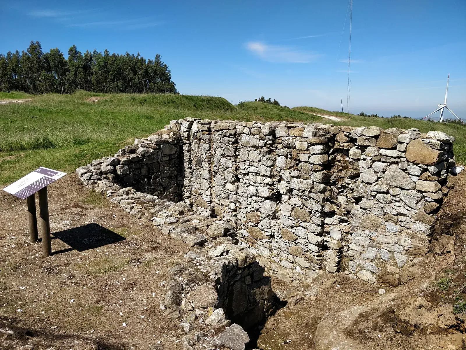
- The excavated powder magazine of the Forte do Alqueidão, the great redoubt on the Monte Agraço above Sobral, photographed in April 2019. The RHLT says the fort had room for 27 guns and 1,600 soldiers. Roundtheworld, CC BY-SA 4.0, via Wikimedia Commons.
- The restored Forte de São Vicente on its hill north of Torres Vedras, with the chapel of São Vicente inside the ramparts, photographed in November 2020. Work on it began on 8 November 1809. Vitor Oliveira from Torres Vedras, PORTUGAL, CC BY-SA 2.0, via Wikimedia Commons.