

A fort called the Nativity: the founding of Belém do Pará, 1616
Three small ships left São Luís on Christmas Day 1615 to claim the mouth of the Amazon for a king who ruled both Spain and Portugal. Their wooden fort became Belém, and within two years the Tupinambá who helped build it were at war with it.
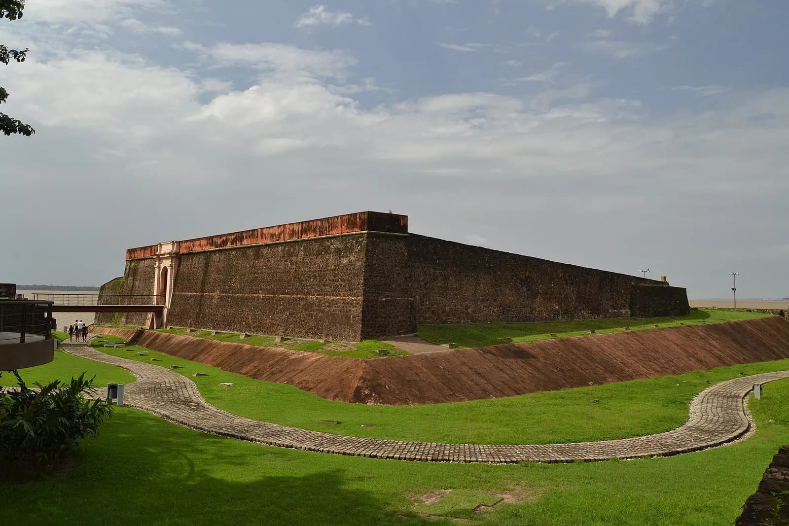
At a glance
- Francisco Caldeira Castelo Branco sailed from São Luís do Maranhão on 25 December 1615 with three small ships and about 150 to 200 men, and early in 1616 built a wooden fort, the Presépio (Nativity), on Guajará Bay.
- 12 January 1616, the date Belém celebrates, is a reckoning: no surviving account gives the day of arrival, and historians worked it out in the early twentieth century from a report that the voyage took 18 days.
- The expedition was sent under the Iberian Union, when Philip III of Spain also ruled Portugal, after Portuguese, Spanish and Indigenous troops had forced the French colony at São Luís to surrender in November 1615.
- Tupinambá villagers helped build the fort, but slave raiding provoked uprisings from 1617 to 1619; the Portuguese reprisal under Bento Maciel Parente destroyed village after village.
- The fort, rebuilt in stone, still stands at the heart of Belém, a city of 1,303,403 people at the 2022 census, beside the Ver-o-Peso market.
Three ships leave São Luís on Christmas Day
On Christmas Day 1615 three small vessels slipped out of the harbour of São Luís do Maranhão, on the northern coast of Brazil: a patache, a caravelão and a large launch. Their commander, Captain Francisco Caldeira Castelo Branco, carried ten pieces of artillery, provisions for five months, spare anchor cables taken from other ships and a set of written orders dated three days earlier.
The orders, from the expedition's overall commander Alexandre de Moura, told him to chart the coast “with the lead in hand”, enter the river of Pará, choose a site he could fortify, win over the Indigenous villages nearby with gifts and, with Indigenous canoes, destroy any Dutch or English trading ships he caught off guard. The chief pilot, António Vicente Cochado, was to map the route for later voyages.
Accounts of the force differ. Moura's papers let Caldeira pick 150 men; Berredo's eighteenth-century history and the IBGE's municipal history give 200. They sailed west for about 150 leagues, stopping at night on the advice of French pilots, against currents that the expedition's clerk, André Pereira, called furious because it was the rainy season.
Then they entered a vast bay of fresh water. Caldeira thought he had reached the Amazon itself. In fact the bay, which its Indigenous people called Paraná-Guaçu and Brazilians now call Guajará, is formed by the mouths of the Guamá, Moju and Acará rivers, on the southern edge of the Amazon delta. Its shores and islands were Tupinambá country, held by Tupi-speaking villages that had their own alliances and enemies.
“We went always among islands, travelling up the river and speaking with the heathen of those parts, who willingly accepted our friendship, saying that we were the true valiant ones for all we had done to the French and the other nations that were our enemies on that coast.”
A Spanish king, a French colony and an Indigenous war
In 1615 Portugal had no king of its own. Since 1580 its crown had belonged to the Spanish Habsburgs, and Philip III of Spain ruled as Philip II of Portugal. This was the Iberian Union, which lasted until 1640. To the Portuguese of the time, “Maranhão” meant the whole unconquered north, from Ceará to the Spanish Indies, roughly the area of today's Brazilian Amazon.
The French got there first. In March 1612 three ships with about 500 men left Cancale in Brittany under Daniel de La Touche, Lord of La Ravardière, backed by the regent Marie de' Medici. They reached Maranhão in July and built a fort on its largest island, Saint-Louis. Capuchin friars came with them, and French and Tupinambá met in the friars' convent to learn each other's languages. The colony was later called Equinoctial France.
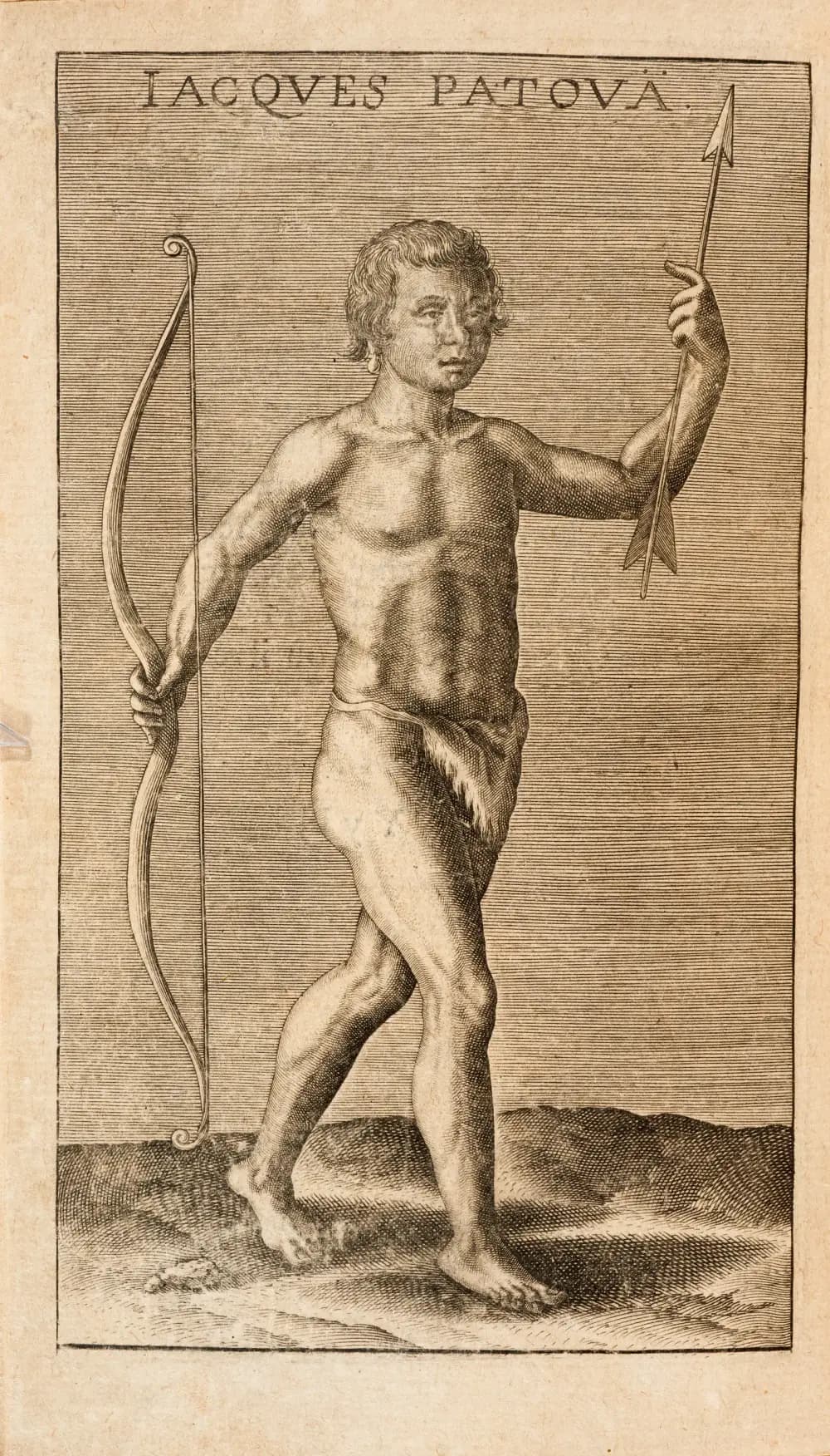
Madrid knew of it by October 1612. The expedition that went to remove the French, from Recife in August 1614, was small: about 300 Portuguese soldiers. It depended on Indigenous archers, rowers, interpreters and the women who carried supplies, recruited village by village. At the Battle of Guaxenduba, on 19 November 1614, contemporary figures give 1,500 to 2,500 Indigenous fighters on the French side against about 200 Indigenous allies of the Portuguese, a famous mismatch that the historian Alírio Cardoso thinks unlikely.
| Principal (leader) | Village | Archers |
|---|---|---|
| Marcos Mariguy | Ibatatan | 22 |
| Arco Verde | Ibatatan | 9 |
| Alexandre | Paravasú | 10 |
| D. Francisco | Tambepé | 35 |
| Jorge | Pindauná | 18 |
| Pau Seco | Joacocá | 22 |
| Mandiocapúa | Joacocá | 16 |
| André | Jacarcuná | 9 |
| Mucurapirá | Pirary | 12 |
| Minásu | Maritanguá | 7 |
| Beyjú | Guaramasio | 16 |
| Tambor | Tambásuramá | 24 |
| Patacú | Rio Grande | 20 |
| Not recorded | Paranasú | 14 |
From the census taken by Sergeant-Major Diogo de Campos Moreno before the expedition to Maranhão, as tabulated by Alírio Cardoso. Campos counted 234 archers under 12 leaders; his list has 14 groups, one without a named leader. A second count in Ceará a month later found 220 more, probably mostly Tabajara. Campos singled out Mandiocapúa, leader of the Tabajara, for his skill in battle.
After Guaxenduba the two sides agreed a truce and sent envoys to Paris and Lisbon. Alexandre de Moura's relief fleet then reached São Luís, and on 2 November 1615 La Ravardière handed over the fort. He was taken to Lisbon and held in the Tower of Belém for years, because ministers in Lisbon and Madrid feared what he knew of the Brazilian coast. Some of his men stayed behind and became the Portuguese expedition's guides and interpreters.
A fort of earth and timber
Caldeira chose a rise on a point of land where the Guamá meets the bay, beside a creek called the Piri. He named the fort Presépio, the Christmas crib, after the day his ships had sailed. Around it grew a settlement called Feliz Lusitânia, “happy Portugal”, placed under the protection of Santa Maria de Belém, Our Lady of Bethlehem. The name Belém stuck.
The first fort was a square palisade of rammed earth and stakes, reinforced with gabions, wicker baskets packed with soil. Berredo, whose history appeared in 1749, says a large number of Indigenous people helped raise it. The historian André da Silva Lima thinks it was probably built on the site of a Tupinambá village, reusing its stockade, and that labour was paid in trade goods. A local tradition naming the village chief as Paraguaçu has not been confirmed in the archives.
Archaeologists working in the fort's moat and courtyard between 2000 and 2003 found Tupinambá pottery about a metre below the surface. Lime kilns beside the fort and the papers of Caldeira's widow show that he also cleared land for sugar cane. Pereira says the fort went up quickly. Lima reads the royal letters otherwise: on 18 September 1616 the king complained that supplies and munitions for “the fort that Francisco Caldeira de Castelo Branco founded in the river of the Amazons” were moving too slowly.
- Sailed from São Luís
- 25 December 1615
- Traditional founding date
- 12 January 1616 (reckoned from an 18-day voyage)
- Commander
- Captain-major Francisco Caldeira Castelo Branco
- Force
- Three vessels, 150 to 200 men, ten guns
- Fort
- Presépio, a palisade of rammed earth and timber; later the Forte do Castelo
- Settlement
- Feliz Lusitânia, under Santa Maria de Belém
Dutch, English and Irish on the Amazon
Caldeira's men soon learned they were not alone. A French deserter told them that Dutch traders were living in villages upriver, learning the languages. A Dutchman captured in one village said he was waiting for his brother to settle at the very spot where the fort now stood, and that three Dutch ships had left a few days before. Pereira reported 250 to 300 Dutch in two wooden forts with two sugar mills.
Northern Europeans had been trading in the region for years; the Irishman Philip Purcell made voyages there from about 1609. In 1616 a ship from Flushing, in the Dutch Republic, the Golden Cock, landed 130 men, many of them English, some with their families. They built a fort between two tributaries and traded with a people the English called the Supanes, who helped them plant tobacco and annatto, a red dye.
Each side relied on Indigenous allies, and those allies chose sides for their own reasons. On the night of 9 August 1616 Portuguese troops under Pedro Teixeira attacked a Dutch ship near the Xingu; one account says it was set alight with Tupinambá fire arrows. From 1623 expeditions from Belém, made up of a few dozen soldiers and hundreds of Indigenous archers, burned the foreigners' forts and tobacco fields one by one.
1623
Bento Maciel Parente burns Dutch and English forts and tobacco fields; the Portuguese fort of Gurupá replaces a Dutch one
1625
Pedro Teixeira routs the Dutch on the Gurupá channel
1629
Pedro da Costa attacks foreign tobacco traders in the Tucuju with 30 or 40 soldiers and 800 Indigenous archers in 40 canoes, by the Jesuit Luís Figueira's count (their opponent claimed 200 and 7,000), and is beaten off; in September Teixeira forces the fort, held by Irishmen including James Purcell, to surrender
February 1631
Jácome Raimundo de Noronha takes an English fort on the river Felipe; his report counts 86 foreigners killed and says many of their Indigenous allies were killed or captured
1632
The last foreign fort falls, at Macapá, by one account; Dutch and English traders keep returning, and eight Dutch ships reach Gurupá in May 1647
The Tupinambá war, 1617 to 1619
The friendship Pereira described did not last. Caldeira sent men into the interior on “resgate” expeditions, a word meaning ransom that colonists used for buying or seizing Indigenous captives as slaves. A Franciscan friar, António de Merciana, wrote that Captain Manuel de Sousa de Sá, on Caldeira's orders, had also made war on a Nheengaíba people who lived in houses raised on stilts. It lasted 30 days; nearly a thousand Nheengaíba were killed and 360 captured and sold as slaves, for one Portuguese death.
The spark came from Maranhão. Late in 1617 a Tupinambá man baptised Amaro, who had learned to read and write with the Capuchins, spread word that he had a letter from Caldeira ordering the enslavement of every village between Belém and São Luís. Whether the letter was real is unknown. The rising began at Cumã, near São Luís. A priest on a relief ship that reached Maranhão on 14 January 1618 reported that the Cumã villagers had killed 37 colonists.
In Pará it began at Caeté, where two men buying captives for Caldeira were killed, and spread to the villages around the fort. Merciana wrote that the Tupinambá, “the most friendly”, had risen, leaving the Portuguese with one poor village of Tapuia, as the Portuguese called non-Tupi peoples, next to the fort, and the Apirapé, more than a hundred leagues away. Besieged colonists went hungry; with no match cord left for their guns, soldiers cut strips from their hammocks and slept on the ground.
“This heathen had much cause to rise, because of the continual vexations done to them.”
Belém was also fighting itself. When Caldeira's nephew, António Cabral, stabbed a popular captain, Álvaro Neto, in the street and Caldeira let him go free, the garrison and townspeople rose in September 1618, put the captain-major in leg irons and chose Baltasar Rodrigues de Melo in his place. On 7 January 1619 Tupinambá warriors tried to storm the fort. Their leader, known to the Portuguese as Cabelo de Velha (“Old Woman's Hair”), was shot dead by Gaspar Cardoso, and the attackers withdrew.
The reprisal was planned in Brazil. On 22 March 1619 the governor-general, Luís de Sousa, ordered Captain Bento Maciel Parente to make the war on the Tupinambá “more vivid” than on other peoples. He left the amount of bloodshed to the captain's “conscience”, adding that the less cruel the war, the more justified it would be. Maciel raised 80 soldiers and 400 Indigenous archers at his own cost in the captaincies of Itamaracá, Paraíba and Rio Grande, north of Pernambuco, and marched from Tapuitapera, near São Luís, towards Belém.
Belém's new captain-major ran a campaign of his own. On 4 June 1619 Jerónimo Fragoso de Albuquerque, with four ships, many canoes, 100 soldiers and a large number of Indigenous allies, stormed the Tupinambá entrenchment at Iguapé, then moved on to other villages and burned them. Maciel's column reached Belém at the end of June.
“Beginning to punish them in the villages of Tapuitapera, he went following them, killing and destroying, as far as the Gran Pará, which is more than a hundred leagues; and after making them lift the siege of Your Majesty's fortress he went following them, killing and capturing many of them, more than two hundred leagues inland.”
Berredo, governor of Maranhão a century later, wrote that Maciel “extinguished the last remnants” of the Tupinambá in that region. Captives were sold to planters in the town. Maciel said the rebels had killed more than 100 Portuguese; Maurício de Heriarte, writing in 1662, gave 222, and said that of more than 600 Indigenous settlements in the province when the Portuguese came, 15 villages now lived alongside them. Lima adds that war, flight inland and epidemic disease all cut the population.
A new state, and a voyage to Quito
Caldeira never returned. In 1619 the new captain-major, Jerónimo Fragoso de Albuquerque, shipped him to Portugal under arrest with his nephew and the men who had deposed him. Lima writes that he was held in Lisbon's Limoeiro prison and tried for misgoverning the conquest; his widow and heirs later petitioned to keep his lands in Pará. When and where he died is not settled in the sources used here.
Because of the distance, and the difficulty of sailing or marching between Ceará and Maranhão, in 1621 the crown split the north off from the State of Brazil as a separate State of Maranhão, whose governor did not answer to the governor-general in Bahia. The first governor named, Diego de Cárcamo, was a Spaniard from Córdoba who never took up the post; the first to arrive, Francisco Coelho de Carvalho, reached São Luís in 1626. In 1627 he granted Belém's town council its first land, and Jesuits arrived in 1636.
On 5 February 1637 two Franciscan friars from Quito, Domingos de Brieba and André de Toledo, and a handful of soldiers reached Gurupá, exhausted, after more than a hundred days coming down the Napo and the Amazon from the Spanish side. The governor in São Luís, Jácome Raimundo de Noronha, decided to send an expedition back the other way. Pedro Teixeira, who had sailed with Caldeira in 1615, left Pará on 28 October 1637 (27 October from Cametá, in another account) with 47 canoes, 70 Portuguese soldiers and 1,200 Indigenous men to row and fight; with their women and boys, Acuña counted 2,000 people.
Teixeira reached Quito, where the Royal Audience, the colonial court, ordered the Jesuit Cristóbal de Acuña to go back with him and report to the Council of the Indies. They left Quito on 16 February 1639 and reached Pará on 12 December. On the way down Teixeira founded a post called Franciscana near the Napo, claiming the land for Philip IV but for the crown of Portugal. At the mouth of the Rio Negro about 300 of the men wanted to go upriver to take slaves, and Acuña served them a written protest.
Near the Tapajós, Acuña found troops led by Bento Maciel, the son of the governor of the same name, preparing to attack the Tapajó, who had offered peace. Maciel promised to wait for orders, then attacked as soon as Acuña left. Once the Tapajó had given up their poisoned arrows, the Portuguese penned them in a stockade and let their own Indigenous auxiliaries strip the village bare; an eyewitness told Acuña that the captives' wives and daughters were abused in front of them. Under threat the Tapajó handed over 200 captives of their own, who were sent to Maranhão and Pará as slaves; Acuña saw them himself.
Who paddled and fought: soldiers and Indigenous fighters on three colonial expeditions, 1619 to 1637
people
- Portuguese soldiers
- Indigenous archers and rowers
Figures as given by Berredo and Maciel's own petition (1619), by the Jesuit Luís Figueira as quoted by André da Silva Lima (1629, where Figueira says 30 or 40 soldiers; the upper figure is shown, and the expedition's opponent claimed 200 soldiers and 7,000 Indigenous fighters) and by Acuña (1637, not counting the women and boys who brought the total to about 2,000).
Show the data
| Portuguese soldiers | Indigenous archers and rowers | |
|---|---|---|
| Bento Maciel Parente, 1619 | 80 | 400 |
| Pedro da Costa, 1629 | 40 | 800 |
| Pedro Teixeira, 1637 | 70 | 1,200 |
“The sacred wood of the cross served to give colour to the greatest injustice, such as the continual slavery of the poor Indians, whom, like meek lambs, they carried in flocks to their houses, to sell some, and treat the others with cruelty.”
July 1612
French colonists found Saint-Louis in Maranhão
19 November 1614
Battle of Guaxenduba
2 November 1615
La Ravardière surrenders the fort of São Luís
25 December 1615
Caldeira's ships sail for Pará
12 January 1616
Traditional date of the founding of the Forte do Presépio and Belém
1617 to 1619
Tupinambá uprisings from Cumã to Belém; Caldeira deposed in 1618
1621
State of Maranhão created, separate from Brazil; first governor arrives in 1626
1623 to 1632
Main Dutch, English and Irish posts on the estuary destroyed; raids go on into the 1640s
1637 to 1639
Pedro Teixeira's expedition to Quito and back
1676
Fifty families of Azorean farmers, 234 people, settle in Pará
1713
Diocese of Pará created, seated in Belém
12 June 1748
Copper, silver and gold coin legally replaces balls of cotton thread and other local goods as Pará's money
13 January 1750
Treaty of Madrid recognises Portugal's hold on most of the Amazon basin
From fort to city
Belém became the gateway through which Portugal pushed up the Amazon and its tributaries. When Spain and Portugal redrew their South American border in the Treaty of Madrid of 1750, they dropped the line of Tordesillas and let each side keep what it actually held. That left most of the Amazon basin to Portugal, and through it to independent Brazil.
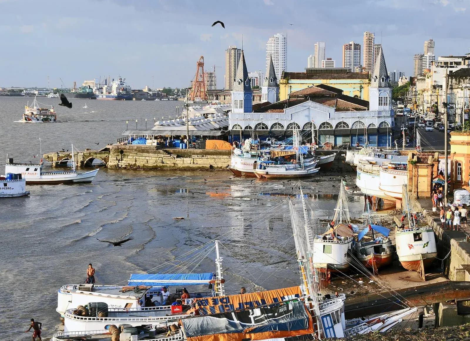
The late nineteenth century brought Belém's “golden phase” on the back of the rubber trade. The city's iron fish market, the Mercado de Ferro, went up in 1901, and in 1908 the older meat market was rebuilt with cast-iron pavilions from the Macfarlane foundry in Glasgow. In the same years the intendant Antônio Lemos commissioned the painter Theodoro Braga to paint the founding of the city.
Braga's canvas of 1908, which hangs in Belém's Museu de Arte, caused a quarrel. It showed a fort built of stone. The historian Arthur Vianna argued that the first fort was of earth and timber, and the art historian Aldrin Figueiredo has since shown that a sketch for the painting had the fort in wood. Vianna's view prevailed.
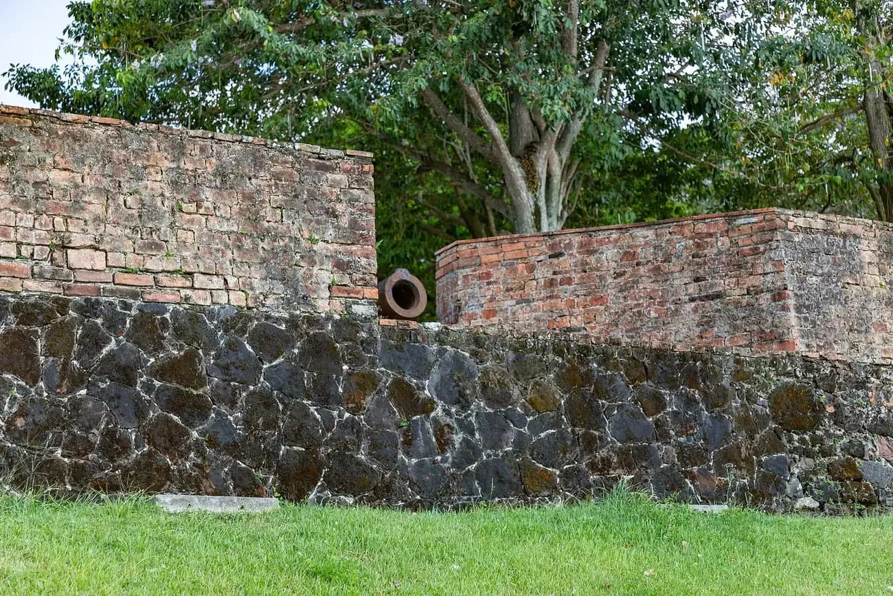
The stone fort that stands today descends from later rebuildings. Between 2000 and 2002 the state culture department restored it as part of the Feliz Lusitânia project, which from 1997 renovated listed buildings in the Cidade Velha, the old town. The fort reopened as a museum on 25 December 2002, a date chosen to mark the expedition's departure from São Luís, with an exhibition on the meeting of Portuguese and Indigenous peoples and the finds from the excavations.
Belém had 1,303,403 people at the 2022 census. Beside the fort, on the dock between the old districts of Cidade Velha and Campina, is the Ver-o-Peso, which began in the seventeenth century as the Casa de Haver-o-Peso, the post where goods shipped through Belém were weighed and taxed for the town council. It is now a market and dock, listed by IPHAN, Brazil's national heritage body, since 1977.
FAQs
When was Belém do Pará founded?
Belém dates its founding to 12 January 1616, when Francisco Caldeira Castelo Branco's expedition is thought to have reached Guajará Bay and begun the Forte do Presépio. The expedition sailed from São Luís on 25 December 1615, but no account written at the time gives the day it arrived. A royal letter of 1616 says the voyage took 18 days, and later historians counted forward from Christmas to reach 12 January.
Why is the city called Belém, and the fort Presépio?
Belém is Portuguese for Bethlehem. The expedition left São Luís on Christmas Day, so Caldeira called the fort Presépio, the Nativity crib, and the settlement, first called Feliz Lusitânia, was placed under Santa Maria de Belém, Our Lady of Bethlehem.
What happened to Francisco Caldeira Castelo Branco?
In September 1618 the garrison and townspeople of Belém deposed him and put him in irons after his nephew murdered a captain and went unpunished. In 1619 he was sent to Portugal under arrest and held in the Limoeiro prison in Lisbon while his conduct, including the slave raids blamed for the Tupinambá uprisings, was investigated.
What happened to the Tupinambá of Pará?
They helped build the fort in 1616 but rose against slave raiding in 1617 to 1619. The reprisal led by Bento Maciel Parente destroyed their villages from Tapuitapera to Belém and far inland, and survivors were enslaved or fled. A writer of 1662 said that of more than 600 Indigenous settlements at the time of the conquest, 15 villages now lived alongside the Portuguese.
Is the Forte do Presépio the original fort?
It stands on the original site, but the first fort of 1616 was a palisade of earth and timber. The stone walls are later rebuildings. The fort was restored between 2000 and 2002 and reopened as a museum on 25 December 2002.
On the timeline
Open the timelineNearby moments from the iberian union (1580–1640).
Birth of João, future Duke of Braganza, at Vila Viçosa (some sources give 18 March). In 1640 the Restoration conspirators proclaimed him King João IV, ending 60 years of Spanish rule and founding the Braganza dynasty that reigned until 1910.
Bento de Góis, a Jesuit lay brother from the Azores, dies at Suzhou (now Jiuquan) on China's western frontier. Disguised as an Armenian merchant, he had trekked for three years from Agra across Afghanistan and the Pamirs, proving that Marco Polo's 'Cathay' and China were one and the same country.
Father António Vieira is born in Lisbon, in a house near the Sé. The Jesuit preacher, diplomat and royal adviser became the great prose stylist of the Portuguese Baroque — Pessoa's 'emperor of the Portuguese language' — and a fierce defender of Brazil's indigenous peoples.
The founding of Belém do Pará
Captain Francisco Caldeira Castelo Branco's expedition from São Luís founds the Forte do Presépio on Guajará Bay, near the mouth of the Amazon, the nucleus of Belém do Pará; 12 January is the traditional date, reckoned from a report that the voyage took 18 days.
Death in Goa of the chronicler Diogo do Couto, aged about 74. Sent to India as a teenage soldier, he found his friend Luís de Camões stranded and penniless on the Island of Mozambique in 1569 and, with others, helped him get home with the manuscript of 'Os Lusíadas'. Later keeper of the Goa archives, he continued João de Barros's 'Décadas da Ásia'.
Baruch (Bento) de Espinosa is born in Amsterdam to a family of Portuguese Jews who had fled the Inquisition. Expelled from the city's Portuguese-Jewish congregation in 1656 for his heterodox views, he became one of the great philosophers of the early modern age, author of the 'Ethics'.
Coming up in history
All long reads 14 January 1659The Lines of Elvas: how a plague-struck town was relieved in 1659
 15 January 1432Afonso V, the African king: born in Sintra, 15 January 1432
 16 January 1711Saint Joseph Vaz, the Goan priest who rebuilt Ceylon’s banned church
 17 January 1995Miguel Torga, doctor and poet of Trás-os-Montes, dies: 17 January 1995
14 sources
Archives, scholarship and reporting this article was checked against.
- 1
A guerra pelas almas: alianças, recrutamentos e escravidão indígena (do Maranhão ao Cabo do Norte, 1615–1647) (André da Silva Lima, MA dissertation)Universidade Federal do Pará, Programa de Pós-graduação em História Social da Amazônia, 2006
- 2
Guerra híbrida no Atlântico equinocial: índios, portugueses e espanhóis na conquista do Maranhão e Grão-Pará (1614–1616) (Alírio Cardoso)História Revista (Universidade Federal de Goiás), vol. 18, no. 2, 2013
- 3
Annaes historicos do Estado do Maranhão (Bernardo Pereira de Berredo; first published Lisbon, 1749), 3rd edition, vol. 1, Florence, 1905Internet Archive
- 4
- 5
Conquistas diferentes e de diferentes climas: o Maranhão, o Brasil e a América portuguesa (séculos XVII e XVIII) (Rafael Chambouleyron)Esboços (Universidade Federal de Santa Catarina), vol. 26, no. 41, 2019
- 6
Além da pedra e cal: a (re)construção do Forte do Presépio (Belém do Pará, 2000–2004) (Dayseane Ferraz da Costa, MA dissertation)Universidade Federal do Pará, Mestrado em História Social da Amazônia, 2007
- 7
Belém, Pará: histórico e formação administrativaIBGE, Biblioteca (Enciclopédia dos Municípios Brasileiros)
- 8O dia em que Portugal perdeu a última batalha pela independênciaObservador
- 9
A explotação amazônica (José Francisco de Araújo Lima)Revista Brasileira de Geografia (IBGE), July–September 1943
- 10
Ver-o-Peso, patrimônio(s) e práticas sociais: uma abordagem etnográfica da feira mais famosa de Belém do Pará (Maria Dorotéa de Lima, MA dissertation)Universidade Federal do Pará, Programa de Pós-graduação em Ciências Sociais, 2008
- 11
Um livro sobre a fundação de Belém (Nélio Palheta)Uruá-Tapera
- 12
Dominios y fronteras en la Amazonía colonial. El Tratado de San Ildefonso (1777–1790) (Simei Maria de Souza Torres)Fronteras de la Historia 8 (2003), Instituto Colombiano de Antropología e Historia
- 13
- 14
Censo Demográfico 2022, população residente: Belém (PA) (table 4709)IBGE, SIDRA data service
Image credits
- The Forte do Presépio, also called the Forte do Castelo, on the point where the Guamá river meets Guajará Bay in Belém, photographed in 2018. The stone walls are later rebuildings of the wooden fort of 1616. Túllio Franca, CC BY-SA 4.0, via Wikimedia Commons.
- Patuá, a youth of 15 or 16 from the island of Maranhão, was one of six Indigenous men the Capuchins took to Paris. He was baptised Jacques and died of fever two days later. Engraving from Claude d'Abbeville's history of the French mission to Maranhão, Paris, 1614. Claude d’Abbeville, Public domain, via Wikimedia Commons.
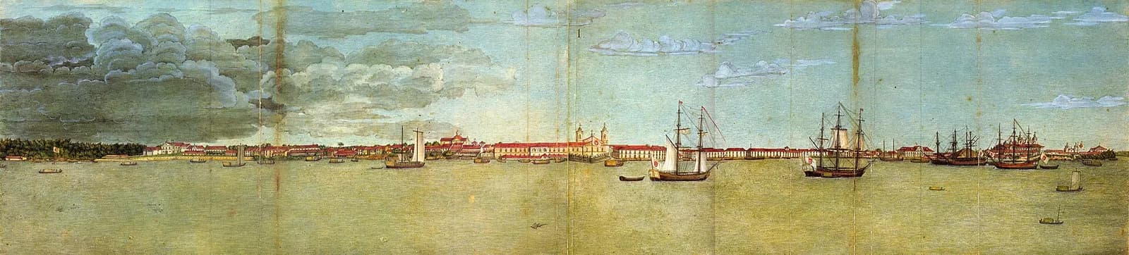
- Belém from Guajará Bay on 20 May 1784, drawn by Joaquim José Codina for the naturalist Alexandre Rodrigues Ferreira's Viagem Filosófica, a scientific expedition through the Portuguese Amazon. Joaquim José Codina, Public domain, via Wikimedia Commons.
- Stone and brick ramparts of the Forte do Presépio with one of its cannon, photographed in 2023. They belong to the fort's later rebuildings, not to the earth-and-timber fort of 1616. Prburley, CC BY 4.0, via Wikimedia Commons.
- The Ver-o-Peso seen from the Forte do Presépio in 2009: fishing boats at low tide in front of the iron fish market of 1901, with modern Belém behind. Cayambe, CC BY-SA 3.0, via Wikimedia Commons.