

Bartolomeu Dias passes the Cape unseen and lands at Mossel Bay, 1488
Two small Portuguese caravels stood out to sea off southern Africa and lost sight of land. When Bartolomeu Dias turned north again he found a bay full of cattle where no European ship had been, and a coast running east.
At a glance
- Bartolomeu Dias left Lisbon in the summer of 1487 with two caravels and a store-ship, under orders from King João II to find the end of Africa.
- Off the west coast of southern Africa his ships stood out to sea and ran south for 13 days. Turning north again, they reached land east of the Cape of Good Hope, which they had passed without seeing it.
- Their landfall was the bay now called Mossel Bay. The date, 3 February 1488, is a reckoning rather than a record: the bay was named São Brás, and 3 February is the feast of St Blaise.
- Khoikhoi herders refused the strangers' gifts and threw stones to stop them taking water; one herder was killed with a crossbow. Later his crews made Dias turn back at the Rio do Infante, now the Great Fish River.
- Dias saw the Cape of Good Hope on the way home and reached Lisbon in December 1488. He died in late May 1500 when his ship went down in a storm in the South Atlantic, sailing in Cabral's fleet to India.
Cowherds on the shore
After many days out of sight of land, the lookouts saw high mountains to the north. Two small Portuguese caravels came in under them and anchored in a wide bay. On the land there were cattle, many of them, watched by herdsmen. The sailors called the place the bay of the cowherds, Angra dos Vaqueiros.
The herdsmen were alarmed. The Portuguese had no interpreter who could speak their language, and the people drove their animals inland. When the sailors went to fill their casks at a spring near the beach, men on a hill tried to stop them and threw stones. A crossbow bolt killed one of the herders; the journal of Vasco da Gama's voyage, written nine years later, says the commander, Bartolomeu Dias, fired it.
The bay is Mossel Bay, on the southern coast of South Africa. Dias did not yet know it, but he had already passed the southern end of the continent. No European ship is known to have been there before him.
The day usually given is 3 February 1488, and it is worked out rather than recorded. No log of the voyage survives, and the only narrative of it, by the royal historian João de Barros, was printed in 1552 and gives no date for the landing. The date comes from the bay's other name, Angra or Aguada de São Brás, the bay or watering place of St Blaise, whose feast falls on 3 February. The Florentine merchant Giovanni da Empoli, who sailed east in 1503, wrote that the cowherds' bay was renamed after the saint because it had been discovered on his day.
What you need to know first
By the 1480s Portuguese ships had been working down the west coast of Africa for decades, trading for gold, ivory and enslaved people. King João II wanted more than trade. He was looking for a Christian king in the east, the legendary Prester John, and for the way to India and its spices.
His captain Diogo Cão had made two voyages south in the 1480s, adding 375 leagues of coast by Barros's count, much of it beyond the mouth of the Congo. Cão marked his progress with padrões: stone pillars carved with the royal arms and topped with a cross, set up on headlands to claim the coast. His last stood at Cape Cross, in what is now Namibia, at 21 degrees 50 minutes south.
No sooner were Cão's ships home than João II prepared another fleet. On 10 October 1486 he granted Bartolomeu Dias, the master of a royal ship called the São Cristóvão, an annuity of 6,000 reais “in consideration of services which he hoped to receive”. Little is known of Dias before this. His birthplace and date of birth are unknown; Ravenstein found that he had commanded one of the ships sent to the Gold Coast in 1481.
The king was trying two routes at once. On 7 May 1487 he sent Pêro da Covilhã and Afonso de Paiva overland, through the Mediterranean and Egypt, to look for India and Prester John. Covilhã carried a chart drawn up by the king's experts; Ravenstein thought Dias was given a copy of the same chart.
Three ships for the south
Dias was given two ships of up to 50 tons each and a smaller store-ship, because earlier voyages had so often been forced home when food ran out. Barros names the officers. The pilot of Dias's own ship was Pêro de Alenquer, who would later guide Vasco da Gama.
| Ship | Captain | Pilot | Master |
|---|---|---|---|
| Flagship, probably the São Cristóvão | Bartolomeu Dias | Pêro de Alenquer | Leitão |
| São Pantaleão | João Infante | Álvaro Martins | João Grego |
| Store-ship | Pêro Dias, Bartolomeu's brother | João de Santiago | João Alves |
Barros does not name the flagship; Ravenstein suggests the São Cristóvão, the royal ship Dias already commanded. The store-ship's clerk was Fernão Colaço, from Lumiar near Lisbon.
There were passengers with a mission. Barros says the ships carried two African men kidnapped by Cão, who were to be returned home, and four women from the Guinea coast. The women were to be put ashore at different points, well dressed and carrying samples of gold, silver and spices. They were to ask whether such goods were found there and spread word of the King of Portugal and his wish to reach Prester John. Women were chosen, Barros explains, because men did not make war on them.
Even the year of departure is disputed. Barros says the fleet left at the end of August 1486 and came home in December 1487. A note in the margin of a book that belonged to Christopher Columbus says Dias landed at Lisbon in December 1488. Ravenstein took the note to be in Columbus's own hand; Axelson credited it to his brother Bartholomew.
Duarte Pacheco Pereira, who sailed home with Dias, also dated the discovery of the Cape to 1488. Counting back Barros's 16 months and 17 days from December 1488, historians since Ravenstein place the departure in late July or early August 1487.
| João de Barros (1552) | Ravenstein (1900) and Axelson (1988) | |
|---|---|---|
| Left Lisbon | End of August 1486 | Late July or early August 1487 |
| Landfall at Mossel Bay | No date given | 3 February 1488, reckoned from St Blaise's day |
| Back in Lisbon | December 1487 | December 1488 |
| Time away | 16 months and 17 days | 16 months and 17 days, taken from Barros |
The 1488 dating rests on the Columbus marginal note and on Duarte Pacheco Pereira's Esmeraldo de Situ Orbis, written soon after 1505.
Blown past the Cape
Beyond the Congo the fleet worked south along the coasts of Angola and Namibia, naming bays after the saints of the day. Somewhere on the way the store-ship was left behind with nine men to wait. Ravenstein guessed it stayed in a sheltered harbour in southern Angola; Barros does not say where.
South of the Orange River the caravels were tacking against steady southerly winds. Barros says that after five days held up in a bay, a storm drove them out to sea for 13 days with their sails half lowered, in colder seas that the crews took for deadly. Ravenstein and Axelson both doubted that a storm drove the ships south. Northerly winds are rare on that coast in January, so Axelson thought Dias chose to stand out to sea on long tacks, and met the strong westerlies of the higher latitudes there.
Either way, the fleet went far south of the Cape. When the weather eased, Dias steered east to find the coast again. After several days with no land, he turned north, and in the end came to the mountains and the bay of the cowherds. Without knowing it he had rounded Africa out at sea.
“When Bartholomeu Dias was here the natives fled without taking any of the objects which he offered them. Nay, on one occasion, when Dias was taking in water, close to the beach, they sought to prevent him, and when they pelted him with stones, from a hill, he killed one of them with the arrow of a cross-bow.”
The people at the spring were Khoikhoi, also written Khoekhoen, herders of cattle and sheep along the southern coast; the Dias Museum suggests they may have been the Gouriqua. Barros says only that the strangers could not talk to them and that, frightened by something so new, they drove their herds inland.
Barros does not mention the stones or the killing. Those come from the journal of Gama's voyage, whose information here Ravenstein traced to the pilot Pêro de Alenquer, and it adds that the herders had refused the gifts Dias offered. The museum points out that the sailors took the water in the herders' territory, without their permission.
The turn at the Rio do Infante
From Mossel Bay the caravels worked east against the Agulhas current and the south-easterly winds, past high mountains and into Algoa Bay. The coast was trending north-east, towards India. The crews were exhausted and frightened, and food was short: they still had to get back to the store-ship, hundreds of leagues behind them.
Dias's orders told him to consult his officers on anything important. He went ashore with the captains, the officers and some leading seamen and asked them, under oath, what they thought best for the king's service. They all agreed to go home and signed a document saying so. Dias asked for two or three more days along the coast; they granted them.
Those days took them to a river that Barros places 25 leagues beyond the islet of Santa Cruz. João Infante, captain of the São Pantaleão, was first ashore, and it became the Rio do Infante. Barros puts it at 32 degrees 40 minutes south; Ravenstein identified it as the Great Fish River, at 33 degrees 30 minutes, on the far side of today's Port Alfred. There the crews renewed their complaints, and the fleet turned for home.
Before that, Dias had set up a padrão. Barros put it on the Ilhéu da Cruz, an islet in Algoa Bay. The distances in Gama's journal, which Ravenstein traced to Pêro de Alenquer, place it instead about 15 leagues short of the river. Axelson argued that Barros had run two places together: the islet probably got a wooden cross, and the stone pillar went further along the coast.
In 1938 Axelson found the pillar's broken pieces at Kwaaihoek, on the Eastern Cape coast. It was dedicated to St Gregory, whose feast is 12 March; Ravenstein thought it may have been raised that day, though such dedications were usually chosen at home in Portugal. Wits University, which keeps the pieces, calls Kwaaihoek the most easterly point of the voyage, but Barros and Ravenstein put the turn a few days further on, at the river.
“When Bartolomeu Dias parted from the padrão that he had set up there [on the Ilhéu da Cruz], it was with as much grief and feeling as if he were leaving a son exiled for ever.”
The Cape, on the way home
Sailing west along the coast, Dias saw what he had missed on the way out: the southernmost cape of Africa, now Cape Agulhas, and then the mountains of the Cape Peninsula, ending in a great headland. He set up a padrão dedicated to St Philip there. Its site has never been found.
How the coast turned: latitude of landmarks along Dias's route
degrees south
Landmarks in coastal order from north-west to east. Beyond Cape Agulhas the coast runs back north as it heads east, the direction Dias's crews had hoped would lead to India. Latitudes are the modern values Ravenstein gave in 1900, converted from degrees and minutes.
Show the data
| Latitude | |
|---|---|
| Cape Cross (Cão's last pillar) | 21.8 |
| Dias Point, Lüderitz | 26.6 |
| Cape of Good Hope | 34.4 |
| Cape Agulhas | 34.8 |
| Cape St Blaize, Mossel Bay | 34.2 |
| Cape Padrone, near Kwaaihoek | 33.8 |
| Great Fish River | 33.5 |
Pêro de Alenquer later remembered leaving the Cape on a morning with the wind astern. Nine months after parting from the store-ship, the caravels found it again. Of the nine men left aboard, three were alive; the others had been killed in a quarrel with local people over trade. One of the survivors, the clerk Fernão Colaço, already weak with illness, was so overcome at seeing his comrades that he died on the spot. There were too few men left to sail the worm-eaten store-ship, so it was emptied and burned.
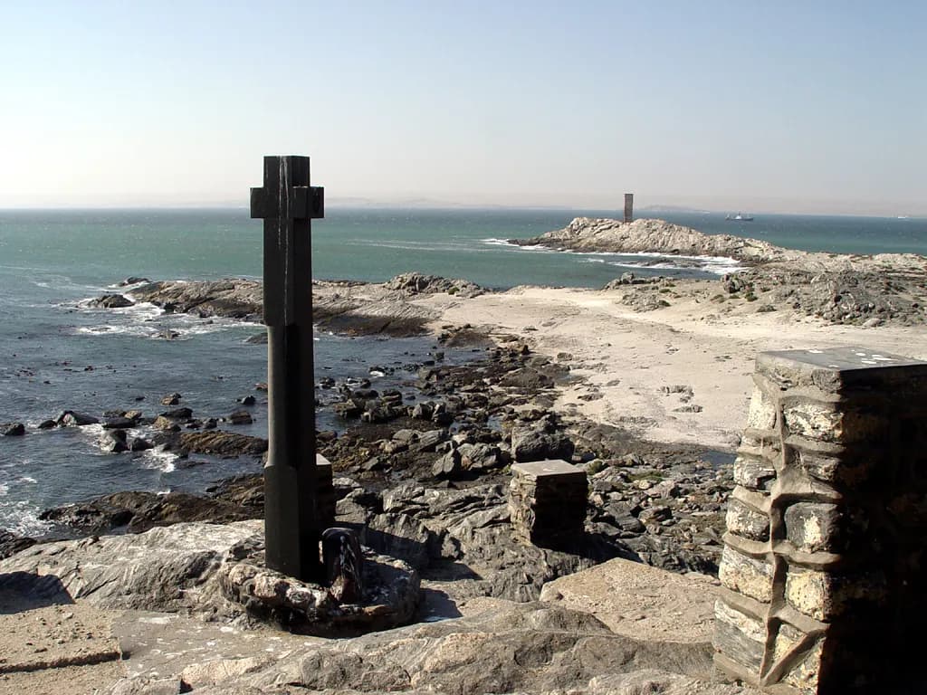
Axelson dated another stop to this homeward leg. Time did not allow Dias to enter Lüderitz Bay, in southern Namibia, on the way out, he argued; on the way home he did, and the next day, 25 July 1488, St James's day, raised his padrão of Santiago on the point now called Dias Point. Ravenstein had placed the pillar on the outward voyage, in late December 1487.
Barros put it elsewhere again, at a Serra Parda in 24 degrees south, and called it Dias's first pillar. The one on Dias Point was already illegible when a British officer saw it in 1786, and its fragments ended up in Lisbon and Cape Town.
On the way north Dias called at the island of Príncipe, in the Gulf of Guinea, where he picked up Duarte Pacheco Pereira, sick and shipwrecked. He traded for enslaved people at the Rio do Resgate so as not to come home empty-handed, and collected gold from the fortress of São Jorge da Mina. In December 1488 he entered the Tagus.
“Note, that in December of this year, 1488, there landed at Lisbon Bartholomeu Didacus [Dias], the commander of three caravels, whom the King of Portugal had sent to Guinea to seek out the land, and who reported that he had sailed 600 leagues beyond the furthest reached hitherto, that is, 450 leagues to the south and then 150 leagues to the north, as far as a cape named by him the Cape of Good Hope.”
The same note says Dias had measured 45 degrees south with the astrolabe. That is ten degrees beyond Cape Agulhas. Ravenstein thought the figure was the furthest south the ships reached out at sea. Axelson argued that it was false information João II, with Dias's knowledge, gave Columbus to keep Spain off the route round Africa. Dias had charted the coast league by league for the king, but those charts are lost.
After the voyage
No reward for Dias is recorded. Between 1490 and 1495 he still commanded the São Cristóvão, and he later became almoxarife, or storekeeper, of the Guinea warehouse in Lisbon, a post he held until at least 25 February 1497. Barros says João II had timber cut for the India ships after Dias came home, and that King Manuel I had Dias finish them so they could stand the seas off the Cape.
Dias did not lead the next voyage. In 1497 he sailed with Vasco da Gama's fleet as far as the Cape Verde islands, then turned off for Mina, while Gama went on to India. In 1500 he was a captain in the 13-ship fleet of Pedro Álvares Cabral, which touched Brazil before heading for the Cape. He and his brother Diogo were to go on to Sofala, in what is now Mozambique, to open trade for its gold.
In the crossing from Brazil to the Cape a comet stood in the sky for eight to ten nights. Then a sudden head wind struck the fleet with its sails half set, and four ships went down with everyone aboard. One was Dias's. A member of the fleet dated the storm to Sunday 24 May 1500; Barros's text gives the 23rd.
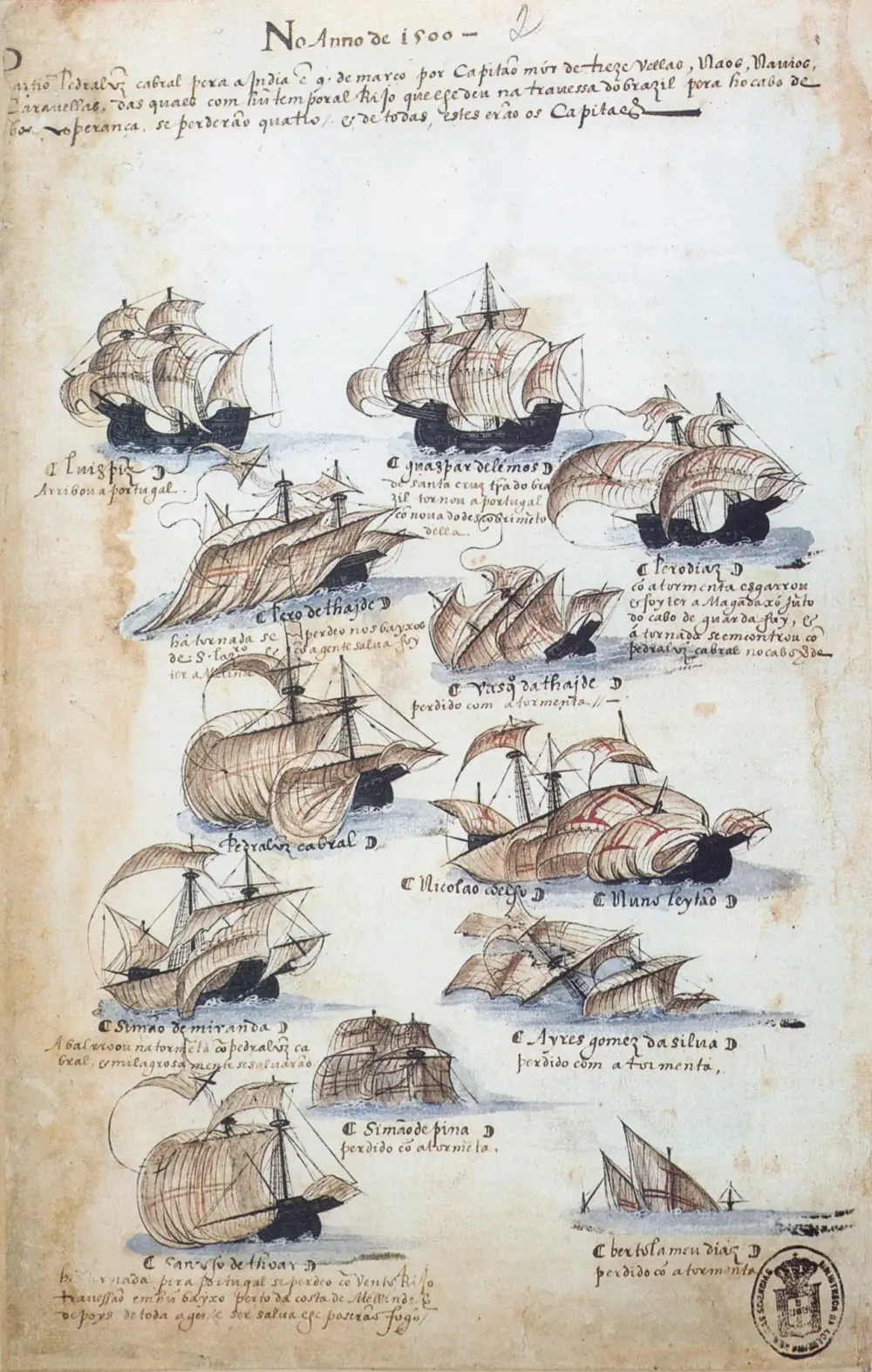
Barros wrote that the storm put an end to a man who had survived so many dangers of the sea, above all at the Cape. Ravenstein had Dias die almost within sight of the pillar he had grieved to leave, but the chroniclers put the storm out in the ocean crossing, short of the Cape. His brother Diogo, separated from the fleet, went on to sight Madagascar.
Ships calling at the bay of São Brás soon used it to leave news for each other. One of Cabral's captains, Pêro de Ataíde, left a letter there in a shoe tied to a tree, and the next India fleet found it in July 1501. The museum shows the tree, now a heritage site, with a post box shaped like a sailor's boot beside it since 1963.
10 October 1486
João II grants Dias an annuity as master of the São Cristóvão
May 1487
Pêro da Covilhã and Afonso de Paiva leave overland for India
July or August 1487
Dias leaves Lisbon with two caravels and a store-ship
January 1488
The fleet stands out to sea south of the Orange River
3 February 1488
Landfall at Mossel Bay
Date reckoned from the bay's name, São Brás: St Blaise's day.
Probably March 1488
Padrão of São Gregório at Kwaaihoek; the crews make Dias turn back at the Rio do Infante
Mid-1488
On the way home Dias sees Cape Agulhas and the Cape of Good Hope
25 July 1488
Padrão of Santiago at Dias Point, by Axelson's dating
Ravenstein put it in late December 1487.
About August 1488
The caravels rejoin the store-ship
December 1488
Back in Lisbon
1497
Sails with Vasco da Gama's fleet as far as Cape Verde
Late May 1500
Lost with his ship in a storm in the South Atlantic
24 May in a fleet member's account; Barros's text gives the 23rd.
Why it still matters
Dias found 350 leagues of new coast by Barros's count, 373 leagues or 1,260 miles by Ravenstein's. Beyond the Cape the coast he followed turned north-east, the way to India, and the voyage showed that ships could sail round Africa. In 1497 Vasco da Gama, piloted by Dias's man Pêro de Alenquer, rounded the Cape, passed Dias's last pillar and went on to Calicut, in India.
| Padrão | Where | What survives |
|---|---|---|
| Santiago (St James) | Dias Point, Lüderitz, Namibia (Barros: a Serra Parda in 24 degrees south) | Fragments taken to Cape Town in 1856; in 1900 two were in Lisbon and one in the Cape museum |
| São Gregório (St Gregory) | Kwaaihoek, Eastern Cape, South Africa | Pieces found by Eric Axelson in 1938, reconstructed at the University of the Witwatersrand |
| São Filipe (St Philip) | Cape of Good Hope | Site unknown |
Barros names the eastern pillar Santa Cruz and puts it on the Ilhéu da Cruz in Algoa Bay; Ravenstein and Axelson place it on the coast further east. The Santiago pillar is dated to December 1487 by Ravenstein and to 25 July 1488 by Axelson.
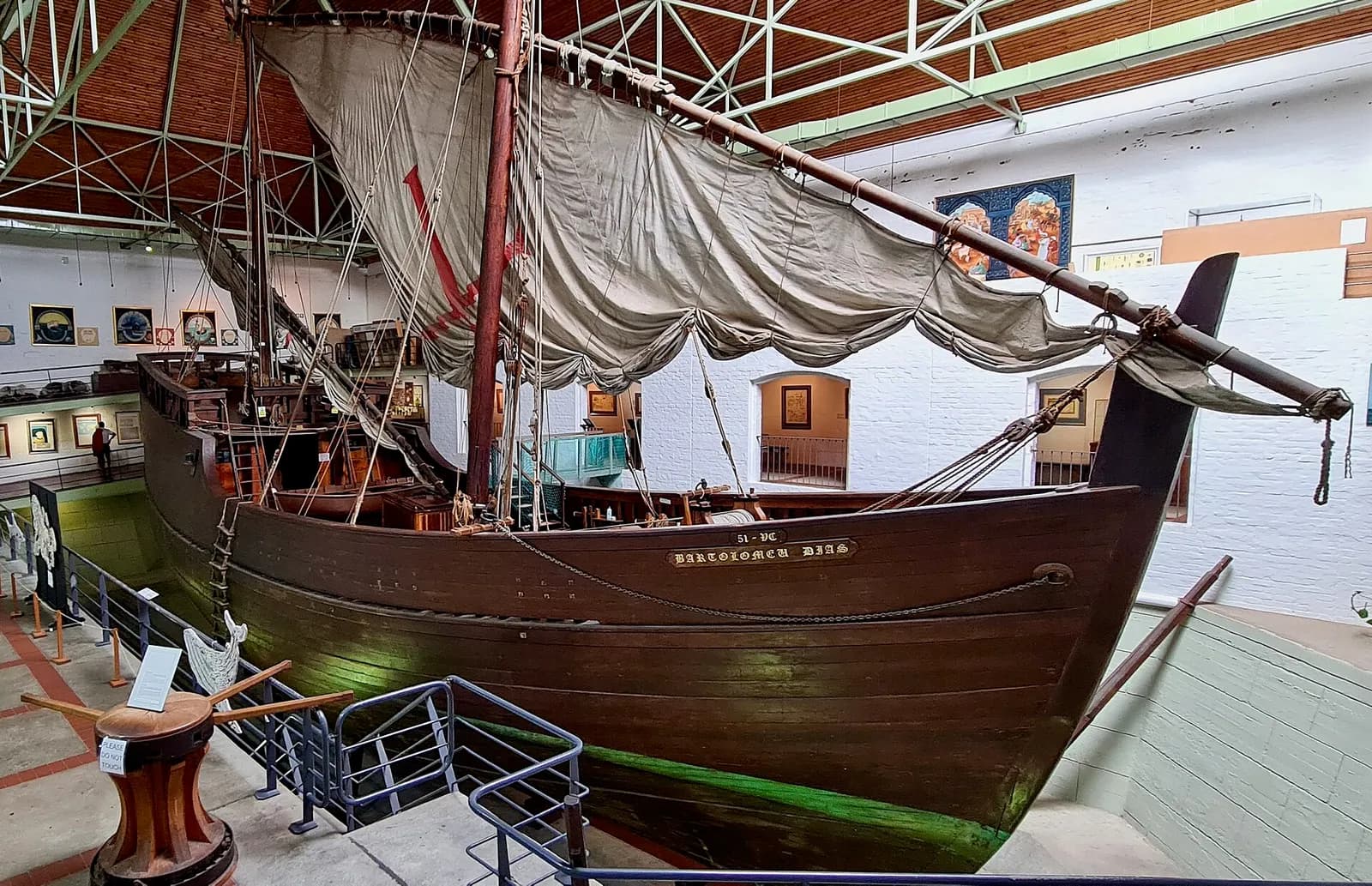
Five hundred years on, Portugal and South Africa marked the voyage together. The Portuguese sail-training association APORVELA built a replica caravel, the Bartolomeu Dias, at Vila do Conde. A crew of 17 Portuguese and South African volunteers under Captain Emílio Carlos de Sousa sailed it from Portugal in three months. It had an engine so that it would arrive in time for the festival at Mossel Bay on 3 February 1988, exactly 500 years after Dias.
The Portuguese national library's dictionary of historians says the joint commemoration, which Axelson helped to coordinate, was not without controversy. The museum at Mossel Bay now tells the story at the spring differently. Dias's voyage, it says, used to be celebrated as the start of a new era of European expansion and trade, but the violent encounter at the watering place is now also understood as the beginning of centuries of colonisation, dispossession and oppression for the indigenous people of southern Africa.
In Lisbon, Dias is one of the figures on the Padrão dos Descobrimentos in Belém, the riverside monument to the voyages. He helps Diogo Cão and António de Abreu haul a stone padrão, and his pilot Pêro de Alenquer is on the monument too.
FAQs
When did Bartolomeu Dias land at Mossel Bay?
The usual date is 3 February 1488, but it is a reckoning. No log survives and Barros gives no date; the day is worked out from the bay's old name, São Brás, because 3 February is the feast of St Blaise and an early traveller wrote that the bay was named for the day it was found.
Did Bartolomeu Dias see the Cape of Good Hope?
Not on the way out. His ships passed it far out at sea and made land at Mossel Bay, east of it. He saw the Cape on the return voyage in 1488, set up a padrão there, and, according to Columbus and Duarte Pacheco Pereira, named it the Cape of Good Hope himself.
How far did Dias get?
To the Rio do Infante, identified by Ravenstein as the Great Fish River in South Africa's Eastern Cape, at about 33 degrees 30 minutes south. His crews had voted to turn back, and he persuaded them to give him two or three more days before he gave in.
How did Bartolomeu Dias die?
He was captain of a ship in Pedro Álvares Cabral's fleet to India. In late May 1500 a sudden storm between Brazil and the Cape of Good Hope sank four ships with all hands, his among them. A member of the fleet dated it to 24 May; Barros's text gives the 23rd.
Where are Dias's stone pillars now?
The pieces of the São Gregório pillar, found at Kwaaihoek in 1938, were reconstructed and stand in the William Cullen Library at Wits University in Johannesburg. Fragments of the Santiago pillar from Lüderitz went to Lisbon and Cape Town. The site of the São Filipe pillar at the Cape is unknown.
On the timeline
Open the timelineNearby moments from the age of discoveries (1415–1580).
King Afonso V of Portugal, known as 'the African' for his conquests in Morocco, dies at Sintra and is succeeded by his son João II, under whom Portuguese exploration would flourish.
King João II grants an annuity 'in consideration of his services' to Diogo Cão, back in Lisbon from the voyage on which he became the first European to reach the mouth of the Congo. Days later he was given a coat of arms bearing the two padrões — carved stone pillars — he had planted on the African coast.
Pêro da Covilhã and Afonso de Paiva set out from Santarém on João II's secret overland mission to find the spice route to India and the court of Prester John. Travelling disguised as merchants via Cairo and Aden, Covilhã would reach India years before Vasco da Gama.
Bartolomeu Dias at Mossel Bay
Bartolomeu Dias lands at Mossel Bay, South Africa, on the day usually reckoned from its old name, São Brás (St Blaise's day). He had passed the Cape of Good Hope unseen, the first known European to sail beyond Africa's southern tip.
Nzinga a Nkuwu, ruler of the Kingdom of Kongo, is baptised by Portuguese missionaries and takes the Christian name João, after Portugal's king. The alliance brings priests and masons, but within a generation his son Afonso I is writing to João III to protest that Portuguese slave traders are depopulating his kingdom.
Death at age 16 of Prince Afonso, only legitimate son and heir of King João II and Queen Eleanor, after a fall from a horse on the banks of the Tagus near Santarém. The tragedy ends the direct Avis succession and sets in motion the dynastic chain that, three generations later, will deliver Portugal into the hands of the Habsburgs.
Ferdinand and Isabella of Spain sign the Alhambra Decree, ordering the expulsion of all Jews who refuse to convert. Tens of thousands of Spanish Jews flee to Portugal, significantly increasing the Jewish population until Manuel I's own expulsion edict in 1496.
Coming up in history
All long reads 5 February 1570Gaspar da Cruz, the plague friar who wrote Europe's first book on China
 6 February 1608António Vieira: the Lisbon-born Jesuit who preached to the fish
 7 February 1992Maastricht, 7 February 1992: Portugal signs the treaty that made the EU
 8 February 2002Alqueva: the day the Guadiana was stopped, 8 February 2002
12 sources
Archives, scholarship and reporting this article was checked against.
- 1
Da Asia de João de Barros: Década primeira, parte primeiraRegia Officina Typografica, Lisbon, 1777 (digitised by the Internet Archive)
- 2
- 3
Popular fallacies about the Dias voyage 1487-1488 (A. E. Axelson)Historia, vol. 33, no. 2 (1988), Historical Association of South Africa
- 4
- 5
- 6
The FountainBartolomeu Dias Museum Complex, Mossel Bay
- 7
Bartolomeu Dias reaches present Mossel Bay (3 February 1488)South African History Online
- 8
O conjunto escultóricoPadrão dos Descobrimentos, EGEAC, Lisbon
- 9
Portuguese Consulate visits historic Diaz Cross at WitsUniversity of the Witwatersrand, October 2022
- 10
- 11
- 12
Axelson, Eric (Tiago Seixas dos Santos), page 2 of 6Dicionário de Historiadores Portugueses, Biblioteca Nacional de Portugal
Image credits
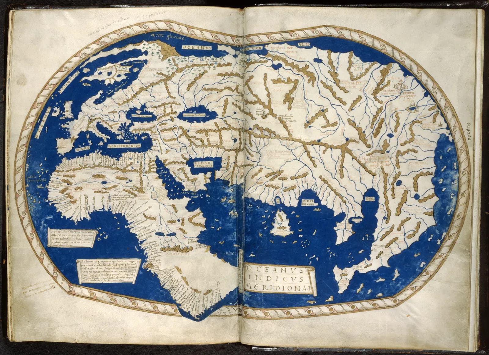
- The world map of Henricus Martellus, drawn in Florence about 1489 and now in the British Library (Add MS 15760). Africa ends in a cape, with Portuguese place-names crowded along its western and southern coasts. Historians use it, with Barros's chronicle, to reconstruct Dias's voyage. Heinrich Hammer the German ("Henricus Martellus Germanus"), CC0, via Wikimedia Commons.
- A replica of Dias's padrão on Dias Point, on the Lüderitz peninsula in Namibia, photographed in 2006. The original pillar, dedicated to St James, was found in pieces in the nineteenth century. Damien du Toit from Cape Town, South Africa, CC BY 2.0, via Wikimedia Commons.
- Cabral's fleet of 1500 in the Livro das Armadas, an illustrated record of the India fleets made around 1568 and kept by the Academia das Ciências de Lisboa. At bottom right a sinking ship is labelled “Bertolameu Diaz, perdido co a tormenta”: lost in the storm. Unknown author, Public domain, via Wikimedia Commons.
- The replica caravel Bartolomeu Dias inside the Maritime Museum at Mossel Bay, photographed in 2023. It was built in Portugal for the 500th anniversary and sailed to Mossel Bay in 1988. Bernard DUPONT from FRANCE, CC BY-SA 2.0, via Wikimedia Commons.
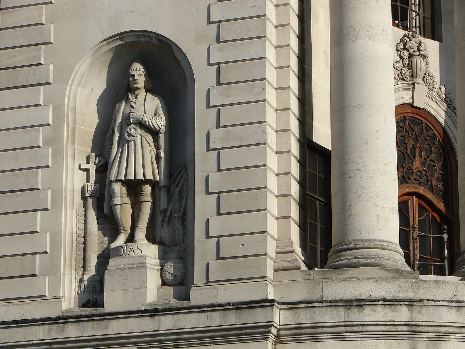
- Bartolomeu Dias in a niche of South Africa House, the South African High Commission in London, photographed in 2007. Beside him is a carved padrão dated 1488. RedCoat (en:User:RedCoat10), CC BY-SA 4.0, via Wikimedia Commons.